
After celebrating the Fourth of July with a night of fire works in Gorham I was seriously thinking of hiking up into King Ravine early Friday morning. It had rained heavily the evening before and Mts. Madison and Adams (seen here from the Durand Rd. in Randolph) were enshrouded with mist including a smooth lenticular cloud poised above Mt. Adams. On the west side of the range heavy mist was descending into the valley. One plan I had was to hike through Kings Ravine and come down via Castellated Ridge but I opted for something different.

I had a yen for a hike worthy of a perfect summer day and, instead I headed west choosing North and South Kinsman, by way of the Lonesome Lake Trail and the Fishin' Jimmy Trail. This ancient yellow birch in the photo stands guard at the bottom of the Lonesome Lake Trail. It's a little over 3 feet in diameter, a giant in this region, and hundreds of years old.

A yellow birch that had the misfortune to start its life on top of a rock.

I had the trail to myself....

...until the height of land and got in proximity to the lake and the Appalachian Mountain Club (AMC) Lonesome Lake Hut where I began meeting other hikers who had spent the night at the hut and were out early. Hot weather over the past week had been generating afternoon thunderstorms across the region. This young woman was heading to Greenleaf Hut via the Franconia Ridge and got an early start to avoid being caught in a thunderstorm on the ridge. (In the White Mountains the word "thumper" is often used to mean "thunderstorm". Derivation unknown but probably crew members of the AMC huts.)

That was also the case for these two. They were nervous about being caught on Franconia Ridge in a "thumper" after hearing wild stories of what it's like on the unprotected, knife-like ridge crest in severe storms. They asked for my advice, but they're own plan: to get out early, keep a steady and moderate pace, try to get up to the ridge around noon, and be off the summit of Lafayette around 3:30, or 4:00 pm at the latest, was brilliant. When I used to guide this trip--from Lonesome to Greenleaf via the ridge on a hot July day--I would try to do exactly what these two hikers were planning, but not without some near misses. Most of those had their humorous sides like the trip member who dragged along because of the hot, humid weather, making us later and later, protesting that they were going as fast as they possibly could, until we were on the ridge and suddenly there was this ripping, tearing crashing, booming, terrifying peal of thunder right over our heads and I have never, ever seen such a tired, woeful person suddenly have the vitality of a quarter horse and beat us all to the hut by a mile. Fear is sometimes a wonderful motivator.

This group had the same apprehensions about thunderstorms and were considering the odds (on Friday) of encountering a thunderstorm as they hiked the exposed, two-mile length of the ridge. Thunderstorms in the mountains are scary, particularly if there's absolutely no protection. When and where storms are likely hikers have to move efficiently, safely, staying together, and using common sense. Franconia Ridge has two exit trails at either end: Falling Waters Trail which descends from the summit of Little Haystack Mt, at the southern end of the ridge, and the Greenleaf Trail at the north end which descends from the summit of Lafayette down to Greenleaf Hut. The advantage the hiker has on Franconia Ridge is visibility. You can see and hear storms coming from a long way off and have enough time to make key decisions, but if you are caught out on the ridge when one hits and, if its safe, you can descend into the trees but only on the east side of the ridge and down just a few feet, until you're below the height of the ridge, and sit down, preferably on something dry (or at least something that's a poor electrical conductor like a backpack, etc), and wait the storm out. Leaving the trail and descending more than a few feet has its own risks. Also, statistics over the years have underlined that it's NOT safe to seek shelter in caves.

They were not particularly concerned about lightning.
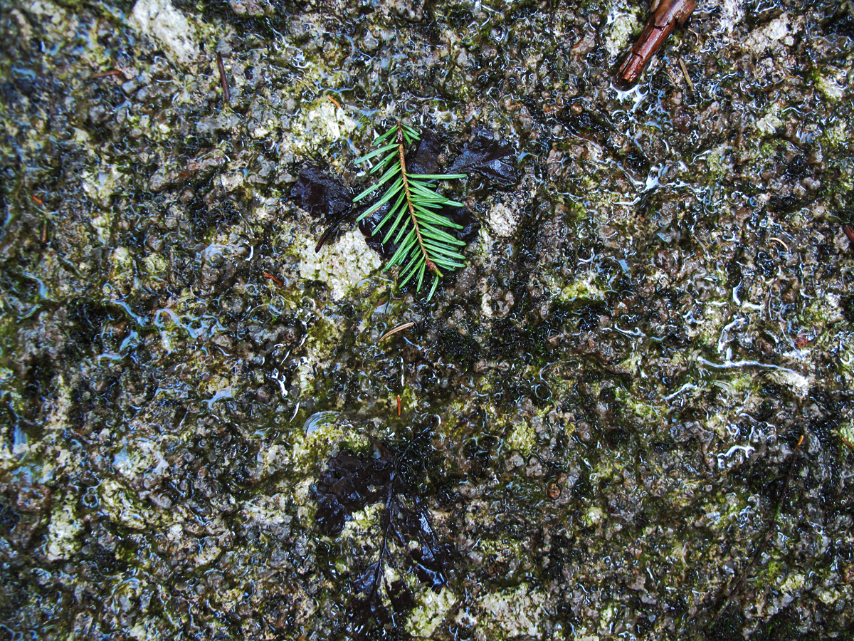
Kinsman Quartz Monzonite aka Kinsman Granodiorite. From Lonesome Lake Hut west, including the Kinsmans, you are walking on what's now called Kinsman Quartz Monzonite and what used to be referred to as Kinsman Granodiorite (KGD). The name changed sometime between 1935 and 1970.
One comparison to make with the Conway granite is that the KZM is rougher in texture and offers better traction for climbing than the Conway granite which has a finer, smoother texture. In the photo you can see the larger grains on quartz and the rough texture.
One comparison to make with the Conway granite is that the KZM is rougher in texture and offers better traction for climbing than the Conway granite which has a finer, smoother texture. In the photo you can see the larger grains on quartz and the rough texture.

A map from Charles William's 1935 study of the geology in the Franconia qaudrangle. The blue circle, (Ed: I drew both of the colored circles on this man) represents the Conway granite (CG) that Cannon Mt. and several other mountains in the region were formed over long periods of time. The area outside the blue circle is dominated by the Kinsman grandodiorite as identified by Williams and now called Kinsman Quartz Monzonite (KQZ). The green circle represents the position of Lonesome Lake relative to the area of Conway granite based on William's mapping in 1935. In 1970 Brian Fowler suggested from his own field work (Appalachia June 1970, pg. 108) around Lonesome Lake, particularly his "stone counts", that the southern edge of the Conway granite was right meaning right under the hut and about a 1/4 mile closer to the joint between the Conway granite and the Kinsman quartz monozite that was originally suggested by Williams.

A miraculous set of stairs!
Williams, in his June 1934 Appalachia article (p. 69) does a good job of outlining the geologic history of the Franconia quadrangle and particularly the the history of these two rock types. He goes back to the early Paleozoic, which by its name alone we know is a long, long time ago, and a period of mountain building called the Appalachian Uplift (roughly 480 million years ago). We know now that the uplifting, or folding of the crust, was caused by continents crunching into each other at their edges. (Continental Drift, or Tectonic Plate Movement). Williams observed that "at the time of the folding which contorted the bedded (sedimentary) rocks large bodies of magma invaded the crust from below, although did not reach the surface existing at that time." The bodies of magma were 10-12 miles long and 3-6 miles wide. It consolidated there under the crust, a few miles down, forming a granodiorite which has been called the Kinsman granodiorite. (or its modern name Kinsman quartz monozite the name we'll stick with). That's KZM in the photo on these steep slabs. There are large exposures of it on the North and South Kinsman summits.
Williams, in his June 1934 Appalachia article (p. 69) does a good job of outlining the geologic history of the Franconia quadrangle and particularly the the history of these two rock types. He goes back to the early Paleozoic, which by its name alone we know is a long, long time ago, and a period of mountain building called the Appalachian Uplift (roughly 480 million years ago). We know now that the uplifting, or folding of the crust, was caused by continents crunching into each other at their edges. (Continental Drift, or Tectonic Plate Movement). Williams observed that "at the time of the folding which contorted the bedded (sedimentary) rocks large bodies of magma invaded the crust from below, although did not reach the surface existing at that time." The bodies of magma were 10-12 miles long and 3-6 miles wide. It consolidated there under the crust, a few miles down, forming a granodiorite which has been called the Kinsman granodiorite. (or its modern name Kinsman quartz monozite the name we'll stick with). That's KZM in the photo on these steep slabs. There are large exposures of it on the North and South Kinsman summits.

The first time up or down these stairs requires a few moments to actually trust them because they appear to be sitting there and not attached to anything, or maybe by some bubble gum, but they're completely safe and trustworthy.
Following the arrival of the Kinsman granitediorite and as more molten rock came into the area but not quite to the surface the Bickford granite, Scrag granite and the Franconia breccia, are all deposited in the area and are incorporated into the Kinsman granitediorite. These minor periods of volcanic activity finally bring us to ones discussed earlier in this blog in the Moat Mountain article a few years ago, which elaborates on the dramatic periods of volcanic activity which involved major flows of lava now found in the Ossipees, the Belknaps. on Mt. Kearsarge, Moat Mt., Owl's Head, Mt. Hale, and North Twin. Williams further describes the large magma reservoir below the crust in this area that, when it cooled, resulted in the numerous ring dikes in what is now central New Hampshire and found in the Ossipee and Belknap Mountains, the Percy Peaks, as well as in the Franconia region. The ring dikes in the Franonias, compared to the other areas, are poorly preserved due to more cutting by magma surging upwards below the crust. This last bit brings us to the arrival of the Lafayette granite porphyry which is visible from Lafayette to Little Haystack, and on Mts. Liberty and Flume, and it outcrops on South Twin, around Galehead hut, and the Bond Cliffs. Finally, this brings on the formation of the Conway granite, which occurred as a subsidence down below the crust when huge blocks of the minerals described above melted, dropped into the cauldrons of molten magma forcing the lava higher into the crust where it cooled slowly. It's gradually exposed on the surface as a result of several hundred million years of erosion, particularly, but not exclusively, by the great ice sheets that slid by here during the Pleistocene Era, between 2.6 million and 12,000 years ago.
Following the arrival of the Kinsman granitediorite and as more molten rock came into the area but not quite to the surface the Bickford granite, Scrag granite and the Franconia breccia, are all deposited in the area and are incorporated into the Kinsman granitediorite. These minor periods of volcanic activity finally bring us to ones discussed earlier in this blog in the Moat Mountain article a few years ago, which elaborates on the dramatic periods of volcanic activity which involved major flows of lava now found in the Ossipees, the Belknaps. on Mt. Kearsarge, Moat Mt., Owl's Head, Mt. Hale, and North Twin. Williams further describes the large magma reservoir below the crust in this area that, when it cooled, resulted in the numerous ring dikes in what is now central New Hampshire and found in the Ossipee and Belknap Mountains, the Percy Peaks, as well as in the Franconia region. The ring dikes in the Franonias, compared to the other areas, are poorly preserved due to more cutting by magma surging upwards below the crust. This last bit brings us to the arrival of the Lafayette granite porphyry which is visible from Lafayette to Little Haystack, and on Mts. Liberty and Flume, and it outcrops on South Twin, around Galehead hut, and the Bond Cliffs. Finally, this brings on the formation of the Conway granite, which occurred as a subsidence down below the crust when huge blocks of the minerals described above melted, dropped into the cauldrons of molten magma forcing the lava higher into the crust where it cooled slowly. It's gradually exposed on the surface as a result of several hundred million years of erosion, particularly, but not exclusively, by the great ice sheets that slid by here during the Pleistocene Era, between 2.6 million and 12,000 years ago.

Does this look steep? It's a bit deceiving in the photo but it is inclined at a steep angle. The stairs were omitted in one section because it's possible hike up and down along both edges of the long escalator-like slab.
The Fishin' Jimmy Trail takes its name from Fishin' Jimmy Brook. The trail was designed and built by Paul Jenk, Charles Blood, and others between 1929 and 1930. You have to be impressed by the enormous amount of work involved when you see how rugged the terrain is, the steepness, and the amount of rock exposed. The trail became one of Paul's and Charles' pet projects, like the Garfield Ridge Trail that they opened together in 1914-1916. They had quite a bit of help in establishing the "line" which must have involved a lot of bushwhacking. At it's inception the idea behind the trail was recognition that Greenleaf Hut was under construction, the Lonesome Lake Cabins had been leased and were being used as a hut by the AMC so that the AMC Trail committee wanted to create more access to the Kinsman Ridge Trail and to create a direct link between Lonesome Lake and the Appalachian Trail to the south.
The Fishin' Jimmy Trail takes its name from Fishin' Jimmy Brook. The trail was designed and built by Paul Jenk, Charles Blood, and others between 1929 and 1930. You have to be impressed by the enormous amount of work involved when you see how rugged the terrain is, the steepness, and the amount of rock exposed. The trail became one of Paul's and Charles' pet projects, like the Garfield Ridge Trail that they opened together in 1914-1916. They had quite a bit of help in establishing the "line" which must have involved a lot of bushwhacking. At it's inception the idea behind the trail was recognition that Greenleaf Hut was under construction, the Lonesome Lake Cabins had been leased and were being used as a hut by the AMC so that the AMC Trail committee wanted to create more access to the Kinsman Ridge Trail and to create a direct link between Lonesome Lake and the Appalachian Trail to the south.

Walking on water. After the staircase the trail emerges on Kinsman Ridge and winds south towards the pond and the Kinsman Trail Junction.

Board walk empire. In other places along the ridge the trail winds through open woods of balsam and red spruce.

A group of four thru hikers heading north.
 |
| Super heavy duty ladder. |

Shelter Caretaker, with friend, ready to leave on his days off.

Oxalis montana, or Mountain Wood Sorrel. The flowers are veined with pink.

Trail up North Kinsman,

More of the trail up North Kinsman.


Using the trail names "Carjacker" and "Manchild" these two AT thru hikers were eager to get to Lincoln to collect mail, eat a big, calorie loaded meal, and attend to equipment repairs.

Lonesome Lake

 |
| Cornus canadensis, or Bunchberry. |
 |
| South Kinsman from North Kinsman |
 |
| South Kinsman with Moosilauke, center, in the distance. |
 |
| Trail between North and South Kinsmans |
 | ||
A delightful character who plies the trails as a volunteer for the AMC to impart information to hikers and hut guests.
 |

 |
| Looking back and North Kinsman from South Kinsman. |

North Kinsman from South Kinsman. The trail between the two summits is like a sagging clothes line and is excellent for running to save time.


The dark clouds cleared off and sun came out and with it any respite from the heat with the exception of the pond.
 |
| A gorgeous summer day! |


