Sunday, July 28, 2013

7-27-13: Mt. Flume and Mt, Liberty.

This is Flume Brook near the bottom of the Flume Slide Trail. The Flume Slide Trail is reminiscent of several other trails in the White Mountains like the Lowe's Path in terms of vegetation and forest type, the topography, and the presence of cold, cascading brooks. Generally, trails on north and west facing slopes have a different mix of vegetation, the north facing slopes particularly because they tend to be wetter (damper?) and a bit cooler.

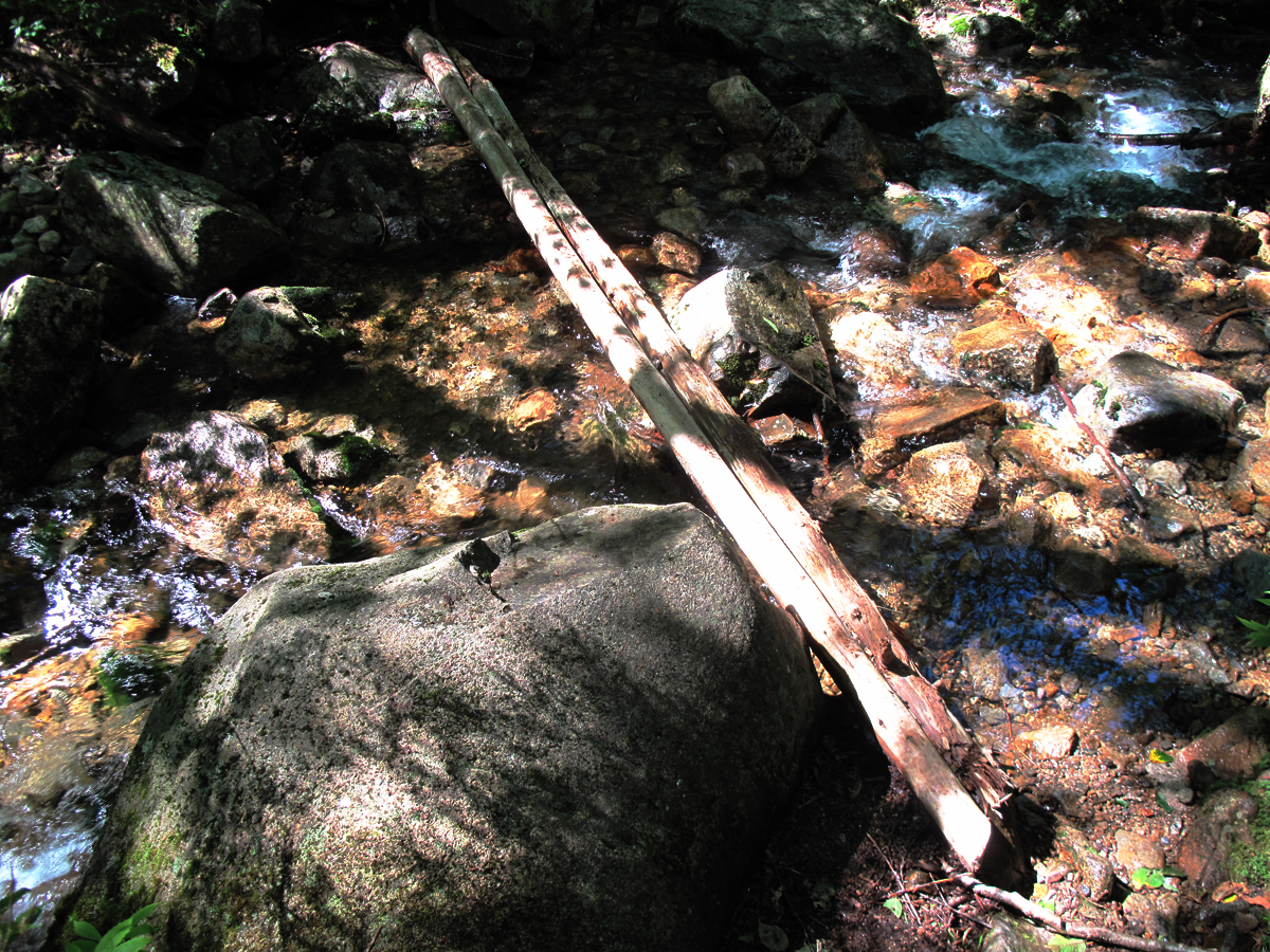
A make-shift bridge over a small branch of Flume Brook higher up on the mountain. The Flume Slide Trail has a split personality, a little bonkers, in that it wanders over the lower slopes of the mountain in a  long traverse that makes the hiker feel they are not gaining much altitude for their hard work and then beckons you onto and then up the steep, intimidating escalator of the "slide". By the way, the best place to park for this trail is at The Flume tourist area with a large parking lot off north-bound I-93 (to the right) a few miles above Lincoln. There's also parking at The Basin a mile further north, but it requires a frustrating hike of some distance back to the trail head. The trail head is right on the bike path on the east side of the highway equidistant between The Flume and The Basin..

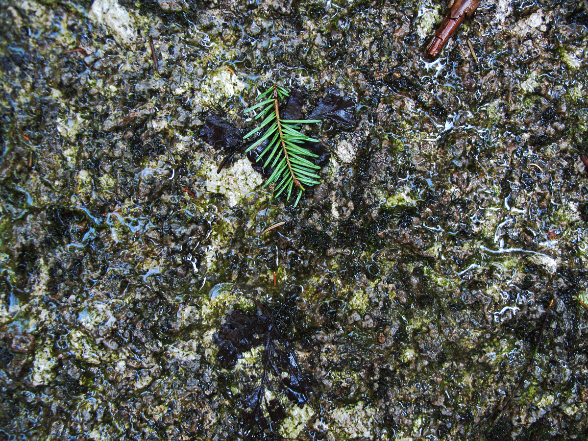
A small shaft of sunlight illuminates this moss covered rock. The forest canopy, meaning the leaves and branches, are dense on the north slope of the Franconias. Franconia Notch has been a state park for a number of years and there has been no logging for at least 70 years. The forest here is reaching climax and, like the forest on either side of the Lowe's Path, showing maturity. The reduction in acid rain in the past 30 years has improved over-all forest "health" which is reflected in the increasing density of leaf canopies.

Speaking of logging many of the trails in the Franconias rely on the old logging "roads" built, in some cases, more than 100 years ago, that are ghosts of the terse logging industry that carried out an aggressive policy of "no tree left standing".  These roads ascended the mountains here along the whole ridge (particularly, Mt. Lincoln, Little Haystack, Mt. Liberty,  Mt. Flume, Mt. Osseo and Big Coolidge Mt.) to just below their summits.

There are some survivors near the trail, like those on the Lowe's Path that I measured last year, with some reaching diameters of more than 3 feet like this yellow birch and....

this sugar maple that's alos 3 feet plus in diameter. The green tint to these photos is caused by the filtering of sunlight through the leaves.

The trail saunters through beautiful woods for quite a while staying close to the 3000 foot contour until it reaches the famous flume slide which is what this particular hike is really about.

The slide, in the past 50 years, has grown in, revegetated, with balsam fir. When I was in my early teens, in the late 1950s, the north face of Mt. Flume was pretty much one large slide. It was gravelly with some ledges to negotiate, but open across the entire face and long. The trail went up the open area at least part of the way. Descending the trail then there was a choice at the bottom of going through The Flume on the board walk or taking the trail directly to the parking lot at Whitehouse Bridge. This is the bottom of the slide and you can see balsam fir 30-40 years old that is enroaching on the slide track leaving narrow, vertical traces of the larger slide.

Does this look steep? I keep asking that but, the difficulty with photographing steep terrain is that, in the photos, the terrain doesn't look all that steep. This is half way up. I was so preoccupied with climbing the wet, steep ledges that  I forgot to stop and take photos.

This photo is a little more effective in showing the steepness. The slide, itself, is close to 1000 feet long. It stops shy of the ridge, but offers a brief course in rock climbing 101. It's good to know a few rock climbing moves like lay-backs. Unfortunately the rock is not coarse-textured Kinsman quartz monzonite that offers such good traction for boot soles. On the other hand, the general populace of hikers has been successful in wresting "go-arounds" at particularly difficult sections of the slide along the edges of the ledges so you can climb through the woods using "vegetable holds" when needed to ascend. It's a little like cheating but, admittedly, I used a couple of them on my ascent. Sheldon Perry and I did Flume Slide Trail with winter conditions a few years ago. We had lightweight 10-point Kahtoola crampons (without front points) and ice axes and it was definitely easier because the snow was much easier to negotiate then wet, bare rock, but, still, at times, it was hairy.

I had the trail to myself most of the morning but once on the slide I was passed by this guy who was flying up the steep, slippery rock with apparent ease. He was in great shape..

as was this hiker who had the perfect build for negotiating the ledges.

It's discouraging to look over and see how little progress you're making. The ridge in the photo is the one I've been bushwhacking a couple of times. It leads up to the col between Mt. Flume and Mt. Osseo (Mt. Whaleback in some guides).

This photo was taken at the top of the ledges and shows the density of balsam firs that have filled in the west face of Mt. Flume over several decades. At the top of the slide the trail alternates between staying on the contours with alternating short, steep sections until it suddenly bursts out on the ridge.

At the top of the Flume slide trail I turned right and descended the new Osseo Trail about a mile to where it curves abruptly down and heads east towards the Wilderness Trail. At several points on the trail way down I bushwhacked out at right angles in a westerly direction across the ridge looking for a sign of the old Osseo Trail. That trail, if you recall from earlier blog posts, was discontinued in the 1960s. It was the southern-most section of the Franconia Ridge Trail for 35 years and was probably re-routed due to the development of the Loon Mountain resort which changed the land ownership so that trail access became a problem as it has at several other sites in the White Mountains.  The photo above shows the vegetation that's similar to the vegetation at the top of the Flume Slide Trail and, also, the steepness as the west face of the mountain as it strikes downward.
Further down the ridge the slope eases back a bit and begins to level off.


Here it dips moderately at the western edge of the ridge but in the back ground you can see the ridge line extending westward from Mt. Osseo down towards Franconia Notch. The adjacent area is a large, nearly flat, table-like saddle on the ridge that I got to the middle of. I was thinking about Paul Jenks and Nat Goodrich back in the early 1900s crawling on hands and knees, bushwhacking, as they tried to establish the best "line" for the many trails they made in the White Mountains like the Garfield Ridge Trail, Webster Cliff Trail, and the Amonoosuc Ravine Trail. When I go off-trail I'm immediately impressed by their trail building abilities.

This is what it looked like on the broad table between Osseo and Mt. Flume. I criss-crossed this area several times looking for anything resembing a trail bed like a trench left by hikers over the years the trail was in use. On the south side of Mt. Osseo someone has been keeping up the discontinued trail and the groove, when you're exactly in the right location, suddenly becomes obvious. A tread was not obvious, at least to my eyes, in the area where I would have expected to find the trail based on old maps.

I finally quit as I was hot and headed due east to the Osseo Trail where you might think that the new trail diverged eastward from the old trail. The tread on this section of the new trail looks new so one would expect that the old trail diverged further back up on Mt. Flume and if it did, again, I was not able to find it. This couple came along as I was eating lunch and were on their way to Liberty Spring Shelter for the night.
This trio popped up off Flume Slide Trail at its junction with the Franconia Ridge Trail as I  headed north again. They looked none-the-worse for wear. They were doing the "loop": up Mt. Flume, across the ridge and down the Mt. Liberty trail. A final thought on the Flume Slide Trail: the guidebooks advise against descending the Flume Slide Trail if you are not properly experienced as it can be dangerous under wet conditions or at any time for novices. I agree. It might not be a problem for some but those with less experience might find it extremely difficult so if you're planning a loop go counter clockwise.

Mt Liberty from the lower summit of Mt. Flume. This is looking almost due North.

Can anyone guess the name of the high mountain in the center. Sara? And Sara correctly guessed Mt. Moosilauke (even though she lives in California). Moosilauke (4802' asl) has a long, colorful history, almost as long at Mt. Washington's, and was the site of Charles H. Hitchcock's and J.H. Huntington's first successful attempt at maning a weather observatory which they did in the winter of 1869-1870 after being denied use of any of the Mt. Washington summit buildings. By the fall of 1870 they had relocated to Mt. Washington. The photo below is of the Mt. Moosilauke summit house, called the Tip Top House, originally built in 1860 with a lot of additions added to it over the years. It was given to the Dartmouth College Outing Club in 1920 which operated it as a mountain "hut", or shelter, much like the early AMC huts were operated, until it burned in 1942. (Frederick W. Kilbourne, Moosilauke The Story of A Mountain, December 1940 issue of Appalachia, p. 147.) The views from Mt. Moosilauke are said to be the best of any mountain summit in New Hampshire.


Moosilauke Summit House 1860-1942. Photo is from the late 1930s.
This is one of the perspectives from Franconia ridge where you can sensually feel the course of the last great ice sheet (the Wisconsinan) as it "flowed" (think of something plastic that's softer than rock but not as runny as pancake batter! Wet cement?) over and through the existing landscape and the under layment of rock, several different kinds of igneous and metamorphic rock, carving its way in a southeasterly direction, and creating a striking topography like the one here with Mt. Liberty (left),  Little Haystack,  Mt. Lincoln and Mt. Lafayette. Mt. Liberty is on a boundary between two types of bedrock: the Lafayette granite porphyry and the Kinsman quartz monzonite with a thin intrusion of Albany quartz synenite running on a north-south axis that brushes the east side of the summit of Liberty and that's exposed on the summit of Mt. Flume. For a general description look at the following map compiled in 1932-1934 by Charles Williams that's likely out of date now, but it still illustrates well the geologic complexity of the Franconia region. Mt. Liberty and Mt. Flume are close to the center of the map as tiny black triangles.

Another comment about the continental ice sheets and their impact on topography that is often not discussed in depth is that, yes, they did move albeit slowly and with enormous downward pressure to dramatically alter the landscape and push rock and soil great distances, but in different climate cycles they also sat in repose for thousands of years and in warm periods they melted, finally melting to their extinction. The area we are looking at in the photo experienced deluges of glacier meltwater. Think of the acre-feet of water contained in one of these vast ice sheets. The Basin in Franconia Notch is a good example of a pothole created by the water dripping from the glacier as is the fluting along the ridge crest of Owl's Head. So, the glacier scraped and carved and the melt water continued the re-shaping during millions of years of erosion and freeze-thaw cycles.
 There are other dimensions reflected in this map. An important one is the concept of time measured in the movement of lava and repeated occurrences of other mountain building forces plus all the erosion, just mentioned, that followed the gradual uplifting of the surface which, as we know full well, represent hundreds of millions of years. Every time you look at Mt. Moosilauke (photo above if you didn't guess it and Sara did guess it correctly), across Franconia notch from Liberty and Flume you have a measuring stick for the enormous amount of time that has passed since it was pushed up by tectonic forces to an altitude, some say, was perhaps as high as 12,000-14,000 feet, or as high as the Rockies are now. In a time of minutes, seconds and nano-seconds thinking in terms of 100 million years is a bit mind boggling.

Looking at the south summit of Flume. The Flume Slide Trail comes to the ridge a 100 yards, or so, south of the Flume summit so that it is a dramatic point in the hike up the ridge to suddenly emerge at this rock outcropping to the fantastic views that follow in the series of photos below.

In this photo you can see Loon Mountain ski area with some of the Sandwich Range in the background to the left. Just below Mt. Flume in the middle distance you can see a series of low summits. Potash Knob is quite low and to the left, Mt. Osseo just below the slide on Mt. Hitchcock, and then the long ridge line, and just appearing over the ridge is Big Coolidge Mt. Between Osseo, Big Coolidge and Flume is the broad "table" or large flat area that I was bushwhacking across this morning (7-27-13) trying to find the old Osseo Trail to no avail (yet!).

The Sandwich Range resplendent. From left to right Mt. Chocorua, almost behind the fir tree,  Mt. Paugus, Mt. Passaconway, Mt. Tripyramid, Mt. Osceola East Peak, Mt. Osceola, Sandwich Dome further in the distance, Mt. Tecumseh, and Mt. Hitchcock with the two slides.

The trail between Mt.Flume and Mt. Liberty is similar to the trail between North and South Kinsman, like a drooping clothes line between two posts so, if you run down to the center, you should have plenty of momentum to take you right to the top of the next.

Looking back through the trees at Mt. Flume with its rugged west face.

A summer reverie.

These guys saved my life. That's a little dramatic, but as I climbed up to the summit of Mt. Liberty (mind that I wasn't running one bit) I hit a wall and was going at a snails pace. Dehydration I would call it, and possibly heat exhaustion, which was quite stressful and made me feel like an idiot for not carrying enough fluid on a hot day. They generously shared some of their "popular sports drink" which perked me up again.

A lovely view of Mt. Lincoln (left) and Mt. Garfield with the north country beckoning beyond Mt. Garfield.

Looking northwest with Cannon Mt. and Cannon Cliffs.

A better photo of Cannon cliffs.

The lovely Kinsmans.

East southeast from Liberty with Mt.Carrigain to the left of center, the Hancocks in the center, then Chocorua, Paugus and Passaconway, with Mt. Flume in the near distance.

Northeast from Liberty with the Twins on the left. South twin is in shadow. The Guyot with all the slides pointing down to Red Rock Basin, Bond, West Bond, and then Bond Cliffs. Owl's Head in the long ridge in the foreground. Mt. Washington and the norther Presidential Range are in the distance.
When you  look at this photo and the next one down, try to visualize The Pemigewasset Wilderness 106 years ago after the disastrous fire of August 1907 when the much of forested area in this photo and much of the forest in the photo below were destroyed right up to the summits in some cases.

Northeast with Garfield, left, the Twins again, Mt. Guyot and the summit of Mt.Washington back there on the extreme right. My proposed bushwhacking route cuts across the bottom slope of Mt. Liberty in the lower right-had corner of the photo, heads to and ascends Owl's Head via that thin slide, then heads into Red Rock Basin climbing out of the basin by one of those slides and then on to Crawford Notch. Looking at it from Mt. Liberty I was seriously asking myself if I was crazy. Who in their right mind would just plunge down the mountain through all those trees?

This view again but worth a second glance.

This is the summit of Mt. Liberty. I took this photo standing on the highest rock on the summit which reminded me of an evening here in 1962 when I had guided a group of young women from a Maine summer camp to the Liberty Shelter after six very wet days of hiking and camping in the Pemi. It rained nearly every minute of the trip and spirits were low. After dinner on the last night, I invited them to the summit of Liberty with the hope that it might clear enough so they could count at least one view from the trip. All the way up from the shelter the mountain was shrouded in mist, but right here,  miraculously,  the summit was just a foot or two above the clouds. There was a beautiful sunset in progress. Mt. Moosilaukee was a dark island in the west silhouetted handsomely against the pink, apricot and lavender sunset.  Mt. Lincoln and Mt. Lafayette, too, were silhouetted against the sea of clouds which bore streaks of color from the sunset as well as the long east-running shadows of the protruding summits. In the far distance Mt. Washington and the northern Presidentials sat regally above the mist, and the closer massifs of  Mt. Bond and Mt. Carrigain looked like dark, mysterious islands in the eastern gloom as the day faded. It was a wild, evocative treat, and the beauty stunned us as we looked around with a sense of wonder. The dense white clouds, so uniform in height, looked like you would imagine the glaciers would have looked thousands and thousands of years before. The moment ended quietly as the clouds lifted over the summit once more to blur our view. It was magical.

Our old friend the Kinsman quartz monsonite which comprises most of the summit of Mt. Liberty.

Mt. Liberty summit rocks......

...and another view of the summit.

Mt. Liberty trail across the summit ridge.

Afternoon clouds moving in from the west forecasting rain.


It's is said by many that the Franconia Ridge Trail between Mt. Liberty and Little Haystack is one of the most beautiful trails in the White Mountains.

The open forest, uniform size of the balsam firs, and the clintonia and other flowering plants entertain the hiker for a few miles.

s
This is the junction of the Liberty Spring Trail with the Franconia Ridge Trail. It's a quick run down to Route 3 from here.

Sunday, July 7, 2013

7-5-13 North and South Kinsman, Fishin Jimmy Trail, Lonesome Lake, Kinsman Quartz Monzonite

After celebrating the Fourth of July with a night of fire works in Gorham I was seriously thinking of hiking up into King Ravine early Friday morning. It had rained heavily the evening before and Mts. Madison and Adams (seen here from the Durand Rd. in Randolph) were enshrouded with mist including a smooth lenticular cloud poised above Mt. Adams.  On the west side of the range heavy mist was descending into the valley.  One plan I had was to hike through Kings Ravine and come down via Castellated Ridge but I opted for something different.

I had a yen for a hike worthy of a perfect summer day and, instead I headed west choosing North and South Kinsman, by way of the Lonesome Lake Trail and the Fishin' Jimmy Trail. This ancient yellow birch in the photo stands guard at the bottom of the Lonesome Lake Trail. It's a little over 3 feet in diameter, a giant in this region, and hundreds of years old.

A yellow birch that had the misfortune to start its life on top of a rock.

I had the trail to myself....

...until the height of land and got in proximity to the lake and the Appalachian Mountain Club (AMC) Lonesome Lake Hut  where I began meeting other hikers who had spent the night at the hut and were out early. Hot weather over the past week had been generating afternoon thunderstorms across the region. This young woman was heading to Greenleaf Hut via the Franconia Ridge and got an early start to avoid being caught in a thunderstorm on the ridge. (In the White Mountains the word "thumper" is often used to mean "thunderstorm". Derivation unknown but probably crew members of the AMC huts.)

That was also the case for these two. They were nervous about being caught on Franconia Ridge in a "thumper" after hearing wild stories of what it's like on the unprotected, knife-like ridge crest in severe storms. They asked for my advice, but they're own plan: to get out early, keep a steady and moderate pace, try to get up to the ridge around noon, and be off the summit of Lafayette around 3:30, or 4:00 pm at the latest, was brilliant. When I used to guide this trip--from Lonesome to Greenleaf via the ridge on a hot July day--I would try to do exactly what these two hikers were planning, but not without some near misses. Most of those had their humorous sides like the trip member who dragged along because of the hot, humid weather, making us later and later, protesting that they were going as fast as they possibly could, until we were on the ridge and suddenly there was this ripping, tearing crashing, booming, terrifying peal of thunder right over our heads and I have never, ever seen such a tired, woeful person suddenly have the vitality of a quarter horse and beat us all to the hut by a mile. Fear is sometimes a wonderful motivator.

This group had the same apprehensions about thunderstorms and were considering the odds (on Friday) of encountering a thunderstorm as they hiked the exposed, two-mile length of the ridge. Thunderstorms in the mountains are scary, particularly if there's absolutely no protection. When and where storms are likely hikers have to move efficiently, safely, staying together, and using common sense. Franconia Ridge has two exit trails at either end: Falling Waters Trail which descends from the summit of Little Haystack Mt, at the southern end of the ridge, and the Greenleaf Trail at the north end which descends from  the summit of Lafayette down to Greenleaf Hut. The advantage the hiker has on Franconia Ridge is visibility. You can see and hear storms coming from a long way off and have enough time to make key decisions, but if you are caught out on the ridge when one hits and, if its safe, you can descend into the trees but only on the east side of the ridge and down just a few feet,  until you're below the height of the ridge, and sit down, preferably on something dry (or at least something that's a poor electrical conductor like a backpack, etc), and wait the storm out. Leaving the trail and descending more than a few feet has its own risks. Also, statistics over the years have underlined that it's NOT safe to seek shelter in caves.

They were not particularly concerned about lightning.

Kinsman Quartz Monzonite aka Kinsman Granodiorite. From Lonesome Lake Hut west, including the Kinsmans, you are walking on what's now called Kinsman Quartz Monzonite and what used to be referred to as Kinsman Granodiorite (KGD). The name changed sometime between 1935 and 1970.

One comparison to make with the Conway granite is that the KZM is rougher in texture and offers better traction for climbing than the Conway granite which has a finer, smoother texture. In the photo you can see the larger grains on quartz and the rough texture.

A map from Charles William's 1935 study of the geology in the Franconia qaudrangle. The blue circle, (Ed: I drew both of the colored circles on this man) represents the Conway granite (CG) that Cannon Mt. and several other mountains in the region were formed over long periods of time. The area outside the blue circle is dominated by the Kinsman grandodiorite as identified by Williams and now called Kinsman Quartz Monzonite (KQZ). The green circle represents the position of Lonesome Lake relative to the area of Conway granite based on William's mapping in 1935. In 1970 Brian Fowler suggested from his own field work (Appalachia June 1970, pg. 108) around Lonesome Lake, particularly his "stone counts", that the southern edge of the Conway granite was right meaning right under the hut and about a 1/4 mile closer to the joint between the Conway granite and the Kinsman quartz monozite that was originally suggested by Williams.

A miraculous set of stairs!

Williams, in his June 1934 Appalachia article (p. 69) does a good job of outlining the geologic history of the Franconia quadrangle and particularly the the history of these two rock types. He goes back to the early Paleozoic, which by its name alone we know is a long, long time ago, and a period of mountain building called the Appalachian Uplift (roughly 480 million years ago). We know now that the uplifting, or folding of the crust, was caused by continents crunching into each other at their edges. (Continental Drift, or Tectonic Plate Movement). Williams observed that "at the time of the folding which contorted the bedded (sedimentary) rocks large bodies of magma invaded the crust from below, although did not reach the surface existing at that time." The bodies of magma were 10-12 miles long and 3-6 miles wide. It consolidated there under the crust, a few miles down, forming a granodiorite which has been called the Kinsman granodiorite. (or its modern name Kinsman quartz monozite the name we'll stick with). That's KZM in the photo on these steep slabs. There are large exposures of it on the North and South Kinsman summits. 

The first time up or down these stairs requires a few moments to actually trust them because they appear to be sitting there and not attached to anything, or maybe by some bubble gum,  but they're completely safe and trustworthy.

Following the arrival of the Kinsman granitediorite and as more molten rock came into the area but not quite to the surface the Bickford granite, Scrag granite and the Franconia breccia, are all deposited in the area and are incorporated into the Kinsman granitediorite. These minor periods of volcanic activity finally bring us to ones discussed earlier in this blog in the Moat Mountain article a few years ago, which elaborates on the dramatic periods of volcanic activity which involved major flows of lava now found in the Ossipees, the Belknaps. on Mt. Kearsarge, Moat Mt., Owl's Head, Mt. Hale, and North Twin. Williams further describes the large magma reservoir below the crust in this area that, when it cooled, resulted in the numerous ring dikes in what is now central New Hampshire and found in the Ossipee and Belknap Mountains, the Percy Peaks, as well as in the Franconia region. The ring dikes in the Franonias, compared to the other areas, are poorly preserved due to more cutting by magma surging upwards below the crust. This last bit brings us to the arrival of the Lafayette granite porphyry which is visible from Lafayette to Little Haystack, and on Mts. Liberty and Flume, and it outcrops on South Twin, around Galehead hut, and the Bond Cliffs. Finally, this brings on the formation of the Conway granite, which occurred as a subsidence down below the crust when huge blocks of the minerals described above melted, dropped into the cauldrons of molten magma forcing the lava higher into the crust where it cooled slowly. It's gradually exposed on the surface as a result of several hundred million years of erosion, particularly, but not exclusively, by the great ice sheets that slid by here during the Pleistocene Era, between 2.6 million and 12,000 years ago.

Does this look steep? It's a bit deceiving in the photo but it is inclined at a steep angle. The stairs were omitted in one section because it's possible hike up and down along both edges of the long escalator-like slab.

The Fishin' Jimmy Trail takes its name from Fishin' Jimmy Brook. The trail was designed and built by Paul Jenk, Charles Blood, and others between 1929 and 1930. You have to be impressed by the enormous amount of work involved when you see how rugged the terrain is, the steepness, and the amount of rock exposed. The trail became one of Paul's and Charles' pet projects, like the Garfield Ridge Trail that they opened together in 1914-1916. They had quite a bit of help in establishing the "line" which must have involved a lot of bushwhacking. At it's inception the idea behind the trail was recognition that Greenleaf Hut was under construction, the Lonesome Lake Cabins had been leased and were being used as a hut by the AMC so that the AMC Trail committee wanted to create more access to the Kinsman Ridge Trail and to create a direct link between Lonesome Lake and the Appalachian Trail to the south.

Walking on water. After the staircase the trail emerges on Kinsman Ridge and winds south towards the pond and the Kinsman Trail Junction.

Board walk empire. In other places along the ridge the trail winds through open woods of balsam and red spruce.

A group of four thru hikers heading north.

Super heavy duty ladder.
Shelter Caretaker, with friend, ready to leave on his days off.

Oxalis montana, or Mountain Wood Sorrel. The flowers are veined with pink.

Trail up North Kinsman,

More of the trail up North Kinsman.


Using the trail names "Carjacker" and "Manchild" these two AT thru hikers were eager to get to Lincoln to collect mail, eat a big, calorie loaded meal, and attend to equipment repairs.

 
Lonesome Lake

South towards Sandwich Range.


Cornus canadensis,  or Bunchberry.
South Kinsman from North Kinsman
South Kinsman with Moosilauke, center, in the distance.
Trail between North and South Kinsmans
A delightful character who plies the trails as a volunteer for the AMC to impart information to hikers and hut guests.   


Summit of South Kinsman looking east with Tripyramid and Oseola in the center distance, Big Coolidge Mt., closer in center, and the Hancocks, Tecumseh, Hitchcock, etc

 Ledum groenlandica, labrador tea. Member of the heath family.
Looking back and North Kinsman from South Kinsman.
North Kinsman from South Kinsman. The trail between the two summits is like a sagging clothes line and is excellent for running to save time.

As often happens in the space of a few minutes a change in weather can occur. In this case it got very dark and rained a few drops just as I got back to the summit of North Kinsman.

South Kinsman, left in distance, and North Kinsman over Kinsman Pond.


The dark clouds cleared off and sun came out and with it any respite from the heat with the exception of the pond.

A gorgeous summer day!