Saturday, December 15, 2012

12-14-12 Lonesome Lake-Mt. Kinsman North

Guess where I'm off to again? It feels like this was my Lonesome Lake year, the result of a large measure of intense work and deplorable lack of time. Lonesome is closest to home and therefore the easiest to get to and in this case hiking there had the extra motivation of wanting to see Miles Howard, currently one of the Lonesome Hut caretakers, before he leaves the huts and the Hills as he moves on to more worldly things. It's hard to believe that the last time I saw him was at Carter two summers ago! I got on the trail early when sunlight was just dripping down the ridge into the bottom of Franconia Notch highlighting these lovely fall colors.
Franconia Ridge, across the Notch, with Mt. Lincoln in the center and Little Haystack a bit to the right. Mt. Lafayette is off to the left (North) and out of the photo.

The light was stunning. The weather forecast suggested a peach of a day for hiking with temps in the 20s, light wind and a cloudless sky. It didn't actually pan out, but the early morning fit the forecast well. The Lonesome Lake Trail was varnished with a smooth coat of slippery ice  so that traction was necessary. I was wearing Micro Spikes (Kahtoola brand) and they worked well, as they usually do, on the ice at lower elevations. I had a few problems with them higher up, though. Mt. Lafayette is visible through the trees.

I'm not sure how many other people marvel at the natural light, generally, or if it's mostly a passion for painters and photographers, but light has always been a very important ingredient in my life one that I am constantly aware of down to the smallest variations in tone. That is true everywhere I've ever been. I'm sensitive to the most minute variations in the light and light has always informed my sense of place whether its in the Sierras, or Scotland, Nepal, Morocco, or on an afternoon in September in the White Mountains. I find the seasonal variations in the light in the White Mountains exciting. I experience light in the same way I experience music with its seemingly infinite tonal gradations. They've both have had a huge impact on my life. (I'm writing this on 12-16-12 which is Beethoven's birthday. It's snowing lightly. I'm listening to Rudolph Serkin and Pablo Casal playing Beethoven's sonata #2 for cello and piano. If I close my eyes I can see snow swirling in the wind, falling on the ice at Lonesome Lake and in the woods around the hut where it hisses on the dry leaves and up on the ridges and summits it races on the wind with sound kind of like a cello.)

The Sierra Club, in the 1960s, published a number of books highlighting the Sierra Mountains, the land of John Muir, with photos by Ansel Adams including one titled Yosemite and The Range of Light. In the mid-1970s I was trying to find a publisher for my book of photographs that I took on my walk across the United States in 1973-1974 and by chance met and briefly talked with Ansel Adams at the New York Graphic Society's offices in Boston. It's difficult to describe what an enormous pleasure it was to sit briefly "at his knee" and talk about our mutual passion for light and how it effects us. I was a student of Ansel's long before that meeting by way of the first Sierra Club book published, Words of the Earth, which paired many of Ansel's photos with the poems of Cedric Wright. It was wonderful and "heady" to talk about our favorite photos, our own, and those of several other photographers like Paul Strand and Dorothea Lange, and which photos, over all, we wish we had taken. I lost myself in describing to him the magical qualities of the light here in the White Mountains, how it has beguiled artist for centuries, and comparing it favorably to the mountains of the West. For that bit of time we joined in our long-felt sensitivity to light and our shared passion for black and white photography.

The Kinsmans, South (center left) and North, looking beguiling at least from this distance. The ice on the lake was as smooth as glass.

The lakeside trail, on the eastern shore, was a ribbon of ice and frozen crust. The sun only reaches it, in the winter, for a few hours a day.

Then there's this view. It felt good to be back at Lonesome Lake and to remember the brief period of time that has passed since I was swimming out across it and under it with my snorkeling gear.

One of the Lonesome caretakers, Beth Swartz, was testing the ice as she skated out tenuously onto the lake. She is making a project of skating on all the mountain lakes this season. Her caretaker stint ends soon and she's undecided where she will go next. If you refer back to a blog entry from last December around this date you will see a photo of Beth when she was begining a stint, also for the AMC, as "hut checker", a coveted position in which she gets paid to hike. She said she may go West for the coming winter.

It was great to see her again. Our conversation centered on whether it was wise to try crossing the lake on the ice (if the ice was thick enough to support our weight?) The consensus was that it would be wiser to wait for a few more days of cold weather. The qualifying point was that if either of us did go through the ice, in all but a few places, the lake is only about 4 feet deep and shallow enough to stand up with heads and shoulders above the ice. But who wants to get wet? Beth was about to leave on days-off. Miles Howard was due back at the hut that afternoon. Later, as I headed home, I met him at the parking lot where we got to talk for a few minutes and catch up a little.

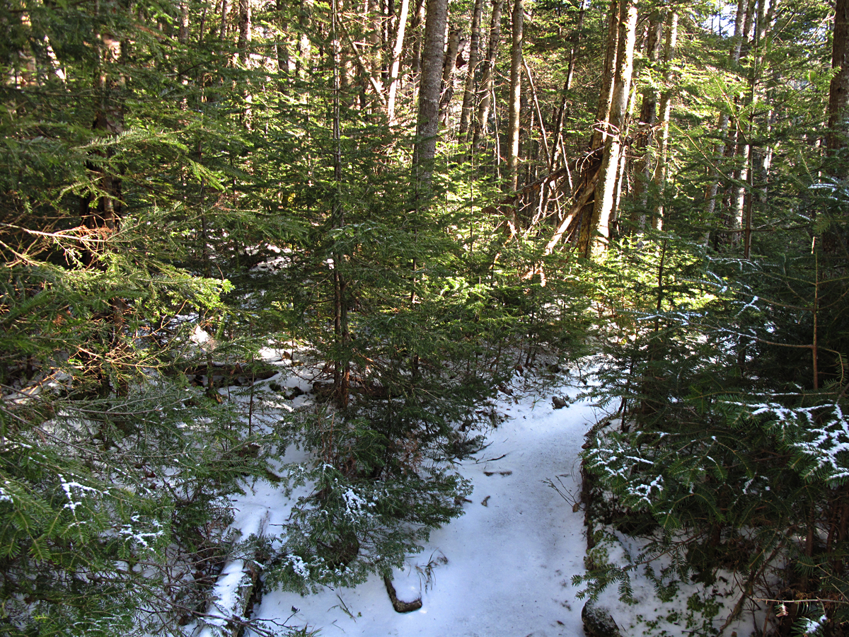
The lower section of the Fishin" Jimmy trail roller-coasters through a forest of spruce-fir-birch trees and is wet in several places. The wet translates into "icy" in the cold months. The iciness varies from month to month and year to year. Last year there was very little ice on the trail. This year the ice over flowed most of the trail making it difficult walking in several sections. I spooked a large moose that was moving on the trail in front of me and I heard ice braking as it crossed a brook and quickly headed uphill and away from me.

This was one of the easier section lower down, close to the hut, on Friday.

The alternative that I took several times was bushwhacking uphill several hundred feet to avoid steep, icy pitches.
This is a typical conditions of the trail above 3400 feet on Friday and was at the bottom and easiest section of the very steep pitch just below Kinsman Junction. The ice was of a quality that made it difficult to find traction with Micro Spikes. They tended to skate rather than dig in making the steeper section a bit sketchy. Part of the problem was that I hadn't sharpened my spikes since last fall so they had lost their bite.

Some, or maybe all of you, know about a new trail crampon made by Hillsounds that similar in most respects to the Kahtoola micro spikes. The "teeth" are longer and the points are hardened with a chisel point and may out perform the micros on the kind of ice I ran into Friday. They're the same price as micro spikes: $60.00. ( You should go to Hillsounds on the web for comments by users.)

I continued up but was slowed by the degree of difficulty on the last 200 feet of the pitch. It became a real ice climb. Because I was alone and it was a weekday (with few hikers out) I had to think twice about each move I made to make sure I was playing it safe. I was cautious enough to pack my camera away where it wouldn't get damaged if I fell. I used a lot of "vegetable holds" and/ or bushwhacked where I could but otherwise climbed tenuously. In these photos the crusted snow looks safe enough  but it's sitting on hard ice. Still, the micro points found some purchase on the hard snow so it was safer than the ice . My steel Kahtoola crampons, which were in my car, would have made this hike a romp with no worries. Later, after I had gotten back to the hut a group came down from the ridge with Micro Spikes and also complained about how inadequate they were for the conditions.

The peachy day turned less and less enchanting as I got to the ridge. Clouds appeared, a wind picked up and the temperature dropped as a cold front moved through. The clouds descended to the ridge and it got quite dark. I had gotten to about 4100 feet on North Kinsman when I turned back. I was mainly psyched-out (scared) about descending the ice pitch. I wanted to take all the time I needed. It took me an hour to descend the two miles back to the hut where I arrived around 1 pm. The combination of weather and time of year made it feel like 5 pm. I changed into dry clothes, had a cup of tea and headed down to the car. With the exception of Beth in the morning and the group that came down just after me, I saw no one all day. I enjoyed the solitude and the coziness of the hut as I have so often. Lonesome is such a lovely place.

Storm clouds over Lafayette make it quite a different scene from the morning.

The trail around the lake in reverse.

Looking back at the Kinsmans above the lake.

Looking west across the lake at the northeast section of Kinsman Ridge where it starts to rise towards the summit of Cannon Mt.

This is an interesting photo of the old Lonesome Lake Trail familiar to me as a kid. It only becomes noticeable in the fall. The current trail basically a long switch back, like a jack knife, but until the 1960s there were several steep, short switch backs all the way to the height of land. The point of interest for me is how little the older trail has grown in over 40 years, like the old Osseo Trail I was on a few weeks ago.

This is looking downhill at that same section of the old trail.

A family from Peterborough, NH, on holiday and on their way back down after an attempt to reach the Lake. They were thwarted by the ice on the trail and not having any traction devices, had given up. I caught up with them as they were trying the age-old technique of sitting down and sliding on the icy sections. They were in high spirits and having a great time.

The wonderful fall colors, again. Agony Ridge and Mt. Lafayette are behind the trees.

This is one of my favorite of Cedric Wright poems from the Sierra Club's book Words of the Earth:

"Tree qualities, after long communion, come to reside in man.
As stillness enhances sound, so through little things
the joy of living expands.
One is aware, lying under trees,
of the roots and directions of one's whole being.
Perceptions drift in from earth and sky.
A vast healing begins."

Happy Holidays.

Sunday, November 18, 2012

11-17-12 Osseo aka Whaleback Mountain, A Bushwhack (complete)

Lovely morning light on Rt. 118, one of the great back roads of New Hampshire, as I headed north over a shoulder of Mt. Moosilauke Saturday (11-17-12) on the way to Lincoln. NH. It was another gorgeous fall day, perfect for hiking, with temps in the low 20 (F) to start but promising a warm day.

My goal was Mt. Osseo, the middle peak in the background. It’s now officially Whaleback Mt. due to the similarity between the pointed summit and the dorsal fin of a whale, or dolphin. Big Coolidge Mt. is to the left of Whaleback and Potash Knob is to the left and lower.  And, while it's true I was going to bushwhack (hike off-trail), I also wanted to see if I could locate the old Mt. Osseo Trail that was abandoned in the mid-1960s (it's last mentioned in the 1960 AMC White Mountain Guide) and that, for 60 years, served as the southern leg of the Franconia Ridge Trail. The Osseo Trail came down the ridge from Mt. Flume, threaded its way over Osseo/ Whaleback Mt. and descended to the Kancamagus Highway just east of Lincoln.  For the purpose of this article I am going to stick with Whaleback Mt. as it's the name found on most maps. However, I'm going to refer to the trail as the Old Osseo Trail because there is a new Osseo Trail that plunges down from Mt. Flume to the Lincoln Woods Trail a mile north of the Lincoln Woods Visitors Center. 


I parked here at end of the road and walked out behind one of the condos and started hiking.

The old Osseo Trail follows Clear Brook for a short distance. This is a branch of Clear Brook.

The morning sunlight was delicious and highlighted the rolling, uneven forest floor.
I'd anticipated finding evidence of both older and more recent logging operations right behind the condominiums as this region was heavily logged in the 1880-1890s right up to the summits of all the neighboring mountains by the famous J. E. Henry whose mills stood less than three miles from this stump. The tree that grew here was obviously cut down with a saw because of the level top but it's difficult to say when. We would have to know what kind of tree it was, softwood or hardwood, and look for other stumps in the immediate area to know if it was cut during a formal logging operations. There were no other stumps and my opinion was that the tree was a softwood, possibly a hemlock, and was cut aroud 40 years ago. There was evidence of more recent logging upslope from this stump that probably occurred when the condos were being built in the early 1970s.
Examples of wind-felled trees. Throughout my hike on Saturday I was confronted with vast areas and numbers of fallen trees, like giant "pick-up-sticks". The impression, on viewing the numbers of dead falls, is that the only enterprise nature is conducting here is soil building and little else. Everwhere you look the impetus seems to be on soil building in all its diverse stages.
The other notable objects that I saw on my hike was a mind boggling array of glacial erratics the size of this one, which was small by comparison, and larger, as big as houses. Some were so large they had forests growing on top of them.
In the "pit and mound" topgraphy of the forest floor I found this pile of broken-up red granite that had been interred in the root ball of a large tree that fell here and has since rotted away. The granite is continuing its metamorphosis into sand and as time goes by it will become sand as it becomes amalgamated into the surrounding soil while adding nutrients and tilth.
A healthy beech tree. I saw many, many beech trees with advanced beech bark disease (BBD) throughout the hike from the lowest elevation to the uppermost areas of the ridge. This tree was 68 inches in circumference, or 21.6 inches in diameter. The largest beech tree I measured during the day Saturday was 28 inches in diameter. 

Bear claw marks on a beech tree. I remember seeing these more often when I was a kid.
When biodiversity was a subject we all talked about a lot there was an adage to remind people that a lot of the biodiveristy in forest ecosystems, perhaps as much as 85 percent of it, goes unseen as it' comprised of  microscopic organisms that are responsible for the decomposition of the dead organic matter like this beech tree. These tiny and numerous animals represent high levels of energy available to the entire system in a number of ways. One way is to provide food source for larger animals like woodpeckers that feed on the grubs, termites, etc. Bears occasionally will tear up a felled tree, or knock a standing dead tree like the one in the photo, looking for food in the form of grubs, insect larvae, beetles, etc. Beetles represent a high percentage of the diversity in a northern forest ecosystem.
A lovely, large, living, yellow birch (Betula alleghiensis) 95.5 inches in circumference or 30 inches in diameter. The size of this tree, and several others close to this size that I measured on Saturday, raises questions about the logging that occurred here 120-130 years ago in the late 1800s. There are photos from that time showing these mountains, Big Coolidge, Whaleback, and Potash Knob, denuded of trees when the loggers finished their work here and moved up the river. The logging roads extended right to the summits. Seemingly nothing was left uncut. However, the size of this birch would indicate a tree older than 120 years. Was it left behind as a seedling too small to cut by the loggers? Or did it grow rapidly in this location due to the absence of any competitive trees?
Whaleback in view. I had hiked up and over two low ridges and now had a high ridge to ascend to get up to the top of the ravine to the east of the summit. Having the leaves off the trees is a major advantage to bushwhacking during the six cold months of the year because of the visiblity. In this case I didn't need a compass. I could see Whaleback's summit (due North) and make out the ski slopes on Mt. Loon, to the south, pretty much the entire time. So I had my two reference points for navigating.
It's difficult to see due to the bright sun striking the camera lens but to the right, a bit, you can see Loon Mt. and I could see white lines of the ski trails being groomed for Thanksgiving weekend. You'll be able to see them in a photo taken from the summit to get an idea. Hiking off the trail requires knowledge about navigation, and knowledge about "place" as in knowing landforms from different angles, brooks and rivers, cliffs, topography, etc, and it requires self-confidence in that knowledge (experience). It also requires some endurance  as, a lot of the time, its hard work, physically more demanding then trail hiking (but not all the time) and can certainly be more frustrating because, in bushwhacking you don't always achieve your goal and have to change plans.

There wasn't a breath of wind. Everything was still. I heard juncos and ravens as I sat here in the sun for awhile enjoying the solitude. The air temperature was 30 degrees (F) and the sun was hot on my face and arms. I was wearing my usual hiking outfit of Patagonia shorts and a long-sleeved, light weight merino wool top with sleeves pushed up, but I was sweating profusely as I hiked. That's a statement about fall hiking. The caveat is that it can get cold in an instant. Crossing over the ridges and descending the shadowed northerly flanks I immediately got chilled. In the photo the slope is getting steeper and often calling for use of hands as well as feet for traction. 
The balsam and spruce on the north facing slope of the ravine I chose to climb directly to the summit of Whaleback. This is at about 2700 feet.
Just a short way up the ravine I encountered this maze. This cross stacking of felled trees represents a real obstacle when bushwhacking and it's best to find a way around it because it's easy to get hurt threading your way threw it unless you're agile. It can take extra time, as well. If you do decided to go through it be careful.
Then there's this stuff. At about 3,000 feet in elevation you usually begin to run into these dense areas of balsam and spruce on north slopes, on ridges and near the summit. It can be incredibly tight and interwoven like a fence, and you have to be patient. Protecting your face and arms is necessary. You also have to try and keep your bearings which is easy most of the time as you are either going uphill or downhill. Just remember, it will end. It's like waiting for on-coming traffic to end when trying to make a left-had turn driving.
When it does begin to thin again you'll see light in front and you'll be able to re-check your "line", or direction and location, and get back on track. On Saturday, in this dense growth I was moving at about 1 mph, or less, while bushwhacking and this isn't even close to how bad it can get on the higher peaks. The rate of progress varies, of course, and in the open woods you can crank, but it is while swimming through this dense vegetation that you'll truly recognize the benefits of a trail.
This is "good passage" on the ridge or summit slopes. I took the photo where it was fairly clear. I reached this point by crawling and pulling myself through with both arms which is typical. There could be a book about the yoga of bushwhacking. There's a ribbon-like zone throughout the White Mountains of short, densely crowded balsam and spruce trees with alder and mountain ash thrown in here and there, that runs through and around the mountains sometimes as low as 3300 feet but always found at 4000 feet up to the tree line itself. Moving through this is difficult and it will often be so dense that it will take all your energy to move a couple of feet. You'll find breaks, clearings, rock outcrops, etc, where you can rest and check your direction. In an article titled "Bushwhacking--Pain or Pleasure" in the June 1963 Appalachia (by Marie Carden and Ronald Glower) the authors state it's "certainly true of some bushwackers who go out of their way to get in a situation where they have to fight through that awful stuff that grows on the top of mountains that the guide book calls 'stunted spruce' rather than follow a trail. But for most people, bushwhacking is a mean to an end rather than an end in itself. It can be either a torture or, with practice quite enjoyable. This is true whether it be for a half-day, or a whole day, or a real production of two or more days."(p. 530)
I was able to stand up and hike in normal fashion for a good deal of the climb up Whaleback on Saturday. I only had to actually crawl a dozen yards, or so. At one point I went past this patch of moss that was somehow in partnership with the sunlight coming through the balsams. It looked like the moss had been able to maximize its use of the sun.
This is the sort of thing you are likely to find when you're hiking off trail. It's cool. Makes you want to move right in. I didn't realize it when I first popped out of the dense firs right next to this leaning boulder that I was standing on the old Osseo Trail.  I was delighted because it would make getting to the summit much faster and easier.

The following is an experience I had that illustrates the points made in the bushwhacking article in AppalachiaOn a south east ridge of South Twin there is a prominent rock outcrop visible from Galehead Hut that beckons to you. From the huts front porch it appears that a fine view of the hut, the Franconia's, and the western half of the Pemi can be seen from there. Having felt the "itch" you attempt getting onto the ridge to gain the outcrop by trying various entry points: from above  descending to it from the Twin Way using a compass bearing. In ten yards your clothes are in shreds. You turn back. You try another entry points. In 20 yards you have no clothes. You turn back. If you keep trying you'll get wiser and eventually you'll find a way through and you'll sit there in awe because the view really is superb. I've tempted myself with staying there overnight to take photos of the hut after dark with the inside lights glowing from the windows, or at dawn when the Franconias and Garfield are in sunlight and the hut it still in shadow, etc. 

I remember when getting to West Bond was a bushwhack just like what I described above and I think a lot of summits including Zealand Mt., Mt. Field, Lowell, Nancy, the Hancocks, Owls Head, were all bushwhacks up to the early 1960s. Certainly, prior to the early 1900s where there was flurrry of trail building activity from Randolph to the Pemi, everyone had to bushwhack who wanted to hike.
This is looking down a stretch of the old Osseo Trail just below the summit.
And from the same spot this is looking up the trail. As you can see it looks neglected to a degree but still in good shape. I was to find numerous places where someone fairly recently, in the past 3-5 years had been "standardizing" it with an axe and saw as several blowdowns that had reached across the trail were trimmed back.
The notation in the 1960 guide book mentions this ledge just below the summit and the view south. That's Loon Mt. across the valley with the ski area. They were taking advantage of below freezing temperatures to try and get some snow on the slopes in hopes of attracting skiers for the long Thanksgiving weekend.
This is looking slightly southeast from the Osseo-Whaleback summit towards the entire Sandwich Range. Left to right is Mt. Hitchcock, The Moats in the background, Mt. Kancamagus, Mt. Tripyramid, Osceola East Peak and Mt. Osceola, Mt. Tecumseh in the back, Scar Ridge and a ridge on Loon Mt. in the right foreground.
Left to right: Signal Ridge, Mt. Carrigain, Mt. Hitchcock in foreground, North and South Hancock, Mt. Huntington, and the Moats in the background.
Mt. Washington on the left and the Pemigewasset Valley in the center with a shoulder of North Hancock to the right (or it's possibly Mt. Carrigain).
I followed the old Osseo Trail for a mile, or so, on the way back down and found it well kept.
It appears unused for the most part...
with the exception of a few small human touches....
.......but for the most part it was hard to discern as an actual trail. Someone has freshly painted yellow blazes, and, as noted above, blow downs have been cut back off the trail. It's possible that it is used during the summer months by residence of the Loon condominium complexes.
In the blog article describing my hike up Mt. Lafayette a month ago I showed photos of frost "quarrying" of rocks, or how freeze-thaw mechanics break ledge and large pieces of rock into smaller and smaller pieces, but this glacial erratic found on the lower slope of Whaleback set a new standard for quarrying in the the square edges and flush planes. It looks as though it was sculpted by an artist using good rock chisels and a practiced hand.

I left the trail at the bottom of the first steep ridge coming down from the summit and found my way back to my car following the approximate route I'd taken on the ascent. It was early afternoon and the light in the woods was amazingly bright and warm and created these dark, crisp shadows these maples and birch.