On Saturday, 10-29-11, I was again starting up the Gale River Trail heading to the research site just off the trail at the site of the 1954 landslide (Hurricane Carol: 8-29-1954). I started up the trail bathed in this gorgeous October-morning light but a major snow storm was forecast for the mountains beginning in the late afternoon/evening and continuing into Sunday, the 30th. I didn't race but I wanted to get up, collect my measurements, check out possible alterations to the research site from the heavy rains at the end of August, make a quick run up to the hut, and try to get back down to the parking lot before the storm became so intense that I might not be able to drive back out the Gale River Road which which the Forest Service does not plow. In the morning I ran into Mike Carifio, the Forest Service district police officer, as I was readying my pack and about to head up the trail. He assured me that the storm wasn't expected to start until well after night fall.
The soil depth measurements I made on Saturday will be added to the baseline I'm working on that, over time, will help me understand soil development on the northern slopes of the White Mountains. The north slopes, generally, tend to be damper and a bit cooler than slopes with different aspects so soil development may be measurably different. My measuring technique is simple and only involves inserting a strong, graduated plastic rod (1/4 inch diameter) inserted vertically down into the soil until it hits the hard-packed gravel till. The measurements are repeated at one inch intervals across the perpendicular transects in each study plot, then a graph of the measurements is laid out, and, finally, a profile emerges that reflects the incremental development of the soil from year to year.

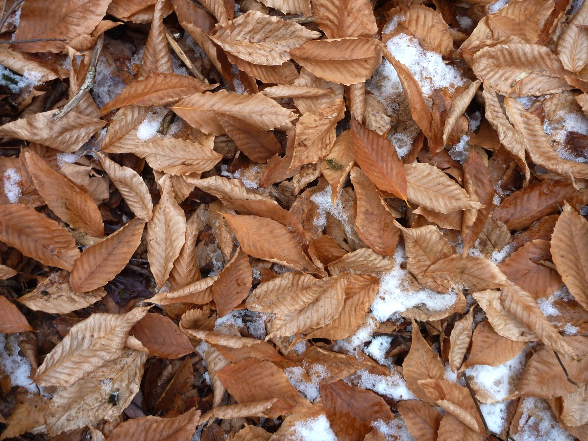
The light, at the beginning of my hike, was dreamy. It highlighted the rich colors of this end-of-October day. This years crop of leaves was above average in volume (not sure why). The yearly harvest of leaves contribute a great deal of nutrient/biomass to the developing soil. As they decay they add all kinds of stuff including organic matter, numerous cations like calcium (Ca), and tilth. Beech leaves, like these in the photo, are noteworthy as they contain a slightly higher amount of calcium cations than other leaves found here. Calcium is a good thing because it helps lower the pH of the soil although the trace amounts of calcium in beech leaves wouldn't raise the pH of the soil much. Herb Bormann and Gene Likens, within their extensive research at the Hubbard Brook Experimental Forest in West Thornton, NH, have contributed insights into the developmental phases of forest soils in and around the White Mountain. They identify three "compartments" of biomass: living biomass (e.g plants and animals, deadwood, and dead biomass. Dead biomass is the "organic matter" in the soil a lot of which is decaying leaves.

A trace of snow at low elevations like this confuses the sense in October. It seems early but actually there are lots of precedents for this much, and sometimes much more snow, early in October. This trace was from a brief storm a few days earlier. Still, it's lovely to see it. I even like the way it smells in the fall air and the way it accentuates the shapes of things even the stones and leaves in the path.

I was shocked at First Crossing to find a sign directing me to use a "new" trail that was recently inaugurated and which cuts off the portion of the Gale River Trail (GRT) on the east side of the river. That means from this point in the photo the trail on the left side of the river is now closed to foot traffic. The new trail segment begins a 100 yards below First Crossing and meanders up a forested ridge on the west side of the river.

The sign is self explanatory. I was stunned and disappointed they were closing the long section of the original trail between the first and second crossings. This trail has been in use for 50 plus years. I knew about the new, alternate section of trail that would be for use in high water as a means to avoid the hazardous river crossings, but I had not idea the 1.5 mile-long section of the trail that follows the river closely would be closed for good. The Gale River Trail through its entire history has been intimate with the Gale River in every sense; with the water, the magical light that dances off the river and surrounding foliage, and the lulling, lyrical voice of the river. Hiking the Gale River Trail, particularly the section they're slicing off, is like a meditation. It's an intimate conversation with all things; great blue herons, deer, mice, the wind, ice, the sun and the rocks, and the huge boulders scattered on both sides of the river. The experience of hiking the whole trail including the 1.5 mile in question is irreplaceable.

The new trail follows a line away from the river. It keeps to a low ridge where it ascends in a serpentine motion bending back and forth along the ridge to keep the ascent angle low and, perhaps, to control water flow. I have to say I immediately missed the river! The new trail was probably justified in some peoples' minds, a reduction of hazard and liability, but new trails are like new anything, they take a while to get used to.

The new trail goes up and down a lot. This section section is referred to as "dugway". It's the same technique used to create logging roads in very steep mountain terrain. The road crews dig out the rocks and soil on the uphill side, spread it out towards the downhill side and pack it down. It washes out easily but can be refilled quickly as well. Remnants of the dugway logging roads built a 100 years ago are still visible in some places.

A positive, perhaps, is the new trail traverses places I'm not familiar with and that I found populated by som large yellow birchs (B. alleghenensis). I measured several that were 30" to 36" in diameter (DBH). One was 40" in diameter which is a good sized tree. In line with big trees another feature of the new trail, evidenced by the above photo, is a vast number of blow downs particularly at the lover end of the trail near its junction with the old trail. Many looked as fresh as one or two years and may have gone down in the February 2010 storm that came in from the southeast.

It's difficult from the photo to grasp the scale here but this is one of the yellow birch trees that's 36" in diameter. The crown is still alive and 60 feet above the forest floor. It's no longer a vigorous specimen and probably no longer a carbon sink. It's one thing to have an aesthetic sense of these old trees but with the current emphasis on global warming old growth forests are seen as carbon sources, meaning they have a negative value.
This yellow birch is 32" in diameter.

The forest traversed by the new trail is typical for most of the north-facing slopes of the White Mountains where the forest is somewhat cool and damp. There's a good mix of hardwoods and conifers on this ridge. Due to all the deciduous trees along the new trail there are good winter views of North Twin.
Balsam firs (A. balsamea) dressed up for Halloween.

The new trail rejoins the old trail a half mile above Second Crossing which, again, means hikers are all but severed from any interactions with the river. This log bridge has been here for as long as I can remember and for me it symbolizes a gateway, an entrance, into the enchanted upper valley of the North Branch of the Gale River, the ridges and summits, and the Pemigwasset Wilderness beyond.

The lower section, the first 2.5 miles, of the Gale River Trail, it should be said, is like a 'death march'. It follows old logging roads that are somewhat boring, often wet, and seemingly never-ending. It doesn't begin to feel like a mountain trail until Third Crossing, or now, perhaps, at the small bridge in the photo above. I loved packing the Gale River Trail particularly with a compact, perfectly balanced 100-120 pound load on my pack board, pushing myself to keep a steady pace, trying to make the 5.8 mile trip (in 1961) from the pack house to the hut in roughly 2 hours. My best trip for combined weight and time was 2 hours 10 minutes with 110 pounds. I had an exceptional day when I felt "fluid" and movement seemed effortless. I viscerally remember the "steps", or steep sections, where I really had to push hard alternating with the "flat" sections, like the one above, where I could relax and recover. Like everyone who has packed in the huts the enjoyment is the challenge and the wonderful sense of rhythm you have with the trail and the mountain. People look at our loads and imagine it's some kind of punishment to carry so much weight but I bet anyone who's packed will admit that, on most days, it's incredibly satisfying.

Keeping with the idea of a "gateway" to the mountain realm above Third Crossing I sense when I see these distinct configurations of stones and boulders strewn on the trail are actually old slide tracks and represent the change in topography where the valley narrows and the slopes become steeper as they rise towards North Twin and Garfield Ridge. There's definitely the sense one has finally entered the mountains. The above photo suggests that the array of stones in this location could be a slide track that is 400 yards north of the 1954 slide track and probably much older. The 1960 AMC's
White Mountain Guide (book) reports that above second crossing the Gale River Trail "crosses two slides just before hooking right and heading up to Garfield Ridge. The two slides described in the guide book included the 1954 slide. The second was south of the 1954 track and about the same size. It may have occurred in the 1930s and was corroborated by Hanque Parker who worked at Galehead in the 1930s and said he remembers there was a fresh slide track at that time, well before the 1954 track. The main point is that "mass wasting" on the east side of Garfield Ridge has been going on for some time.

This is study plot #1 looking north. The mantel of snow is only a few inches deep but hindered taking measurements. I go to great pains to avoid disturbing anything on the slide track to the extent that I walk as little as possible on the site. I ended up having to move the snow away from the transects slightly to obtain accurate measurements.
Ever since the heavy rains of August 28th, when Hurricane Irene was moving north through Vermont, I have been curious to see if there was any alteration to the 1954 slide track itself or to this small research area on the lower end of the slide track. In response I have to say that at the lower end of the track there was no visible impact of high water anywhere. That does not exclude the shifting of rocks in the river and other perturbations that I probably would not have noticed to begin with.

Study plot #1 looking west and uphill. The snow cover which probably won't last long was hiding the leaf litter on the forest floor so it was difficult to get a measure of how much there was. The soil depth has increased incrementally but there are climatic and other environmental factors to include. The rains during the past two months, including the approximate 6.6 inches dumped by the storm of August 28th, have saturated the soil. I discovered this when I put in my measuring pins and the soil gripped them so tightly I had to use all my strength to extract them.

Study plot #2 looking east. The snow makes the area of trees look denser than it is but it was still difficult to collect measurements. The brook runs through this plot which makes taking measurements more challenging. There were no measurable changes in plot #3. There was incremental increase in depth on one side of plot #2, and an equally small change in plot #2. Until I graph the results I won't really be able to make much sense out of the data. The data baseline I'm constructing is just a few years old, not really enough time to observe patterns.

Looking for evidence of the heavy rains of August I headed up the slide track. This is at the bottom of the track where there's a lot of gravel mixed with clay and lots of odd sized boulders. As I've mentioned before the rocks on the slide path are varied to the extreme and occasionally I've found rocks the size and shape of basketballs or cannonballs; perfectly round and where they sit the soil is puffed up around them as if they fell from a great height. They're puzzling.

This configuration of stones is also puzzling. Some one many years ago went to some lengths to make what appears to be a throne-like seat, complete with arm rests, that has the view of North Twin in the photo below. Without the snow the seat, or chair, is quite comfortable to sit in.

This is the view from the lower northern edge of the slide track. The light, within the space of an hour, has changed dramatically and at this point I could smell the snow storm that was forecast moving in over the mountains.

This is the long clay bank that extends up the northern half of the slide track for several hundred feet. It has a soft texture and my boots would sink in an inch or two when I try walking on it. I try not to disturb it and walk at the right edge along the balsams. There is no visible sign that August's heavy rains altered this site in any way. Virtually nothing has changed and I could clearly see my footprints from three years ago in several places. Does this mean it didn't rain here as much as, say, on Mt. Washington which is 16 miles away? I don't know, but one would expect that the sheer volume of water that was poured over this landscape in such a short span of time would have left some trace. Either that, or the existing hydrologic system was able to handle heavy flows.

Looking north from the top of the clay bank. The west ridge of North Twin juts into the photo and beyond that are the Burke Mountains in Vermont. The sharpness of the features on the ridge in left center is another indication of an approaching storm and a drop in the barometric pressure.

Half way up the slide and from the middle of the slide track looking at a dense cluster of balsam firs that crowd right up to the north edge of the slide and bump up against the white birch growing just beyond the slide track. Even though the birches were not damaged by the slide they were impacted in other ways and most notably the huge increase in the amount of sunlight they received after the slide created the large opening. Vermont mountains in the far distance.

This is the upper half of the slide track and you can see attempts by various species of plants to colonize the rock ledge that was exposed by the slide. The succession here, since 1954, has included alder, pin cherry, balsam fir, poplar (aspen), and maple. The balsam are thriving in the areas up to but not including the ledge. There is some soil in pockets but for the most part the ground is a hard gravel with larger stones mixed in.

As I've noted before a new species in the mix is white pine (P. strobus) that is not represented anywhere else close to the site. In the center of the photo is a three year old white pine that is happily growing at 3250' asl. This is another puzzle in terms of where the original seed stock came from and probing the question of how far white pine seeds travel, generally. On a separate note, looking around from this vantage point that is 150 feet below the top of the slide there is nothing to suggest impact from the August 28th storm. The whole slide track looks similar to the way it looked in May.
This is the tallest white pine on the slide and is located just under 3000' asl and is a little over 40' tall.
The photo above and the photo below are of two white pine seedlings growing 100 feet from the top of the slide track. The evidence is that the white pine is pioneering this niche and seems thrive here, with the question still open about what conveyance brought the white pine seeds here, e.g. wind, animal, etc.


There are no other white pines in the vicinity.

Here on the slide track, however, there are now 20 established specimens. I recorded most of them last fall and their heights vary between 40 and 8 feet. In this photo, two white pines stick out. One's in the upper right corner and the other is in the lower left corner. The introduction of the white pines to this site offers us a good snapshot of the process of succession that we've been discussing. The site has been in flux for nearly 60 years there's . White pine is certainly a common species throughout northern New England so whether it belongs here is not an issue. It's not an invasive, but it is here at the edge of its range just in terms of the altitude. I've mentioned before in the blog that there's evidence of white pines growing up to 3000' but not over that altitude. The other nagging question is where did the original pine seeds that started this process come from. The phenomenon of "buried seeds" is a possible answer. This is an adaptation by which plants produce an abundance of seeds some of which germinate and grow and others that are eaten, rot, etc, but many get buried by environmental mechanisms like leaf drop and become incorporated into the top soil. When the soil gets disturbed by any number of events the seeds start to grow. There are vast differences between species in terms of how long a seed that has been buried will remain viable and there's the possibility that each seed might be affected by other environmental factors such as temperature. I'm not suggesting that the white pine seeds were somehow lodged here before the slide occurred but I do think it offers speculation about how the northern forest emerged at the end of the last ice age 10,000 to 11,00o years ago. Is it possible, I might ask, whether viable seeds were held in glacial ice for tens of thousands of years that were deposited in the post-glacial soil when the glacier ablated?

The colors, with the snow and the flat light created by the clouds, were lovely. The reds are the berries of Mountain Ash and the orange belongs to the needles of a Larch tree which, like the white pine, is rare for this particular site.
Getting to and from the slide track engenders bushwhacking 50 yards through this dense balsam stand. It's one of those challenges that requires the strength of football line backer. You kind of put your head down and push and try to prevent your clothes from getting badly torn.
While I had my head down and pushing myself through the trees I found this curious set of prints from either a raven or crow that were inside the dense cluster of balsams where no bird could fly. It looked as though the bird had done a dance on this stone, walking back and forth a few times, and then pooped and went on his/her way.

Red fox.
After a quick hike up to the ridge to check the hut I came down quickly. This is a glimpse of the new trail. The storm was definitely not a threat at this time, as I had originally thought it might be. I expected the clouds to descend and spitting snow at the hut but it was clear to the bottom of the trail.

There are some glades along the ridge that will offer good skiing with more snow.

Another skiable section of the new cut-off.
As I mentioned earlier there's a large number of blow downs in the area just to the west of the trail near First Crossing. The new cut-off threads its way through them including this towering root ball from a downed balsam and we are offered another snapshot of biotic succession in these downed trees.
The bole of this balsam is 18 inches in circumference and it's close to 90 years old. With it's demise a number of critical factors were triggered, including increased sunlight to the forest floor, that will bring a new generation of balsams and some competitive species to light.

Sub-angular glacial erratics on the lower section of the trail.

A wind-fall sugar maple.

Beech leaves.
The Highland Center with 6 inches of new snow, October 30, 2011
I spent the night at the AMC's highland center where I finally got to meet Keith Wehmeyer in person after corresponding with him for a couple of years. I pulled an all-nighter (almost) in the library going through old Appalachia (the journal of the Appalachian Mountain Club) covering the years 1902 -1922 and earmarking all of the articles on White Mountain history, natural history, including biographies. It takes hours to go through a single volume because it's easy to get pulled into reading all the articles. They're fascinating and filled with lots of great stuff. All this effort will hopefully aid the completion of the glossary I'm compiling of Appalachia articles focusing on the White Mountains that might be useful to readers of this blog.

The Mt. Washington Hotel at Bretton Woods in Crawford Notch. The snow storm raged into the late morning accompanied by a strong wind and when it was over the notch was pasted with wet snow under a concrete sky.
One string of articles in the Appalachia from 1915 thru 1918 covers a massive storm that hit the White Mountains in September 1915 and according to the various articles that covered different aspects of that storm make it out to be the most destructive storm of the last 100 years. The detailed descriptions of the damage to the trails is awe inspiring. In one article by Charlie Blood who what trail master in 1915 he describes blow downs extending for miles across the Ethan Pond trail.

The Gale River Road with new fallen snow.
I didn't realize it at the time I took these photos Sunday morning that to the south in western Massachusetts where I live, and in northern this Halloween Storm had caused a great deal of damage estimated in the hundreds of millions of dollars. The wet snow associated with the storm stripped large limbs off trees that brought down electric wires and caused black outs throughout the area that lasted for 8-9 days in some places. It was quite impressive. I had clients who were without lights, heat, or any way to keep fresh food for more than a week. All schools, colleges, malls, doctors offices, wings of hospital, and, best of all, most fast food restaurants had to close for an entire week. The nights were amazing with the bible blackness that settled in everywhere when the sun set. And then there were the stars.

The Gale River Trail.

A photo taken on October 30th of this familiar scene on the Gale River Trail.......

......also photographed at dawn on July 22nd.