 |
| At dawn on Saturday I was on the Lowes Path heading up to a large forest tract where last summer (July 2011), while hiking up to King Ravine, I observed and photographed a number of very large white and yellow birches and sugar maples. Some of the individual trees were nearly 10 feet in circumference and 3 feet in diameter. Much of the forest within the White Mountain National Forest has been ravaged by logging and fires in the last 125 years so a tree with a 38 inch DBH is definitely large if not considered "old growth". |

I took Lowes Path because it nicely transects the area of the "big trees". What I planned to do was crisscross the trail at 100 foot intervales and schmooze with the trees up to 200 feet on either side of the trail. This gave me the best chance to find the larger trees in that tract. This was between 2,000 feet and 2,700 feet in elevation (approximate). Once at the junction of the Lowes Path with the Link I was going to head down the Link for 3/4 of a mile and then bushwhack back down to the Lowes Path hoping to catch it right at the trail head. That would give me two long transects with numerous shorter, perpendicular transects for a quick survey of the vegetation. The Lowes Path is considered the oldest trail on the north slope. It was cut in 1875-1876 by Charles Lowe and William Norwell and was designed to go from Lowes' front yard to the top of Mt. Adams but it connects with a number of other trails allowing access to all areas of the Northern Presidentials. Lowes is considered the easiest trail for ascending Mt. Adams due to the "gentle grade". It's used a lot in the winter for that reason. Lowes also gives the best access to the RMC huts, Gray Knob and Craig Camp.
 |
The
Lowes Path can be soggy for the first mile. There are two sections
where detours have to be made around mud, but on Saturday the brooks
were down and in some cases, non existent.
|
 |
| A healthy beech in the woods close to the trail head. A few years ago I did a story in the blog about Beech Bark Disease and its impact on a large tract of beech between the Valley Way Trail (on Mt. Madison) and the Cold Brook Trail less than a mile away from this tree in the photo. Quite often trees that are effected by BBD are 12 inches, or greater, in diameter. This tree is a little larger than 12 inches. Another factor is that the insect that carries BBD is wind born which is an inaccurate and random means of transport. It means that, at least for a while, some beech trees are given a reprieve. |
 |
| Sugar maple is a common tree on the north slope. Between the Lowes Path and the Valley way there have been years when local farmers have developed large "sugaring" operations across this slope. This is a "burl, or burr which is a growth representing an anomaly or some kind in the trees cell development. Burls contain xylem and phloem, the tissues associated with normal tree growth, but either a disease, an environmental stressor, or combinations of stressors causes the burl to form. They get quite large and are prized by artists and furniture makers because of the unique designs formed by the woo. |
 |
| This large roots system, cleaned of soil and dried for a number of years also resembles a sculpture. |
 |
| This root system, up ended fairly recently depicts a stage of decomposition that is a fundamental part of soil development, at least one type of soil development. In the lower part of the forest tract, just a 1/2 miles from the highway and where the ground is level, there is all kinds of evidence of the various dynamics of soil building. |
 |
| When you're walking in the woods and come across this "pit and mound" topography you are in an areas that was affected by a large storm at some time in the not too distant past, roughly 40-150 years, and this area represents a mid-stage in soil development as root balls like the one in the photo above completely decompose but leave a mound of soil behind which further weathers and, over centuries the forest floor becomes more and more level. |
 |
| This is a more comprehensive photo that shows the root ball and the decaying trunk of a tree that probably was toppled in a storm that approached from the southeast, which means it could have been a hurricane or a large winter storm (like the January 2010 storm on the Presidentials). At this stage of decomposition this tree probably went down 50-60 years ago. You can see, from all the facets shown in the photo how the "pit and mound" landscape develops over time. It is far more dramatic in flat areas than on steep slopes, but it is congruent with major perturbations like hurricanes and also normal succession patterns in any forest. |
 |
| Decompositon is continuing while the tree is still standing. Fungi, or mushrooms, are agents both of assisting in breaking down nutrients for trees to use for growth and in decomposition of the tree at the end of its life. The mycorrhiza, or the microscopic filaments that are produced by fungi to assist in transporting nutrient in the form of ions to trees and herbaceous plants. They also assist in the all important production of healthy soil. Mycorrhiza have been the keu engineers in the recovery of the forest in the northeastern US from the assault of acid rain over the past 75-100 years. |
 |
| Two very healthy white ash trees towering above the canopy. |
 |
| The sun comes over the ridge. On the right you can see a portion of a large glacial erratic deposited near a small outcrop of the bed rock. The top soil here is rich and quite thick, 6-7 inches in palces, except on the bedrock itself. |
 |
| A large blow down on the ridge. This is at 2,400 feet in elevation and the size of the downed white birch is still inferior to the trees I am looking for. |
 |
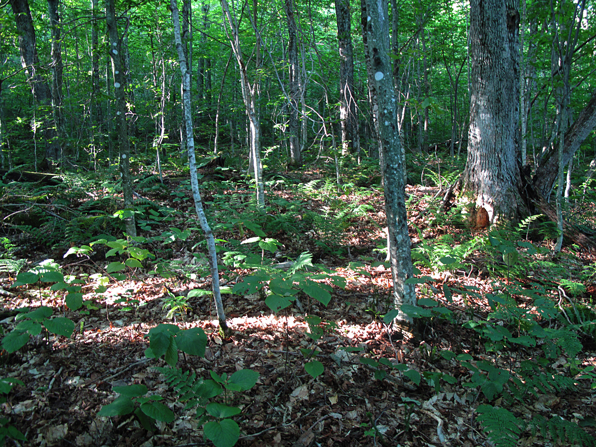
| A picture of health in this forest ecosystem. |
 |
| As is this picture but, at closer to 2,500 feet, I'm finding maples and birches that are greater than 76-78 inches in circumference. The average circumference here has jumped to 100 inches with the largest at 120 inches = 38 inches On a small cap of protruding bed rock there were several red spruce that were in the 76-78 inch circumference range. |
 |
| I was having difficulty getting my tape around the trunk of one of the larger red spruce next to the trail when I was besieged by a swarm of hikers filing past. They were members of a Manchester, NH, church group on their way up Mt. Adams, most of them for the first time. These two obligingly helped me wind the tape around the spruce trunk and chatted while I measured. At one point a member of the group asked how old the spruce was that I was measuring and I erroneously blurted out 180 to 200 years for some reason. If any of the group reads this you might pass along that the spruce is probably 100-120 years old. It was 80 inches in diameter. The red spruce are prolific in a dense cluster on top of a knoll on the ridge where the underlying rock ledge is close to the surface. | |
|


 |
| This is a white birch that I recorded last year at 103 inches in circumference. It's still 103 inches in circumference. One reason I am so ensconced with these trees is that while they are definitely living they're also dying. It's a good probability they've stopped growing. So here they are, starting to exit the stage, and leaving an example of what this forest probably looked like 300-400 years ago, before European contact. |
 |
| A large beech decimated by BBD (beech bark disease: did you forget?). The circumference was 101 inches or 32.15 inches DBH (diameter at breast height). |
 |
| A gnarly white birch measuring at 36 inches DBH. |
And the crown was magnificent particularly in this early morning light.
 |
| A three foot DBH sugar maple on my return bushwhack. Quite lovely! |
 |
| French toast. Yum. |
 |
| This will be continued but basically the conclusion from my tramping about is that the larger of these trees follows a line up the ridge itself and close to the Lowes Path. There are only a few large maples and birches on either side of the ridge. This winter I will explore this more. There are numerous questions still unanswered. One is how did these trees survive the logging that was taking place here between 1902-1916. It's probable that the loggers were after spruce and let the medium sized (at that time) birch and maples go and these are the remnants of that population. On the other hand, the trail was here first and there may have been an agreement that no trees would be cut in the trail "corridor" but that's highly unlikely judging by the loggers' attitudes demonstrated on Madiosn, Washington, etc. where they cut everything down, trail or not. In fact, it's exactly that absence of integrity that pushed the RMC and AMC folks to hammer through the Weeks Act establishing federal jurisdiction over these forest tracts that became known as the National Forests. |
 |
| Another healthy beech that's grown to a 34 inch DBH. See the pit and mound "texture" of the forest floor? On the northern most-facing slope there were a lot of seeps of water probably movement of water over the bed rock. Where there were seeps the soil was wet and muddy and lots and lots of fresh moose tracks. | |
|
 |
The
wtiness. This is a hollowed out, older trunk of a red or black spruce,
that saw everything that happened here back around the 1890s or even
earlier. If it could only talk.
|
 |
| The couple at the end of the trail. I was back to the highway and they were just starting out and looking forward to a grand hike up Adams. They were also knowledgeable about the surrounding forest which impressed me as my hope is that most people who climb in the White Mountains have a basic working knowledge of the social history as well as the natural history of this region. Are you all sick of hearing me say that? "Preach, preach, preach. He won't stop!" I hear you saying. |


No comments:
Post a Comment