 The first breaths of dawn were rippling with heat as my daughter, Liz, and I headed up the Gale River Trail. We'd come up from Springfield-Northampton, MA, where temperatures the week of July 18-23 stayed around 100 degrees (F). We were on the road by 4 am hoping for respite in the cool woods beside the Gale River and, perhaps, cooler still on the high ridges above where a cool breeze might be blowing; even something in the mid-80s would be okay.
 Getting on the trail at dawn reminds me of the scene in Kenneth Graham's Wind in the Willows where Mole and Water Rat find Baby Otter at the feet of Pan who has directed them to the lost otter with enchanting music from his famous pipes. The moment the morning sun first touches the tops of the trees bringing with it a deep, reverent stillness, fills me with awe, as it did Mole and Rat at the sight of Pan ("The Helper"). On this Friday morning, though, the sun's entrance instantly made the air feel hot. We were motivated to move quickly up the trail.
 Getting on the trail early Liz and I were also planning an early arrival at Galehead to relieve the regular croo who were eagerly waiting to run down the mountain and kick off their joint 3 day-set of days off. The heat slowed us down a bit and we got soaked through from sweat in a few minutes as if we were carrying heavy packs.
 The water at the crossings was eerily low. The heat wave certainly had something to do with the low volume but it seemed a bit early in the summer for this extreme. There has been a lot of rain recently so one would expect a higher level of flow.
 Even a minor rise in air temperature exponentially affects the evaporation/transportation potential of deciduous trees. A combination of warm winds and above normal air temperatures has an even more pronounced affect. Mid to late-July is the peak of leafing-out for deciduous trees and, all combined, they use enormous amounts of water daily which their roots suck out of the ground before it makes it into local streams. That might be part of the reason for the lower water levels in the brooks and streams. Trees use the water for sugar production and the suction is created by evaporation of water vapor from the surface of the leaves. The trees create enough suction to "pull" the ground water all the way up to their crowns. This process gradually declines through August as the days get shorter and cooler and it will drop off steeply with the cool nights of September when sugar production in the leaves halts.
 At 8 am the river looked like a perfect place to escape the heat of a mid-summer day.
 Liz walked upstream to one of her favorite haunts, these pools about 200 yards above the slide on the Gale River. There are two prominent pools each resembling a bathtub that are about 4 feet deep; just deep enough for a bone chilling soak.
 The water is really, really cold, even on a hot July morning.
 While Liz cooled herself I continued upwards to "free" the croo and get settled into the hut where Liz and I would be working for the next two days and nights. We would be joined by Sue Dickman and Ari Ofsevit later. My oldest daughter Julia had called Thursday to say that she and her boyfriend wouldn't be able to join us due to illness creating a bit of a bind in terms of croo strength. Meanwhile, Ari texted on Wednesday that he had to spend Friday in New York due to a family matter. He said he would drive back up late Friday night, pack up to the hut and be there early Saturday morning (which he heroically accomplished getting to the hut at midnight. We were happy to see him. )
 Almost at the crest of Garfield Ridge I recognized this woman by her boots (they're Peter Limmer boots made in the 1970s from a beautiful chestnut brown Scottish aquatite leather) and her name is Nancy Thomas. It was wonderful to see her again! I last saw her several decades ago and like Sondra Cohen in an entry a month ago, Nancy was one of the first women to work as a paid AMC employee in the AMC Huts. She worked at Lonesome in the summer of 1973, was winter caretaker at Zealand 1973-74, and worked at Greenleaf in 1974. We reminisced about her two years in the huts, the hut folks of the 70s, and exchanged some current gossip, but I felt compelled to get up to the hut.
 I did pause on the ridge to take a photo of this balsam spar that I hadn't seen before and that had managed to eke out a long existence and assume noble stature here on this weather beaten ridge.
 Half the croo was waiting patiently for us to arrive, pack boards loaded with trash (yes, trash) which is packed out and recycled. (Left to right) Phil Crosby, Assistant Hutmaster (Phil was at Greenleaf last summer ), Hilary Burt, Hutmaster (also at Greenleaf last year), and Christoff Griesshammer (he was at Carter Notch last year). Missing from the photo are Anne Flemming, croo, and Alex Wick, Hut Naturalist. It should be made clear that croos regularly pack out all of the hut trash, everything but garbage, generated from the daily operation of the hut. Everyone else, as I hope you all know by now, is responsible for taking out their own trash.
 Liz and I rested for an hour to look around and rehydrate. It was a gorgeous day. There was heat in the air but it was cooler than the valley and there was a breeze. The above photo is looking north towards Vermont and Quebec.
 Looking west towards Mt. Garfield
 Look at all those trees! Could you guess how many trees are in this photo? Everywhere you look from Galehead Hut you see gazillions of trees. Galehead Mt. is in the background. The mountains beckoned cheerily in the gleaming sunlight.
 THE KITCHEN also beckoned and it's where we'll be ensconced the next two days and nights. The overnight counts for Friday and Saturday were 37 and 38 respectively. That means a full house each night. We would be spending a lot of time in the kitchen particularly with our diminished ranks.
 Hilary, Phil and Christoff had left us in good stead. The bread had been proofed and punched down twice and was ready to go in the oven. The croo had started the soup which was simmering on the back of the stove as was the sauce for the chicken Parmesan, so we had a fairly light work load for our first night.
 Sue Dickman and Liz in the comfortable, large, efficient, bright, new Galehead kitchen. Sue, a good friend who worked in the huts for two summers in the mid-1980s and an excellent chef and baker, arrived in late afternoon so we were up to 3 croo. If we needed more help we could barter with AT Thru hikers, offering food in exchange for work.
 Guests linger at the tables after dinner on Friday night. Several activities are offered to fill the evening hours. One is a nightly Natural History program offered by hut naturalists. I'd been looking forward for several weeks to taking the lead in the natural history discussion on both Friday and Saturday nights. I worked at Galehead in the summer of 1961 but first visited the hut in 1949 so my first hand experience of Galehead covers 60 years. Friday night I wanted to explore some of the information contained in those 60 years that might be interesting and possibly useful. Sixty years can seem like a long time but in the mountain context its just the blink of an eye.
 Guest watch the sunset from the top of the boulder.
The following night, Saturday, I planned to ask the guests to use their imaginations and multiply my 60 years experience here by the factor of 200 to try and create a picture of what the forest might have looked like in various developmental stages during the last 12,000 years. That's the approximate time period since the demise of the Wisconsinan continental ice sheet that pushed through here 30,000 to 40,000 years ago, got mired down as the climate changed, and over a period of a thousand years or more, melted ("down wasted" is the technical term). I was trying to get the guests to think how the current forest we're familiar with today evolved over time and by what mechanisms. In addition I wanted them to think about whether the forest is going to stay this way for eternity, or change (evolve more) and, if so, how? If it is continuing to evolve, adapt, etc, what agents (e.g. climate, biotic succession, etc) might bring about that change? To assist them I described an article in the June 1931 Appalachia by a well known ecologist who theorized that "biotic succession in the New England mountains will eventually succeed in covering the summits with dense, mature forests." My last question was what "limiting factors" exist to prevent this outcome and what attributes might support it?
 On the other side of the hut, to the east, the shadow of Galehead Mt. inches up South Twin.
My first trip to Galehead was in 1948 or 1949. It was a long haul for me as I was young. I came up with my mum, accompanied by two men; Joe Dodge (manager of the huts at that time) and Carl Blanchard. Joe and Carl were on hut business but also carrying fishing poles and creels. They fished the river on the way up with some success. At the hut we were welcomed into the kitchen by the hutmaster and offered blueberry muffins and coffee. The hut was rustic to say the least, even the way it smelled. The kitchen was small and cozy with a wood stove, a cooking scheme consisting of a row of propane "burners" on a narrow shelf against the wall (there was a similar arrangement at Carter) and a dutch oven. There was a table covered with red and white checked oil cloth in the center and, along the north wall, a cast iron sink with a single cold water faucet. Sitting at the table was an older man with a dark green timber cruiser hat, a red plaid wool shirt, wool pants and high boots with hob nails in them. Both Carl and Joe joked with him and obviously knew him well. It turned out he was the "lookout" from the fire tower on Mt. Garfield. He'd hiked over from the tower for a cup of coffee and conversation. Carl quickly fried the fish they'd caught on the way up and we all got samples. I shyly stayed in the background watching and listening to the banter. The men talked about fishing and hunting. (It strikes me now that a passionate discussion about local fishing would never occur at any of the huts today.) It's safe to say I fell in love with Galehead the first time I saw it.
 Back then the hut looked like this (photo). The balsam fir crowded in to kiss the hut and the sensation was of being in the center of a wild, expansive forest. Galehead is about forest, about trees, more than any other hut. I got to spend a lot of time there in 1961 during my first summer working in the huts. It was paradise! Joe Dodge wrote an article in the June 1932 Appalachia, Log of a Hill Jack, which is a must read if you enjoy the huts. It's a fine description of the construction of Galehead and Zealand Huts in 1931 (both huts formerly opened in 1932). The article also includes a thumbnail sketch of new construction at Lakes of the Clouds in 1931.
Galehead is romantic. Madison's romantic, too, since it's a high mountain refuge nestled among towering alpine peaks. Galehead's romantic in it's solitude and the pleasurable feeling that you're in a far outpost gazing across wild mountains and the beautiful Pemigewasset Wilderness. In 1961 Galehead was far from the maddening crowds. It was a great place to lie in the sun and stare at the clouds passing overhead and to read novels or write letters that you'd never finish. The technology at work at Galehead in 1949 didn't change up to 1961 but it was about to be swept out and completely replaced. Those rudiments, in place from 1932 to 1961, have been mentioned: cast iron wood cook stove, a barrel stove for occasional heating, propane burners for cooking, and, of course, flush toilets. (Dealing with human waste in the huts becomes a dilemma as hut use by the public increases. Read on.) Up to 1961 Galehead's toilets discharged into the Pemi via a long drain pipe but in 1961 a septic "pit" was dug to filter the waste. Fresh food (e.g. turkeys, hamburg, pork shoulders, hams, lettuce, tomatoes, cucumbers, milk, butter, eggs, oranges, bread, etc) was packed in twice a week, as needed, on our backs using AMC pack boards designed for carrying heavy loads comfortably. At the hut end, food scraps were disposed of in "the gaboon", a hole dug to a depth of several feet and sprinkled with lime once a week. The gaboon was filled in at the end of each summer. Lighting was provided by kerosene lanterns. The kerosene was packed up the trail in 5 gallon metal jerry cans. We also packed in 45 pound propane tanks (nicknamed "bombs") often two at a time. The hut used roughly two of the 45 lb. bombs a week but we always had spares around just in case. (In 1963, we were able to get 85 lb. cylinders that held more propane than 2 of the 45 lb. tanks together. Adding the weight of the pack board, the 85 lb. tanks were an easy-to-carry 100 lb. load.)
 Galehead in winter. Up until the late 1960s the kitchens of
all huts were left open for the winter so they could be used
as emergency refuges. By 1965 increased vandalism made
this practice prohibitive.
One state-of-the art innovation I almost forgot to mention is the RCA wind-up "Victrola" at Galehead the summer of 1961. It only played 78 rpm records and there was one "78" at the hut that had Cole Porter's "Begin the Beguine" on one side and "Night and Day" on the other. I think I played "Night and Day" a thousand times that summer. In 1961 Sony FM battery-powered radios made their way into the huts. From Galehead we could listen to Montreal and New York stations after the sun went down. Being at Galehead (its nickname is Ghoul) was simplicity itself. Like other huts Galehead was a refuge from the storm and little else. It was a snug, secure, mountain shelter where one could stop for the night, enjoy a simple meal, rest, enjoy the views, watch the sunset or listen to the sound of rain on the roof, read a mystery, have a conversation with the croo and/or other guests, and sleep.

Until the summer seasons of 1961-1962 at least three of the huts (Galehead, Zealand, and Carter) used wood as a cooking and heating fuel. (see the above poem ) At Galehead the use of wood fuel impacted the site in varying degrees from summer to summer, but croos were instructed to spread wood cutting out over a wide area to minimize visual effects. Then, one moonlit night in the July, 1960 Galehead Hutmaster, Chuck Darlington, packed a four-burner propane range complete with a working oven (thermostatically controlled no less!), across the Twinway from Zealand to Galehead (Zealand got a new stove and Ghoul got their old one). Wood burning decreased dramatically with the new stove and the cooking improved.
 Between my first visit in 1949 and 1961 I noticed few changes to the site and its immediate surroundings. In 1949 there were several large birch or poplar trees (roughly 12 inches in diameter) just west of the hut (see photo above). The above photo, looking out Galehead's kitchen window in the summer of 1936, shows two large deciduous trees growing behind the big boulder. They look like yellow birch trees but might be aspen and in the photo they look like they might be dying from drought or a disease. Their presence shows what the forest makeup on the ridge could have been up until 1936. Other photos taken around the site during the initial construction of the hut in 1931-1932 also show large deciduous trees near the hut. They weren't there in 1961. Hurricanes in 1954 and 1958 had toppled a lot of trees on Garfield Ridge which could be one explanation.
 Mizpah Hut during the first snowfall of the season, Fall 1973
In 1964 the helicopter, the portable two-way radio, and the overwhelming increase in hut overnights that were spurred by the May 1961 National Geographic article: "The Friendly Huts of the White Mountains," by Supreme Court Justice William O. Douglas, irrevocably changed the way the huts were administered. Just a few years later all the huts had refrigerators, six-burner propane cooking ranges, propane hot water heaters, and two way radios that connected all the huts together and each of the huts to a centralized radio at Pinkham Notch. The light weight radios could quickly be made into portables and taken out onto the trails to implement search and rescue emergencies.
Another catalyst for change between 1961 and 1964 was the construction of Mizpah Springs Hut (photo above). As early as the 1920s the AMC wanted to add more huts/shelters along the Presidential Range as a backup for Madison Spring Hut that was often over crowded with guests. The AMC had been looking at sites on the ridge like Edmunds Col but the lack of good water sources was a limiting factor. Even Mizpah, a preferred site, had sketchy water. By the early 1960s there was a dire need for another hut somewhere on the ridge and in 1963 construction was a "go" for Mizpah. Its construction proceeded through 1964 into the early summer of 1965. The hut was opened for business in mid-season 1965. Many of the innovations installed at Mizpah soon made their way to the other huts.
 This photo shows Mizpah Hut just after it's official opening in 1965 but still under construction. Willy Ashbrook, first Mizpah Hutmaster, is in back while several members of the construction croo sunbathe in the foreground. Syd Havely is in the center. (These four guys together probably packed more weight into the huts in a given summer between 1961-1966 than the rest of the hut croos combined.)
 Galehead, October 1976
These innovations dramatically changed the culture of the huts. The radio, particularly, erased the sense of isolation, independence, and uniqueness of huts like Galehead, that for a long time had a reputation for solitude. With the two-way radios, the helicopter, and the 1960s in general, solitude in the White Mountains became more difficult to find: more people on the trail, more commerce, more rescues, more of everything. Croos talked about the changes. I remember the morning that the Lakes opening croo was brought out of our well deserved slumbers by a huge racket outside. (Like Santa Claus with his reindeer and sleigh). We looked out the window into the cold May morning to see a huge red helicopter, a Sikorsky, of Korean War vintage perched on the little knoll in front of the hut. For two days the helicopter made round trips from the Wildcat Ski Area parking lot to Lakes bringing in the entire initial requisition that, up to that time, was packed in by hut croos over weeks. The initials included everything that would be needed at the hut over the summer, e.g. all the canned goods, and at Lakes it weighed several tons. (Some huts originally got their initials packed in by donkeys).
 This is the style of helicopter adopted by the AMC in late 1960s. It was faster, more efficient fuel wise and didn't make the racket the large Sikorsky made. In the photo the pilot is approaching the pad at Carter very slowly as he brings in a gas bomb.
By 1961, to insure reliable water, most of the huts had either propane or gasoline fueled water pumps that were used to fill 400 gallon reserve tanks that provided gravity fed water to the hut itself. Prior to 1961 a mishmash of water systems existed. Carter and Galehead had the most ephemeral water supplies that could easily disappear in dry summers and that were essentially spring fed from high up on the mountainsides. The water descended via gravity through black plastic pipe to the tank.
 "The good old days."
Steve Colt (center), Zealand winter caretaker, & four volunteers move
a barrel of human waste out behind Zealand Falls Hut in March 1982.
All of the huts had flush toilets up until the 1970s. Madison Hut which was rebuilt this past year (2010-2011) was the last hut to boast flush toilets. The flush toilets were removed from a number of the huts by the 1970s due to environmental issues. The flush toilets were replaced with a labor intensive system consisting of ratchet hoists, 55 gallon barrels, dollies, and medieval devices for carrying the barrels to the back of the hut for helicopter evacuation to the valley. The 55 gallon drum was placed under the toilet seat. The waste would drop into the barrel. When the barrel was full the croo lifted it from the hole with a ratchet-operated hoist. The barrels were quite heavy when full, as you can imagine. The barrels were then lowered onto a strong dolly with very sound wheels underneath, the top of the barrel was sealed tight, and the barrel was wheeled to the side door of the hut. From there they were carried, with the help of volunteers using that rig you see in the photo, way around in back of the hut where they stood ready to be helicoptered out during the airlift. The helicopter would bring a load of supplies in and take out a barrel filled with, well, human waste. After being airlifted the barrels were taken by truck to an approved site for dumping. The amount of labor involved was daunting. The AMC hoped to install composting toilets at all facilities including huts and shelters as early as the 1980s but early experimentation with composting toilets at shelters and tent sites was moderately successful. Reliable composting toilets did not come on the market for almost another decade.
 Galehead in 1982 with a group of revelers at its 50th anniversary celebration. In the background is one of the water tanks installed in the 1960s to help huts cope with sketchy water supplies.
 "The good old days."
Steve Colt (center), Zealand winter caretaker, & four volunteers move
a barrel of human waste out behind Zealand Falls Hut in March 1982.
 Galehead in 1982 with a group of revelers at its 50th anniversary celebration. In the background is one of the water tanks installed in the 1960s to help huts cope with sketchy water supplies.
 Galehead from the back in August 1982. Between 1961 and 1982 an enormous amount of money was invested in Galehead including replacement of the original log walls, a new roof and new siding. Inside, the kitchen was re-done. You can see the rack of propane tanks, (referred to as "bombs") at the back corner of the hut. By 1964 Galehead and all the huts relied on propane for cooking. This was made possible by a number of innovation not least of them the use of helicopters for bringing supplies to the hut. For lighting, up to 1961-1964, the large huts had gasoline fueled generators they fired up in the evenings to illuminate the kitchen and common room. For efficiency the generators were only kept on for about an hour each night. Galehead and the other small huts had both kerosene lamps and pressurized vapor lamps with incandescent mantels that were bright enough to read by. By the late 1960s mounted propane lights, also with incandescent mantels, replaced all other forms of lighting in the huts. They produced more light, were more efficient, and also offered some warmth.
 The Galehead kitchen was the hut's sore thumb in the 1990s. The kitchen was small and, for large crowds, inefficient. By 1998 the decision was made to tear down the old hut and replace it with a state of the art building with more permanency and a large, efficient, state of the art kitchen.
In this photo, taken in July 1996, Sarah Hurley, the Galehead Hutmaster, is at the stove on the left. Sarah had an all female croo that summer, a first for Galehead. In my opinion, the most important and far reaching change in the huts over the past 60 years occurred when women were finally allowed to work in the huts in 1973. Seeing Nancy Thomas on the trail in the morning reminded me of the vast importance of this. At the 50th Anniversary of Galehead in 1982, in the group photo above, Rebecca Oreskes, in the center of the photo and just to the right of the water tank, was Hutmaster at Galehead that summer. Seeing and remembering these women who were present in the huts for great spans of time inspire the question of what the plight of the huts might have been if they had not been given entry into this exclusive male realm? It's probably a moot question today. It's more than likely that most of the women working in the huts now have no idea what a struggle it was for women to win positions in the huts. On the other hand, it's important for the women working now to understand the incredibly positive impact created by having women working in the huts, and to really understand the profound changes that occurred as a result of that policy change.
 On August 31, 1999 festivities at Galehead to commemorate its long, colorful history and mark its imminent removal, to be replaced by the present hut. This photo shows just a fraction of the gang, present and past Galehead croo, who attended this Farewell Party.
For the first naturalist talk on Friday night I told my audience the 60 years I've observed the site around Galehead had the potential to be a period of incredible change just as any other time period could. I reminded them that a lot of nominal change goes unnoticed only because we, as observers, don't stand still long enough to see it happening. More dramatic changes catch our attention for a moment and are stored away in our memories. For instance in August 1954 Hurricane Carol dumped a huge amount of rain across the WMNF that caused several huge landslides. One roared down from Garfield Ridge across the Gale River Trail and the river causing a huge flood that raced down the river valley towards Rt. 3. On my first pack trip to the hut in the early summer of 1961, the slide, then 7 years old, was a great surprise to me. I was astounded by the size of scar the slide had made; a huge open space several football fields in length and width. Fifty-seven years later there are only subtle reminders of the scar. To the casual observer there's nothing to infer a huge landslide had cross the trail there. These changes, I told the guests, occur constantly: gravity and rain sometimes conspire to move thousands of tons of rock and trees down a mountain side and within a relatively short period of time the trees become re-established, the precious soil that was washed away is replaced by new soil, the community of herbaceous plants and shrubs quickly reaches its former complement, and the slide area becomes relatively stable after a few decades (I'm anxious, however, to see if the rains from Hurricane Irene have compromised the site. Irene occurred almost exactly 57 years from the day the slide first washed down off Garfield).
 Around 9 pm on Friday looking up at South Twin. Liz and Sue, with assistance from thru-hikers finished clean-up and were preparing "dries" for breakfast. At about 11 pm Liz turned the lights off in the kitchen just as I got into bed and for a second I was taken off guard by all the light suddenly coming through the window by my bed. I thought someone outside the hut had turned on their headlamp until I recognized that it was star light. It's such a treat, as I've said so many times, to suddenly look up and become mesmerized by the stars, to have your breath taken away by them and feel humbled by that beauty.
 Suddenly it was 4:45 am. The sun had somehow taken a short cut and snuck up on us tugging at the weary and pronouncing it was time to make the coffee. The coffee was nearly my downfall Saturday morning. We were perking it in 6-cup percolators. I had made a full pitchers for the early-rising guests and had one spare. I started two more but started them with cold water (second mistake). I got caught off guard. The gist of the story is that guests got to drink the first pitcher, but thru-hikers quickly consumed the second without asking. At 6:30 there was no coffee. (getting out coffee out early is mainly a courtesy for early rising guests.) Anyway, we recovered in time to get enough coffee on the tables on time. It's a feature of working in the huts that you can find yourself in a lonely, anxious place if you happen to fall behind in your part of getting a meal out. You feel like you're messing everyone else up.
 A Stunning Sunrise over South Twin....
 and another gorgeous mountain day. It was tempting to take off and get an hour-long hike in. Ari got out for awhile and ran over to North Twin and back which must have felt good after his long drive the day before. I stayed close to the hut, though, as we expected a high volume of day visitors and a lot of over the counter (OTC) business at the hut.
The number of hikers each summer reflects things like weather, the price of gasoline, or the state of the economy in general, but over the years the numbers of visitors to the WMNF have been rising slowly. While working in the huts you quickly become aware of patterns. One impact on the numbers of hikers is the perennial popularity of the "4,000 Footer Club." Conceived by a small group of people that included Miriam and Robert Underhill the 4,000 Footer Club gets its first mention in the December 1958 Appalachia (pg. 258). It came under the aegis of the AMC and was designed to encourage people to get out and hike. It worked better than expected and continues to grown in popularity. Everyone who can prove they've climbed all the peaks in New Hampshire between 4000 feet and 6288 feet above sea level ( e.g. the 4000 Footers) can become members. Membership includes a nifty patch and an official membership certificate. Originally there were 46 peaks that qualified; that became 48 with better maps, though that may actually only be 47 thanks to the new GPS-Satellite technologies. Owls Head, in the Franconia Brook watershed and one of the most difficult to get to, may be under 4,000 feet in altitude. By the early 1960s a certificate was also offered to those who climbed the peaks the winter (between December 21st and March 21st each year). Now there's a new challenge, something called "The Grid", in which the hiker climbs each summit in each month of the year. (If interested: AMC Four Thousand Footer Committee, P.O. Box 444, Exeter, NH 03833-0444).
It would be interesting to take a survey and find out what percentage of hikers on a given day are out trying to complete their 4000 footers, or, for that matter, how many folks have completed it in the past 53 years. Similar clubs now exist in New York's Adirondacks, Vermont and Maine, and then there's the combined New England-New York 4,000 Footer Club, New Hampshire's 100 Highest, New England's 100 Highest, on and on and on. I have to admit that when the 4000 Footer Club was established I didn't think very highly of it. Being a purist, I saw the 4000 Footer Club as a fad. Using it, I thought, to get someone out on a trail and up a mountain was corrupt in some way, but I'm impressed by the numbers who have "been called" and who are in much better shape because of it.
 North Twin at noon on Saturday in a lovely repose.
 (Above photo) Looking down into the "Pemi" (short for Pemigewasset Wilderness) from the rock outcrop a few yards south of the hut. If you enlarge the photo you can see distinct lines slanting slightly upwards from left to right across the ridge slightly left of center. These are reminders of the logging roads, called Dugway Road because of the way they were constructed, that traversed almost every mountain side in the White Mountains 110-130 years ago, prior to the creation of the White Mountain National Forest.
In 1945 David Brower, of the Sierra Club, published an article in the Sierra Club Bulletin, titled "How To Kill a Wilderness." The article was published in the December 1945 Appalachia. It's a short article and well worth reading. Brower wrote down a recipe for destroying a wilderness. The recipe is suited for the time it was written when wilderness was still part of the American consciousness. Around 1913 there had been a huge debacle over Hetch Hetchy Valley (part of Yosemite Valley in California) which the government wanted to flood to provide water for California. The Sierra Club, under John Muir, fought fiercely against the federal government in an effort to preserve the valley. Muir lost the battle, but not without building strategies for the future. When Brower was writing in 1945 it was in preparation for fights over proposed dams in Dinosaur Monument and Glen Canyon (Interested in the history of this period? Read John McPhee's, Encounters With the Archdruid, 1971, Farrar, Straus and Giroux, NYC and available at Amazon), that had huge economic potential for developers but that were intrinsic parts of the larger fabric of American wilderness still in place in 1945 but shrinking fast. It's also important to remember that Brower was writing about the American west, not New England.
Brower's experience was that wilderness is easy to destroy but impossible to replace. His recipe for destruction: first, build a trail into the wilderness. People will use it. They'll want a lodge. Build it. They'll want conveniences and comforts like running water, then hot running water. Provide them with all conveniences they desire (they'll spend more money). They'll want a bigger lodge for all their friends. Make the lodge bigger. They'll want to supply the lodge with airplanes and guests will start arriving in airplanes. Brower warns that the argument FOR the development will drown out anti-development voices with the cry that we're "creating the greatest good for the greatest number" e.g. more jobs and more money, taxes revenues. Some of this applies to the White Mountains. They're particularly vulnerable because there's a lot of private land suited for development. Developers have come and gone, but they'll be back, I'm sure. It seems inevitable, only a matter of time, or perhaps I'm too pessimistic. With the large numbers of people who live only hours away and who visit the area with the enticement whetted by the incredible beauty of the area there is definitely a market. When the developers arrive some people, perhaps many, will applaud the potential for money and jobs.
 The new hut was completed in 2000. In comparing it with the original hut that stood here for 67 years one has to compliment its design and purposefulness. The new hut IS beautiful. It was brilliantly designed and executed by the construction croo but it does not have that lovely secluded feeling. The old hut was very much an extension of place. It looked a part of the ridge and the trees and was subjected to the same forces of nature as the forest. The new hut exudes permanence rather than connection to place. It's rock solid and seems larger boldly states "I'm here to stay." This idea of permanence probably ranks high on the AMC's goals for securing the long term future of the huts as a means of securing the club's future in the WMNF.
Nearly all the huts have been refurbished or rebuilt in the past decade. Rebuilding Madison and Galehead and the retrofitting of other huts was to weatherize each of the huts, make them safer and more comfortable for guests and croo, make them more efficient e.g. solar panels to power lights and two-way radios and the installation of the composting toilets. Putting these factors together insures the huts have a minimum impact on the environment. Their footprints have grown in this process and justified at some huts just to accommodate the composting toilets. At Lakes of the Clouds the entire kitchen had to be moved to accommodate the bulky and unwieldy toilets. Other goals accomplished by all this investment of work and expense was to make them a positive experience for the hikers who use them, but could also be seen as a way to make the hut system immune to criticism from the public-at-large. The positive aspects of the invested labor and money, are that the huts, with their new water wells drilled into the core of the mountains, are free of the vagaries of temperamental water supplies (seeps, springs, streams, etc) and, with the composting toilets, free from health risk and potential environmental disasters. The new toilets are also more dependable and far less labor-intensive than older waste systems. Finally, these improvements insure the huts are compliant with New Hampshire health codes.
 Saturday (7-23-11) turned out to be a busy day with a brisk lunch trade. Liz had made a delicious black bean and turkey soup that was a hot OTC item. Sue stayed pretty much in the kitchen all afternoon baking cakes and bread.
Every 30 years the AMC is required to renew its U.S. Forest Service permit to operate on public lands. I witnessed this process in 1965 when it took a week, or so, to complete and mostly in offices behind closed doors. What a lot of people hoped would be the same smooth process in 1995, however, took close to a decade. There were several reasons, but the central knot in the rope was that the public, rightfully so, wanted to be participants in the process. The AMC suddenly found that it had enemies, or if not "enemies," then detractors: people at large who felt the AMC was too big for its britches. These detractors alluded to the huts as "stores in the woods" zeroing in on the AMC's non-profit status and its use of public lands in retailing all kinds of items to hikers that local merchants felt was an unfair advantage.
 The following photos demonstrate how a big boulder can win out over the best video game.
 Another aspect of this schism is the belief by the AMC's neighbors in the North Country that the AMC doesn't put enough money into the local economy as it could, for instance, by hiring more local people. There has probably been a study done at some point to determine how much money the AMC contributes to local economies. Obviously hikers and campers buy meals, equipment, gasoline, and sundries and perhaps a motel room now and then (they make up for the small amounts of money they spend by their sheer numbers), but even so, the AMC had a reputation in 1995 of not investing enough money or enough interest in the local communities.
 In 1995 the local people who live and work in the small, economically frail towns in the shadows of these beautiful mountains, felt transparent and resented the AMC's terse environmental stance on several issues that, if passed, might have meant more jobs and income for these towns.. They felt the AMC had too much power. Some complained that the AMC was telling the Forest Service what to do when it was supposed to be the other way around. Some of these observations were based in fact. In its response the AMC did what large corporations are apt to do and dug their heels in, or in other words, they circled the wagons and settled in for a long siege. They passed up a great opportunity to invest some good will in the local communities
 Victory! Followed by a fresh ascent on a new route!
During the 1995-2004 re-permitting process what worried me most was the relationship between the Forest Service and the AMC. In 1965 the permitting process was friendly and collaborative. In 1995 it was occasionally bruising . On a few occasions I brought friends from both camps to engage in constructive conversations over dinners in neutral places to try and find common ground but failed to grease the skids towards collaboration. The most glaring criticism of the AMC-Forest Service relationship in 1995 was that the AMC was allowed to use public lands under Forest Service control to create and execute its own political agenda. The AMC could not run from that accusation. Instead the AMC's response, over time, has been to strengthen its considerable foot hold in the White Mountain National Forest and to rise above the criticism by making it moot.
This was a period when the AMC invested in aggressive membership drives with impressive results which gave it a larger constituency along with more power and influence. It was the period when plans were conceived and executed with the building of the highly visible Highland Center at the height of land in Crawford Notch where the venerable Crawford House had stood for a century. The Highland Center was the AMC's response to all the criticism. The site was not on public lands so it made the AMC free from criticism. The former hub of AMC activities, the Pinkham Notch Camp, is located on public lands and is still the tactical supply depot for the huts and a center for operating their excellent educational programs.
This was a period when the AMC invested in aggressive membership drives with impressive results which gave it a larger constituency along with more power and influence. It was the period when plans were conceived and executed with the building of the highly visible Highland Center at the height of land in Crawford Notch where the venerable Crawford House had stood for a century. The Highland Center was the AMC's response to all the criticism. The site was not on public lands so it made the AMC free from criticism. The former hub of AMC activities, the Pinkham Notch Camp, is located on public lands and is still the tactical supply depot for the huts and a center for operating their excellent educational programs.
 Dark afternoon clouds. Before the advent of two-way radios it was customary to (try to) forecast weather using interpretations of various things including the clouds, the wind and a barometer. When I was a kid in Intervale the mountain folk where I lived could give an accurate three-day forecast using the clouds, wind, and humidity. I became reasonably good at forecasting when I was guiding for the AMC. In fact, for several years, the AMC published a cloud chart with photos of all the different types of clouds with instructions how to interpret them. I have one of the charts tucked away somewhere. I'll try to find it and publish it here in the blog.
The AMC, during the long re-permitting process, answered the criticism of what was perceived to be its monopolistic advantages by pointing out to detractors that the White Mountains are within a 4-5 hour drive of millions of people and that its role is to collaborate with the Forest Service in stewarding the WMNF. It's a point well made because this is actually what the AMC does best. The AMC, remember, is 35 years older than both the Forest Service and the WMNF (1876 versus 1911) and it is, at its core, a conservative organization whose founders believed if the AMC (and RMC) had not existed there would never have been the powerful lobby needed to fight for the creation the U.S. Forest Service and National Forest system.
That aside, I've always felt that at ground level, away from the politics and posturing, the holier than thou attitude of the higher ups, and the incessant fund raising, that the AMC does a superb job of stewarding the WMNF as well as other areas of New England (principally northern Maine). The hut croos are the best example of this in their dedication and hard work. They're on the job 24/7 and hard pressed from every direction, often to the point of exhaustion, in taking care of people in the mountains. They often save lives. Their design and presentation of the various education programs is brilliant, the staffing is excellent, and the programs reach hundreds of people. There is a case to be made whether the U.S. Forest Service could afford to provide what the AMC huts, the AMC hut croos, the AMC construction croo and the AMC trail croo provides each summer, and what the AMC education department provides every day. I'd be willing to bet that it would cost the Forest Service 10 times what it costs the AMC in providing these services. On the other hand the forest service, meaning we tax payers, pays very little for the astonishing array of services provided by the AMC, the huts themselves, the hut croos, the education department, the trail croo etc.
 Looking south into the Pemmigwasset Wilderness.
There have been discussions, of course, on the pros and cons of the hut system that have been going on for decades. Would the WMNF, like New York's Adirondacks, be a better place without the huts? Do the huts attract too many people, or people who would not otherwise be in the WMNF e.g. would there be fewer people in the mountains if the huts had never been built? They're moot questions. No one is saying, "The huts have to go!" On the other hand the AMC hut system is being copied in several parts of the world, in northwestern Maine, in Colorado, Canada, and as far away as New Zealand.
The idea of creating the chain of huts from Lonesome Lake to Carter Notch was brilliant, I think. It was inspired! To think that, in 1932, a person could travel 60 miles comfortably across the entire WMNF with just a few personal items in a backpack is astonishing. The alternative then would have been to carry a heavy, cumbersome pack, with blankets, pots, tent, etc, which for many people would have been too much of an ordeal. (Certainly there are those who thrive under the cumbersome pack who are passionate about their freedom to do as they please in the mountains. Those opportunities still exist.) For the men and women who designed and built the huts, and who first worked in them, as well as for the guests who stayed in them over the early years, the hut system was a great adventure. It still is. When you work in a hut you often see first hand the sparkle in peoples' eyes when the first enter a hut. But, yes, the hut system made the mountains more accessible to people who probably would otherwise not have ventured into them. On one hand there's the self-reliant, woodsman-backpacker thriving in the wilderness, perhaps sneering at the cosmopolitan, modern, go-light hiker, but there are people I've hiked with who are legally blind, or have progressive diseases like MS, or who have prosthetic legs, and each of these people enjoys hiking in the White Mountains because the AMC facilities exist .
A good question is whether the presence of the huts in the WMNF has a negative impact on the mountain experience of large numbers of hikers, or more simply, does the presence of the huts seriously impair the enjoyment of a large segment of the hiking public? Another question is whether many hikers spurn the WMNF and hike in other, more remote areas, because of the congestion in the WMNF and who see the huts as a main cause of the congestion? I don't know the answers to either question.
 Dinner Saturday night was followed by this stunning sunset. The photos that follow were taken by both Liz and myself. This one is looking west across Galehead Mt. to Mt. Garfield.
Those people who built and staffed the huts in the first year were first and foremost woodsmen. They came to build and work in the huts because they liked roughing it. They had a passion for being out of doors and living off the land. While I was growing up in Intervale and North Conway, some of these men were my neighbors. I played with their kids. Carl Blanchard and his brother Bill, Roddy Woodward, Wen Lees, and Toni Samuleson, were a few that I interacted with daily. I admired them for how much they loved the mountains and the woods. They had a deep passion for hunting and fishing which they handed down to us kids (except hunting in my case). Most, like Carl and Bill Blanchard, were superb woodsmen, carpenters, and craftsmen. Carl worked in the huts into the early 1970s, and when I worked at Galehead those first years I thought often of the legacy these men had left my generation in terms of their woods ethic and the huts as an extension of that ethic. What I experienced during my first years working in the huts was the rapid transition from that ethic to the sometimes overwhelming effort to contain the large populations from the cities surrounding the WMNF coming here just for recreation.
 Looking north (and the great unknown).
In my naturalist talk on Saturday night I repeated the conclusion that my 60 years of observing at Galehead was not enough time to really measure change. I asked the group, instead, to imagine that Galehead was built 12,000 years ago and to imagine changes an observer at Galehead over that period of time might have observed.
It's difficult to visualize 12,000 years. I use that figure because it's roughly the time that's elapsed since the Wisconsinan glacier, the last continental glacier, lost momentum and came to a halting stop in the White Mountains. I prodded the audience to imagine this huge, melting glacier, a vast sheet of ice 6,000 feet high stretching to the north horizon. Climate, of course, played a role in how fast the glacier melted ("down wasted" is the technical term). It would take 1000 years possibly, or more, to melt appreciably and in that time several things might occur. Paleobotanists say there were large areas of muskeg in what's now northern New England as the ice sheet melted, but there were also eskers and moraines of stratified layers of glacial till e.g. sand, gravel and stones of all sizes, and scattered organic detritus that had been plucked by the glacier as it came south and which dropped out of the melting ice. Plus, there were the mountains themselves. The landscape could well have looked like that at Glacier Bay, Alaska, today. The pattern of biotic succession, as in the Glacier Bay area, would be towards forest. We often see this pattern when beaver ponds fill in, first with washed in mud and then aquatic and then non-aquatic plants, and the ponds eventually turn into meadows and, finally, forests. That's an example of simple biotic succession. Another example of simple succession occurs when plants take over sand dunes where pioneer species get a start in a protected niche in the dunes and eventually colonize the dune, allowing other species access. Johannes Greisshammer, the Madison Hut Naturalist this past summer, wrote with the observation of how hemlock trees (Tsuga canadensis) often take over a moderately dry site, near a stream or on a north-facing slope, and create a damp site due to the density of the crowns.
In getting the guests to think in terms of this larger passage of time my emphasis is on the forest, the plants and the soil, because my real intent is to build a deeper awareness of the forest, to help hikers see it and understand it better. Most hikers are marginally aware of the forest. They think of it as just something to "get through", as one put it, on the way to the summit. It often blocks views, one of the keen pleasures of hiking. I remind them that this northern forest is a unique, amazing entity, definitely not static, and constantly interacting with other systems in a "the whole is greater than the sum of its parts" collaboration. The collaboration is between the bed rock which helps supply soil ingredients, climate which affects everything, weather which is part of the climate but also different, the soil, the seasons, the sun and the sun's cycles, and water. The forest is like any living thing. It has a proclivity to experiment constantly driven by a flirtation with limiting factors. The forest is about vitality and growth and the tension of evolution which is the tension between adaptation and limits. Biotic succession is an off-shoot of those tensions.
I asked the guests how they believe the forest that we're familiar with today might have gotten started 12,000 years ago. Did the ice sheet grind up an earlier forest that existed here 40,000 years ago? Were there seed stocks caught in the ice that got planted again when the glacier ablated? Or did the Wisconsinan glacier shape this "new" forest in other ways? There are no solid yes or no answers to these questions. We only know what we know. For the moment it's wise just to say, "I don't know."
 Mt. Garfield with the sun disappearing into Vermont.
What we know is that a vast trans-global forest system, the boreal forest biome, grew at the heels of the glacier and began a complex process of biotic succession in which the forest evolved for at least 10,000 years and eventually became the forest we're familiar with today. I asked the guests if their sense is that the forest has evolved as much as it's going to? Has it reached a status quo, a "climax stage", or might it continue to evolve over another 10,000 years, and, if so, what might it evolve into, e.g. what did they imagine the outcomes of future biotic succession would be?
The December 1931 Appalachia article by Irving H. Blake titled, "Biotic Succession on Katahdin" (p. 409-424) which I mentioned earlier to the guests has a provocative, interesting theme in which the author postulates that, in time (how much time he didn't specify) biotic succession will culminate with forests covering almost all the New England mountains, even the highest peaks. It's a revolutionary idea. We become so accustomed to the status quo that it's difficult to take leaps like Blake is suggesting. What Blake is saying is that the limiting factors we take for granted today, e.g. the timberline, may not be limiting factors at all and merely represent a dynamic that in our snapshot of time (like my 60 years of observations presented here) is not what we assume it to be.
The December 1931 Appalachia article by Irving H. Blake titled, "Biotic Succession on Katahdin" (p. 409-424) which I mentioned earlier to the guests has a provocative, interesting theme in which the author postulates that, in time (how much time he didn't specify) biotic succession will culminate with forests covering almost all the New England mountains, even the highest peaks. It's a revolutionary idea. We become so accustomed to the status quo that it's difficult to take leaps like Blake is suggesting. What Blake is saying is that the limiting factors we take for granted today, e.g. the timberline, may not be limiting factors at all and merely represent a dynamic that in our snapshot of time (like my 60 years of observations presented here) is not what we assume it to be.
 Looking northwest.
Robert Monahan, who worked in the huts in the late 1920s and at the Obs in the 1930s wrote a classic paper, "Timberline," for his master's thesis at Dartmouth (accepted in 1932.) A condensed version was printed in the June 1933 Appalachia (p. 401-426). Monahan explored a wide spectrum of possible limiting factors that would prevent tree growth above a certain line on the Presidential ridge. He defined this line as a variable between 4,800' and 5,200' feet. For limiting factors he looked at the effects of climate, cold, heat, drought, precipitation, humidity, fire, topography, aspect, soil and wind. He wrote, "I have attempted to stress the necessity of considering each factor not only from the view of its individual effect on tree growth but also in its relation to the complex of factors whose combined influence governs the altitudinal extension of timberline." (p. 425)
He continues, "I do not claim to have solved this problem, which numerous investigators have failed to explain fully. I do, however, take this opportunity to emphasize one set of conditions which must be considered in the case of the Presidential Range. It has been pointed out that the snow cover on these upper slopes is surprisingly thin and therefore provides no protection to the soil beneath. Whatever moisture may be in the soil is frozen and consequently not available to the tree during long periods. Simultaneously strong dry winds are sweeping across and promoting a high transpiration loss that the tree is unable to sustain through further absorption of soil moisture. The result is that the tree literally dies of thirst. The leader may be killed, or the entire tree may die, if the period during which these condition prevail is prolonged." (p. 426).
This last paragraph, by the way, contains a brilliant insight for understanding a feature of biotic succession that is not a constant (trees dying of thirst) and not expressly about proving the formation of timberline areas of the Presidential Range. Most importantly it speaks to the phenomenon of fir waves, as they've come to be called, those areas of dense, standing dead wood on exposed areas of the higher peaks, like South and North Twin.
 L.C. Bliss in his paper, "Alpine Zone of the Presidential Range" (1963), follows Monahan's lead.
He defines Timberline as the "upper limit of upright trees in high mountains." He distinguishes a timberline for "commercial timber" at 4800 feet and the timberline for "stunted upright trees and patches of dwarf, matted trees (Krummholz) that reaches a limit of continuous cover between 4,800 and 5,200 feet." (p. 15). Bliss continues, "The reason for such a fluctuation in timberline from 4,800 to 5, 200 feet is largely the effect of exposure. If one stands at the head of Great Gulf, the timberline on Mts. Clay and Jefferson is around 5,200 feet on the protected east slope where winter snow accumulates. On the opposite side, the wind exposed northwest-facing slope of Mt. Washington does not support trees above 4,900 feet." (ibid). Monahan and Bliss agree regarding limiting factors, those that control the upward growth of the balsam fir and black spruce in the Presidential Range.
 Looking due North over the long, sloping west ridge of North Twin towards northern New Hampshire and Quebec.
Bliss continues, "The upper limit of tree growth is probably determined by a combination of factors including wind exposure and the related snow depth plus fog frequency. Decrease in temperature at higher elevations is no doubt also important for this affect the rates of food manufacture and good utilization by the trees (p.17)." (I summarized these passages for the guests.) So Bliss is close to Monahan in his conclusion about timberline. They're in agreement on the limiting factors that limit the upward movement of balsam fir and black spruce. (I was present in the early 1960s during some of the discussions regarding the nature of the timberline between Bliss, Slim Harris, Gramps Monahan, and Miriam Underhill as they moved towards consensus regarding Bliss' statement quoted above and can vouch that it was a probing and definitive discussion.)
To play the devil's advocate, I suggested to the guests that perhaps the factors impacting the location of timberline explored by and agreed upon by Monahan and Bliss regarding the altitudinal "zone" of 4,800 feet to 5,200 feet representing their definition of timberline on the Presidential Range shouldn't be taken as a constant. I explained that recently we've discovered balsam fir, small specimens, growing in semi-sheltered sites high up on Mt. Adams and Mt. Washington. Slim Harris in Mountain Flowers of New England (AMC, 1966) cites a rare variety of balsam fir, Abies balsamea var. phanerolepis, found growing on the cone of Mt. Washington. Are these plants anomalies, merely flukes, or could they be pioneers mapping out new territory? Again, the limiting factors are daunting. For instance, there is no soil to speak of except in the lawns and that is very thin and fragile. Still, it could be a beginning for pioneering efforts by the adaptive balsams. We have to bear in mind what we don't know, and I suggested to the guests that it's all a mystery meant to keep us observing and questioning. In meanwhile the forest is offering us a glimpse into the relationship, the enormous tension, between "limiting factors" and the "coiled spring." The forest, after all, could simply be trying to find ways to move higher and go over the ridge to make the forest on both sides seamless. It would not happen in a short period of time, either, but maybe during the next 11,000 years.
A foot note which may be interesting to some readers concerning the time period used of 11,000 years is that going back 11,000 years ago there were humans living here in the White Mountains, living at the face of the Wisconsin glacier and possibly on it and hunting wooly mammoths, sabre toothed tigers, bears, deer, etc, and making tools from Jasper, a stone found in what is now the city of Berlin, that shows up at many archeological sites around New England. This is interesting to me because I often wonder if any humans will be here 11,000 years from now to observe ongoing changes in the landscape.
 Sunday morning's weather was unsettled. From the sunset the night before all signs pointed to a beautiful day, but a feature of these mountain, and probably all mountains, is they can easily make their own weather, particularly around thermal transitions periods like sunrise and sunsets. In this case it even rained for a few minutes just before breakfast.
 The rain shower proceeded southeasterly and by the time we called "Breakfast!" the sun was coming out.
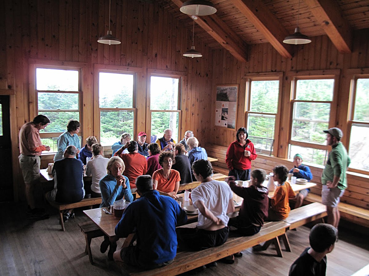 Sunday breakfast went well. The shortcoming of running a hut for just two days is that just as you get fluid again and have a clear sense of what you're doing you have to leave.
 A 20-plus year-old hut tradition is the Blanket Folding Demonstration, or BFD. I've always been too shy to get heavily into the dramatics involved, but various croos, over the years, have come up with stunningly successful scripts for these short dramas. Ari is one of those gifted ones and he has a genius for these kinds of things. His repertoire contains quite a few original BFDs that rank high on the success list. The object of a BFD is simple: to encourage guests to fold their blankets in a uniform way to reduce work for the croo. The BFD can also be used to slow breakfast down when the croo needs to buy time when there's a problem getting breakfast out on schedule (the griddles acting up, etc.). An alternative objective is that BFDs are important for the local economy, and it's well known that a really good, hilarious BFD will add a few dollars to the tip jar. At any rate, against my nature, I agreed to take a small part in a BFD that stars teen-aged girls at a slumber party who are surreptitiously reading Glamour magazine. In the photo, Ari, who was hilarious, is sitting, wrapped in blankets, and I'm in the jacket and blonde wig playing an outrageously defiant 13-year girl (with a fake English accent) who won't agree to anything and who's flipping through her iPhone looking for tweets about Justin Bieber. The photo is blurry because everyone's laughing.
The day before, on Saturday morning, I was surprised when a guest asked if there was going to be a BFD. I said no, and he became upset. "You have to do a BFD! I brought my son up here just to show him a BFD. I want him to see one," he said. I'd never heard of a parent dragging his child all the way up to Galehead just to witness a BFD. Ari was glad to oblige and quickly, with some help from Liz, got one going and, back in the kitchen, all we could hear was the crackle of laughter.
 I talked about the 4,000 Footer Club and its unequaled success at getting people off their couches and into the mountains. There's also the somewhat-related (not really) entity called Appalachian Trail (AT) thru-hikers. This could easily stand alone as a separate blog piece. The subject of the Appalachian Trail is as long as the trail and so is the history of the thru-hikers. One aspect that has not been explored (except by hut croos in personal conversations) is the relationship between the thru-hikers and the AMC huts. Thru hikers add a colorful piece to hut history. In the 1960s we rarely saw any. When a thru hiker stayed at the huts they were friendly, modest, and a lot of fun to talk to. They had great stories and were inspirations to us kids. Around 1978 that changed due to unknown factors, and instead of a few thru-hikers each season there were dozens and dozens coming through the huts, mostly going south to north on the Trail. The numbers kept growing from year to year as the average ages of the thru hikers decreased. In the 1960s most of the thru-hikers were in their 40s and 50s. In the late 1970s they were in their 20s and early 30s.
The young man in the photo is Aaron, and he's a thru-hiker in the literal sense meaning he started in Georgia and each day, or almost each day, he makes his way north. He is not planning to stop before he reaches the northern terminus of the Appalachian Trail on the summit of Mt. Katahdin. He's an interesting guy. He's learned about social adaptations through his encounters with the different people he's met on the trail. Listening to thru-hikers talk about the trail quickly teaches you that hiking the trail is, for many, more of a social endeavor than one of solitude and self-study. Aaron was the first thru hiker to admit to me that he has a specific strategy for exploiting the huts and hut croos, He said he had thought about different strategies a lot in advance of the huts. I won't betray his strategy, but he's one of many thru-hikers who feel compelled to get what they can get from the huts for free. They get to the huts expecting to be treated like royalty because of the difficult thing they are doing.
Sunday morning Aaron introduced himself to us and stated clearly what work he'd do in exchange for a breakfast of leftovers. We agreed. He was well organized. He ate first. You can see he was hungry. Notice, too, that he's filled his water bottles with cocoa from the hut's cocoa powder dispensers and milk left over from breakfast. That's smart on his part as he's going for the calories. After breakfast he worked diligently sweeping the entire hut with the exception of the kitchen. This is a very different image from the thru-hikers of the 1960s.
I'm not trying to demean thru hikers. They're certainly important to the huts in varied ways: they will do work around the hut and some are extremely diligent, even skilled, and get a lot done in an hour or two of work. Their willingness to eat any and all leftovers placed within their reach is a great service to the huts as it reduces the amount of waste.
 Pam is also hiking the AT but as a section hiker. When she has a vacation, or a long weekend, she will do a section. She'll hike for a weekend, or a week, or for a specific distance, and then red line her map to keep track of what she's done and what she has left to do. She does the sections arbitrarily, depending on the weather, or how much time she has, or how she feels. She might do a section in Pennsylvania she hasn't done and then head up to the White Mountains where she'll do another section (e.g. before cold weather sets in). Section hiking is becoming more popular and accepted. I wonder at times if some thru-hikers, the ones doing the whole trail, look askance at section hikers because they're not fully engaged in the full experience of being on the trail for months but who are primarily interested in saying they've done it, but that's probably true of a lot of people on the AT.
 Ella was hiking with her family. She was a great help at mealtimes setting and waiting on tables both at dinner and breakfast. Many people who eventually work in the huts got their first tastes of hut life when they're quite young and hiking with families or camp groups. The relationship between families and the huts is an interesting history. Here again, back in the 1960s (and earlier) we often carried on long-term friendships with families that visited our hut(s) year after year. They often kept in touch during the winter with holiday and birthday cards, and brought us gifts (fresh corn!) when they returned the the next summer. I have several Peterson Field Guides in a book shelf at my elbow that were birthday presents from a family that I communicated with for years, even after I left the huts. That's extraordinary when you think about it today. People had their favorite huts and when they came back to visit it felt like a family reunion. It was quite special.
 Ella with her family as they got ready to leave for Zealand. Aaron is on the left still diligently sweeping out the dinning room.
 Guests who waited out a shower before getting on the trail over to Zealand. A few minutes after they left the sun came out and it turned into a perfect mountain day.
I'll write about weather later in the blog. I was moved, though, watching the sunset Saturday night by how lovely it was and priceless. I think for me and lots of other people the weather endears them to the mountains and a "perfect mountain day", a crisp, cool and ultraclear day, takes our breath away. There's nothing like hiking up a challenging peak like South Twin (or any mountain) on one of these perfect days and, getting to the top, being able to look out across the miles in every direction and to see, really see, with a deep, residing pleasure, all there is to see. It's a lovely and rewarding feeling, so much so that humans must have a genetic predisposition to go to the farthest range, to get up high and see what lies beyond.
 For a few brief seconds a stillness fills the hut when the last guest leaves and the door closes behind them. It's a welcome moment. There's a pause as if the hut was taking a deep breath and girding itself for the next onslaught. In the quiet on Sunday, Sue and Liz finish up the breakfast clean up and start cooking the Sunday night meal.
 Zealand Falls Hut in the moonlight. January 1976
I would be remiss if I didn't mention another brilliant idea the AMC put into action with the decision to keep Carter Notch and Zealand Fall Huts (and now Lonesome Lake Hut) open year round. Beginning in 1976 caretakers were hired to "winter over" at both huts. The caretakers were there from October to May with regular days off every two weeks. What made the idea brilliant was it gave the hiking public access to the mountains in winter that was never available before. What was also brilliant is that it gave the fortunate caretakers the opportunity to spend an entire winter in a cabin deep in the mountains. There's probably no other place on earth where that opportunity would occur. The winter huts became favorites for school groups and scout troops. On caretaker basis Carter and Zealand became economically accessible for a lot of people who took advantage of having their shelter provided for and only having to pack in food and sleeping bags (and other personal effects). It's not clear whether the AMC has ever broken even with the winter huts, but it has afforded a lot of people a truly remarkable experience they otherwise would not have had; this applies to both the caretakers and the hikers.
 It was Sunday. The regular croo would be arriving around 1 pm and we would be heading down. It seemed like we just got there. I was just beginning to unwind from a difficult work week made more trying by the heat wave. I would have preferred to stay at Galehead, but my scheduled surgery was a week away and I needed to prepare for that. It's an echo of the frustration of the weekend hiker in which you get up to the mountains and hike for a few days and finally begin to relax just as you have to leave. It's what makes working in the huts a dream. You don't have to leave each Sunday. You have the luxury of all those days and nights to burrow in.
 Our cars are parked somewhere out there and we know we have to leave, but.....
 ....going down is difficult.
 This is a section of the Garfield Ridge Trail just below Galehead Hut, and looking at this photo brings up my last comments in this article about the impact of people on the White Mountains and it's along the subject of trail erosion. In 1961 the Bridle Path up Mt. Lafayette had a section known as "Subway" because hikers on Mt. Lafayette had gouged a trench in that part of the trail that was almost 5 feet deep by a hundred yards long. The trail croo worked on it in 1963 and that part of the trail gets occasional touch ups but is still in excellent shape. Trail erosion goes back prior to the large increase in trail use during the late 1960s-1980s. The Valley Way on Mt. Madison, a well trod trail, has had the trail croo's attention for years. Sections of it have been re-routed a few time and almost half of the entire length of the trail has seen work, mainly step building and water bar construction, to combat erosion. The discussion about the impact of the huts on the mountains should get mention here because it's true, the trails in some places are badly eroded due to foot traffic which leads to erosion by storm run off. At the same time the AMC trail croo's expertise in trail building and maintenance is known throughout North America and in places as far away as New Zealand. They do an unbelievable job. The croos are seldom seen at work by hikers and their finished work is equally invisible to most hikers. That's how good it is. Appalachia, particularly from the 1920s through the 1950s, has a lot of great articles on trail building, trail upkeep, and erosion prevention that make good reading.
 The 1976 Fall Trail Croo in Pinkham Notch.
Admittedly, I have not known many members of the AMC Trail Croo over the years. The '76 Fall Croo was an exception. They were charged with rebuilding the Twinway from Galehead up to the summit of South Twin and eastward to Mt. Guyot. They stayed at Galehead for a few weeks while I was fall caretaker. I used to bring them a hot lunch from the hut at midday and had a chance to sit and learn from them. The photo is missing a few of that fall croo. I'm not sure why they are posing like that. I don't remember. They wanted a group photo as a keepsake. I recently looked through my negatives of them and printed some of them but I found that in many of the photos they were only half dressed. While I was getting ready to take the picture they would quickly turn around and drop their pants to moon the camera. What does that say about Trail Croo? At any rate, this croo did a brilliant job on that tough mile of trail up South Twin. They turned it from a steep, slippery ladder that was prone to erosion into a steep, heart-pumping staircase.
 I find myself wondering whether the huts are sustainable in ways not mentioned. They're solidly built, extremely efficient,and accommodating but will the AMC be able to afford to operate the huts in the years to come amid stridently increasing costs. Will the AMC's existing sources of revenue suffice to operate the huts and will the number of donors and income received increase in stride with costs? For both non-profits and for-profits alike money is disappearing. There's a lot of competition for dollars. Non-profits are dependent on aggressive, endless fund raising campaigns which becomes a vicious circle when every activity, basically, is about fundraising. I've spent hours while hiking, or in discussions with other people, to try to figure out creative ways to endow each of the huts in order to lower the volume of fund raising and keep overnight fees reasonable so they will be accessible for people with low incomes. For me, exclusivity is a major issue regarding the hut system as the prices for consumers climb higher. Sustainable means that the huts remain accessible to people with lower and moderate incomes.
 Then there's the larger question regarding sustainability, particularly while looking at these photos of the forest along Garfield Ridge, and that question is, will the huts and shelters adapt to pressures that are sure to come in the future? Will the AMC as a large organization be able to adapt to the pressures to come? If not, will there be a participatory process that includes public input in an open discussion regarding the long term vision of both the forest resources and the hut/shelters and trail systems?As I talked to the guests Friday and Saturday nights about the 50-60 years that I've been hiking this trail I was wondering what it will be like 50-60 years from today. What will Galehead and the other huts look like in 2070? Will things be pretty much the same? Will they still serve pancakes and bacon for breakfast? Will the huts even be here? Will the forest look the same? Trees will be bigger, but will there be as few changes as in the last 50-60 years? It's interesting to think about. The worst case scenario is that population increases along the eastern seaboard will increase pressure on the forest and the hut/shelter system. Higher demands on the huts under those pressures might mean significant adaptations in the way they serve the public.
 During the population-pressure-building years beginning in the 1960s we often joked about what the huts might be like in the future and the assorted and sundry systems that might be forced upon the public to limit the numbers of hikers in the WMNF at a given day or even hour. One scheme was a lottery in which prospective hikers will have to buy lottery tickets to hike in a certain time period on a specific trail, or a combination of trails. A limited number of tickets would be winners on any given day. This would help with over-crowding and raise money for back country maintenance. My favorite, the "pick a number" idea borrowed from supermarket deli counters where you take a number and then wait your turn at the bottom of the trail until someone is through with their hike and leaves the national forest. Another idea was to run the huts like a New York City automat where you'd buy pre-made foods like sandwiches and soup from a vending machine and sleep in tubes stacked up to the roof of the hut. Guests would sleep in shifts. Trail or hiking taxes could become the vogue, and a lottery just for a bunk. The AMC's reservation system is almost like that now. On the other hand the new hut system in western Maine might take pressure off the AMC huts in years to come or new huts might be built in the less traveled areas of the WMNF that would help pull people away from the more crowded areas.
 Sunday was such a beautiful day! It was hard to face going back down to the blare and cry of the valley and as we descended we could feel the heat again. That meant a mandatory stop at Slick's Ice Cream stand a few miles south of Franconia near Woodsville, NH (on Rt. 10) for some really outrageously creamy homemade ice cream.
 Up along Garfield Ridge the Clintonia berries were still green.......
 ...and down by second crossing they were already blue.
 The end. Have fun and remember to always be kind and true.
1 comment:
Great photos. Fascinating commentary.
Post a Comment