 |
Saturday morning (5-3-14) I met Doug Dodd (L), Chris Stewart, and Maverick at the Cog Railway base station for an overdue hike up to Lakes of
the Clouds via the always beautiful
Ammonoosuc Ravine Trail (it's referred to also as the "Ammy" or "ART"). Adding up our combined ages would equal about 200 years and among us there are probably 30 years of employment in the AMC huts with Dougy, perhaps, having the most. We also represent at least 150 years of combined experience hiking, running, skiing, swimming, bushwhacking, exploring and backpacking in the White Mountains. The point is that individually and as a group we've spent a lot of time and had an awful lot of fun in these mountains.  There was an array of trail conditions prevalent on the Ammy as far as Gem Pool. The assortment included this icy sidewalk which, until recently, had been snow, 4-5 feet of it, packed down by myriad hikers and that is now condensed to an uneven tread that made us don our micro spikes and crampons. |

Before the ice sidewalk there was a stretch just up from the trail head of mud that, in places, was 6 inches deep and deceiving, too. It would look firm but we'd sink in up to our ankles!

Even higher and above all of that there was rotten snow with vast opportunities for "post holing" up to one's hips if you like, or something completely beyond mere post holing where it requires a feat of ingenuity and brute strength to dig yourself out.

But, then, what could possibly be lovelier? It was wonderful to be back!

Gem Pool is a prominent feature of the Ammy dating back at least to the 1700s and, for all those years, has often been used as a swimming hole. The Ammy, as we find it today, was "standardized" by Charles Blood and Nathaniel Goodrich in September 1916, but in its earlier history was referred to as "The Escape Glen" and used by scores of hikers, as early as 1742, to get down of the ridge quickly when bad weather set in.

Snow banks and open water. The shade of the woods around Gem Pool keeps the snow from melting, or at least not quickly, until June some years, and it also keeps the water in the pool at a toe curling low temperature. Gem Pool is but one cascade in a chain that descends the headwall of Ammonoosuc Ravine starting at the Lakes of the Clouds and then becomes the Ammonoosuc River.

Above Gem Pool the trail begins a steep ascent up the headwall of Ammonoosuc Ravine. On Saturday there were random patches of blue ice on the steeper sections of the trail that called for the use of crampons or micro spikes. And I can personally attest to the usefulness of hiking poles in scrambling up the steep ice. At 10 am the top surface of the ice was softening making the purchase more secure.

As the trail arrives at the top of the head wall this view opens up! It's looking north towards Vermont and Quebec over the Dartmouth Range in the mid-foreground with Cherry Mt. (Mt. Martha is another name for it) in the center background. At this point the sky had cleared and we were enjoying the sun and blue sky. It actually got hot for the last stretch to the hut.


We were surprised to see the extent of this ice formation on the river. It's different every year but this is the first time I can remember it being completely frozen.

As we got close to Lakes of the Clouds hut where we each have worked for a number of summers and mostly back in the 1960s and early 1970s a switch seemed to have been turned on with the phrase "Hey, do you remember the time..?" or, "Do you remember so and so..?"and the answers came in fragments until the memory took form and was followed by cascading laughter as we remembered incident after incident, character after character. It was great fun.

The winter trail goes all over the place. Often the person who broke trail after a snow storm goes a little to far north, or south, then someone decides they know a better route, until its a maze of snow shoe tracks. But, as the snow melts and the river rises with snow melt and eats at the snow from below creating hazards for hikers where they might break through, the choices narrow down and hikers tend to wander less and stay on the official, blazed trail. In those early months, though, it's stunning to wander about footloose and fancy free and go anywhere you like across the wide wind packed snow.
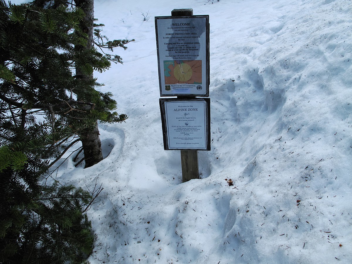
This attests to the snow depth at this site which is about 4 1/2 feet deep.

Looking up to the summit of Mt. Washington with the summit itself hidden in clouds. There's a light dusting of snow around the summit, down onto the saddle. This is that time of year when leaves are just beginning to come out in the flat land, suggesting that spring has arrived, and, here, you can climb back up into winter.

A few minutes later with a clearer view of the summit. The weather was being fickle and teasing with bright sunlight and warmth but a front was building and coming in from the southwest with darker clouds.

The higher, the better the view. Still looking northwest.

Lakes of the Clouds Hut with the summit of Mt. Monroe to the right.

Pardosa. That's the name of one of a "genus" of spiders that inhabit the alpine zone. You can refer to them as thin legged wolf spiders. It's usually associated with grassy fields and is very common in the "lawns" of the Presidential range. I'm not sure which species this specimen is as there are several different ones on Mt. Washington. I'm going to make a guess that it's either P. distincta, or P. saxatillis. They survive here all winter and are out surprisingly early. Doug saw this one as it scurried up the steep ice. Makes you cold just looking at it! As you hike above timberline you will notice these wolf spiders moving quickly on the rocks in and near the trail. They are of utmost importance to the ecology of the alpine zone so use your utmost care not to step on them.
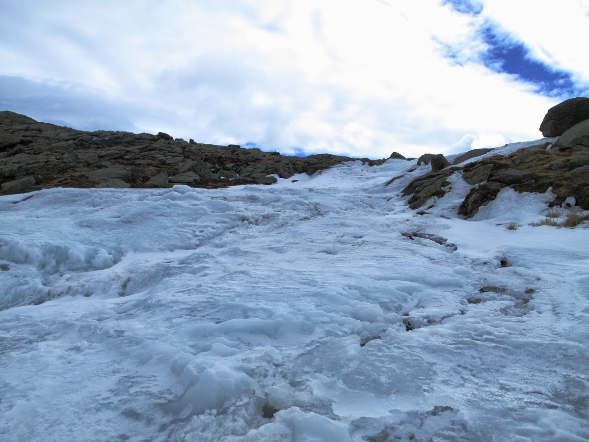
Ice, suggesting a glacier, from surges of water coming out of the Lakes during changes in temperature. Water pressure building in the larger (deeper) lake often pushes the ice up and out of the way as it heads for the Ravine causing a bulge of ice to form behind the hut.

A clearer view of the summit.

Getting ready for hut opening which should be happening in a few weeks.

We encountered very few people on the trail. I think, in all, we met 7 other hikers all day which is unusual. The weather was slightly psychotic, but not terrible, and the air was really clear making for great views. This couple passed us on the way up the Ammy and were headed back down after summiting Mt. Monroe.

Mt. Monroe. Note the black clouds. Also note the lack of snow in this photo and the one below. A number of the alpines will be blossoming towards the end of this month and even if there is no snow now the ground is saturated with water that the plants will depend on. The soil will dry quickly as the sun rises higher in the sky, so the plants have to flower in a small, but critical window of time.

Mt. Monroe, again, looking at the terracing on what has long been referred to as Monroe Flats. This area is federally protected, as is the entire Alpine Zone of the long Presidential Range, and is habitat for some of the rarest of the 43 species of alpine plants that are found on Mt. Washington. I came up to Lakes principally to note snow cover in the plant habitat areas. Monroe Flats experiences high wind velocities all year which accounts for the topography and the lack of snow. Alpine flowers bloom very early to take advantage of the short growing season but also the fluctuation in soil mositure. Water is most dependable just as the snow is melting. Monroe Flats is an amazing ecological realm that compares to areas of the high arctic but here it is extremely fragile and becoming more so every year. After attending to it for more than 50 years I've seen profound changes which included the near demise and then the heroic restoration of a species, Dwarf Cinquifoil, as well as the continued erosion by natural elements. The reddish, rust-colored plant is Diapensia lapponica which grows in tufts, or "cushions" of myriad plants that are one of the first to bloom here with a beautiful, small white blossom.

The Bigelow Sedge-Potentilla lawn to the south of the larger lake. The ridge in the background is the boundary between the Dry River and the Ammonoosuc River watersheds. It's also the route of Crawford Path #1 that first came into use around 1819 as a bridle path from Crawford Notch to the summit of Mt. Washington--a long trip with much of it exposed to the weather.

Looking a bit more to the northeast from the last photo to the highest areas of the Ammonoosuc watershed with the summit of Mt. Washington to the left. It's so beautiful! The light on Saturday was amazing.

Isn't this cool? I think it could properly be referred to as "periglacial" activity.

Diapensia, Bigelow Sedge, Haircap Moss, and assorted lichens.

Diapensia laponica L. Again, the Diapensia is at home in the high arctic. There has long been debate regarding the morphology of this plant and the reddish "cushion" that is its most notable feature. The dark red color absorbs the sun's warmth so it makes sense that the cushion protects the plants from the cold, particularly sudden drops in temperature, and it also helps the plant retain water.

Deer's Hair, Scirpus cespitosis, var. callosus

Doug and Maverick looking where a plaque used to be fixed to the rock he is looking at. Following the death of Stuart "Slim" Harris in 1969 the plaque was fixed here (see next photo), but has since been moved.

Slim was a denizen of these mountains for years and a formidable botanist as was his wife, Calista, or "Cal" as everyone called her. Slim worked in the huts in the 1920's through the 1940s, off and on, and stuck around long afterwards to help document native plants in a tradition that goes back to the early 1800s with Bigelow, Tuckerman, and Oaks. Slim, like many other great names that explored the flora of the White Mountains was part of the last generation of botanists that studied under the esteemed Merritt Lyndon Fernald at Harvard and used the Whites as their laboratory.

The dedication ceremony of the plaque for Slim in August 1969. Doug is the fourth face from the right. He remembers the day as being windy and cold. Cal Harris, is the sixth face from the left, a brilliant ecologist-botanist in her own right, and revered by all of us who worked in the huts when she and Slim spent their summers here. Doug went on at length describing the summer periods when Cal and Slim would stay for weeks ar Lakes going off during the day to study the plants, and, in the evenings, leading informal "flower walks", and talking to guests about the rare plants they prized, and helping out around the hut.
Since posting this aticle I've heard from Slim's and Cals' children/grandchildren including their son in law, Sanford "Sandy" Wilbur who is the person peeking out third from the left in the above photo. The person to the far left is Curt Curtis; then Natalie Curtis next; Sandy; Cal Harris sixth; Miriam Underhill with the hat, Shawn Wilbur and Sally Harris Wilbur, Doug, two hut crew members, and Bruce Sloat.
Sandy said that the momentum for Slim's plaque, in addition to Slim's family and friends, had come from the hut crew who wanted to honor Slim and the botanical work that was his legacy.

Sandy also suggested that the missing plaque where we were looking on
Saturday may have originally been the location of a plaque commemorating
the death of William Curtis by exposure in the famous blizzard of June
30, 1900.

An example of "nivation".

Looking south towards the Moats, Mt. Chocorua, and, to the right, the Sandwich Range. The Old Crawford Path is visible in near the bottom of the photo threading its way between the rocks. It hasn't been in formal use for a hundred years but you can still follow it in places,

Showers moving in from the southwest.

The upper water collection area for the two Lakes of the Clouds and uppermost source of the Ammonoosuc water "system". This depression on the flank of the mountain that was provided by glacial mechanics thousands, maybe millions, of years ago, and is where the Ammonoosuc begins. The larger Lake is the blue area in the photo's center.


and looking back to the northeast and the ridge. Up to the left, that long slope covered with snow is the cutting edge of the divide between the Ammonoosuc River (eventually the Connecticut River) and the Saco River.

The weather had changed quickly and completely. It was getting cold and rain showers were closing in. It looked like a temporary system, but we headed down.

Showers moving rapidly towards the northwest seen from the Ammy.

Back in the trees again, just above Gem Pool. It was a great hike, a rare treat to hang out with Dougy and Chris, and a lovely day all in all. I'm hoping this hike will be the first of many over the coming months. See you in the Hills.


 -
-


