Sunday, July 7, 2013

7-4-13 Big Coolidge Mt, Franconia Ridge, Off Trail.

Early July 4th morning I was wandering around the Forrest Ridge condominium complex near Lincoln, NH, looking for a relatively easy route for bushwhacking up to Franconia Ridge from Lincoln. I had tried variations back in the fall from another starting point without any luck but came out of it a little wiser. The route I was going to try on Thursday was to circle upwards around Big Coolidge Mt. staying in hardwood forest as much as possible and avoiding the dense coniferous growth of spruce and fir near the treeline.
On Thursday my y primary purpose was to find a small "opening", a small place to push through that dense coniferous growth so I can scoot over the ridge and slip down effortlessly into the Pemi on the east side of Mt. Flume. After an hour of searching I found a likely lead consisting of an grown-over path heading uphill and into the woods (first photo). Mt. Coolidge was heavily logged about 120 years ago and I expected to find some of the dugway roads loggers used to bring the logs to the mills and use them as a resource. The one in the photo above was close to the Condominium parking lot running east and west. There were foot prints and tire tracks in a muddy sections indicating it's being used recreationally by folks at the condos.
Higher up the mountain flank I found more remnants of older logging roads that probably dated back to the 1890s. Records indicate that both Little and Big Coolidge Mts. along with Whaleback (Osseo) and Potash Knob were all logged off in 1893-1894 by J. E. Henry and Sons of Lincoln, NH (from Bill Gove excellent book, J. E Henry's Logging Railroads, published by Bondcliff Books in 1998).  In some cases, as on the Hancocks, the dugway roads circled the mountains. Dugway logging roads were the most expedient system for moving logs downhill. Crews simply dug into the mountain pulling the soil away from the uphill side across to the downhill side until a wide enough, level roadway existed which eventually got packed down from use. The track in the second photo above is a good example.
It got steeper and steeper until I came to the base of a high cliff with huge boulders stacked around the base that seemed to be in competition with the trees. There were large trees, one or two measuring 3 feet in diameter, consisting of white ash, sugar maple, beech and yelllow birch growing in and around the boulder field at the bottom of the cliff while white birch and balsam fir grew on the cliff face taking root in cracks and on ledges. The cliff is about 100 feet high.
Hey, I was here first!
Downhill roots of an ash tree that measured 95 inches in circumference, or 2 feet 8 inches. The downhill roots are more thicker and longer on the older, larger tree as a necessary means to steady the tree against the inevitability of gravity.

Further to the west and away from the cliff the terrain and forest looked like this and was easy to navigate through.
This is looking up the cliff face. It's barely visible through the foliage but dramatic all the same.

 I'm going to say it's weathered Conway granite. Most of the cliff face was encrusted with lichen and moss.  I have to say that I'm drawn to cliffs and find them both fascinating (mesmerizing) and exciting to be near, if not on. Like the mountains themselves, cliffs, particularly high, dramatic ones, like the Eiger, or El Capitain that represent the ultimate challenge, draw one to them making the pulse beat a little faster.
Edging around the side of the cliff.....
.....and topping out. Finding the cliff was an interesting start to my explorations for the day and created some unexpected excitement for me.
At the top of the cliff there was an open forest, mostly of small balsams, and a great deal of moss on top of the rock cap. The space created by the trees, moss and sunlight was breath taking.
The reasons for wanting to do this bushwhack is to return to the forest in a purposeful way,  to relax in it and move through it quietly without an agenda, without any pretense. I have to admit that I know little about the forest inspite of all the time I've spent in it. Learning about the forest requires patience and insight and being able to slow down and savor it. I can run up mountains as fast as I can go which is fun and relaxing. On this trip I want to go slowly. I think it will take 3-4 days, maybe longer. It's only about 25 miles and some of the bushwhacking will be relatively easy while some of it will be slow and painstaking, naturally. 


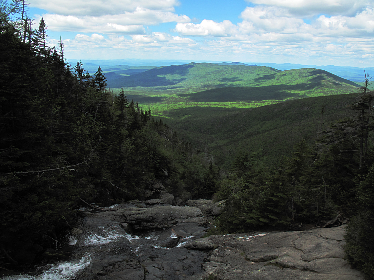
To help us get oriented I'll use this photo I took from North Kinsman on Friday, July 5th. The arrow points at Big Coolidge Mt. (3294 ft. asl) with its long southwestern ridge running down to the right and a deep notch to the left. You can see the patterns of conifer forest areas and the hardwood areas (lighter green). From that notch up to the summit of Mt. Flume which is right next to Mt. Liberty, the two high points on the left, you can see those patterns of darker and lighter greens. I was trying to stay in the hardwoods, the lighter green. Behind the arrow is Tripyramid with Osceola just to the right of the arrow, Mt. Hitchcock lower and to the right, and Sandwich Dome to the right of that. Carrigain is peeking over the ridge to the left of Liberty and Flume. 
Working my way up out of the notch towards the upper ridge.
The hike reminded me a lot of my climb up Mt. Osseo last October (2012) in a variety of ways. The diversity of vegetation was one, terrain was another, the exposure was similar so the light was also the same, and the height. Osseo is only 300 feet higher than Big Coolidge.
I was amused by my proclivity to see "evidence" of human activity. Often there were features that were similar to trails, at least for short distances, that I immediately responded to and that made me feel less lonely even though the entire effort I was engaging in was to get away from the very thing. We are creatures of habit. At any rate I was back in the coniferous zone but at this point it was open. There was a lot of digging and clawing with feet and hands to get up through the soft duff and I often slipped backwards two steps for each step I climbed. In the hardwood areas I was amazed at the depth of the leaf litter which in some places was a foot.
A key thing to remember is that this forest, the forest ecosystem we're looking at in the White Mountains today, is the replacement for the forest ecosystem that was here for a very long period of time, perhaps as long as 10,000 years, but was then destroyed in a few hundred years. The modern forest has only been here for perhaps 100 to 200 years and is still "young" and in a constant state of transitioning. The old forest was a legacy of the massive ice sheets that covered this part of the world for hundreds of thousands of years and only ablated 11,000 years ago. The new forest, in striking ways, is a legacy of that old, post-glacial forest ecosystem. We don't have an exact history of the old forest and where it was in its development. Was it vibrant and healthy, or was it past its climax and in decline? We have an idea of some of the changes in the land and climate and the adaptations and succession that occurred when some species died off and other species moved here. We have a good idea of how climate changes impacted the entirety of that vast forest ecosystem that stretched across the continent. We know the history of the "modern" forest pretty well. Scientific documentation of the post-glacial forest began with the first European "contact" between 1500 and 1600 by navigators like Jacques Cartier and Samuel de Champlain. Both these individuals were notable for making scientific observations: transcribing invaluable descriptions offered by natives, collecting, identifying, and describing specimens of much of the flora and fauna of the northern forest. Much of the forest witnessed by Verrazanno, Champlain,  Cartier, and others, particularly the natives of that period, is gone. It disappeared in the blink of an eye. That the modern forest has survived its first 100-200 years is certainly cause for celebration. I hope it's still here, still evolving, 9,900 years from now.
This is what takes the wind out of your sails. I carried and briefly used a bike helmet and the kind of  knee pads used by roller derby competitors to make crashing through this forest web a little more feasible.
Or this. This is actually easier to negotiate. It reminded me of the bushwhack on Mt. Deception two years ago and is typical of what the upper west-facing ridges look like generally--a lot of wind damage. When I see this I remember the hard work of the early trail builders here in the Whites and remain in awe of what they accomplished with hand tools.
This is what finally stopped me. It was hot, I was tired. To make it worse I was carrying 5 quarts of water; two for me on the hike and three to drop that I could pick up on later on the bushwhack to save time and energy. I drank two and drained the others before descending.
At any rate I had reached my turn-around time and was ready to head back down after a casual lunch which was when I consumed one of the water bottles and the water came pouring out of the pores in my skin as if I was a sieve.
I altered my return course to explore more to the north and west of my two ascents. I found it easier heading due West course but it was not exactly from the starting point I wanted. I might have to compromise on that. The woods were stunning in the early afternoon light. In the valley it was in the 90s all day but under the heavy foliage (healthy foliage) it was much cooler.
I stopped often to listen and watch. This photo is static. It's frozen within an instant of time. Sitting there, though, was to be aware of movement, particularly the bright shards of flickering sunlight that were animated by the wind combing through the leaves in the upper canopy. Added to that was the movement of birds and insects and the trees themselves. Peachy.

Monday, June 17, 2013

6-15-13 Ammonoosuc Ravine, Lakes of the Clouds, Mt. Washington, Alpine Flowers, Lapland Rosebay.

A few Red Trillium (Trillium erectum L.; the larger, symmetrical plants with three leaves) at the trail head of the Ammonoosuc Ravine Trail a little worse for wear after several days of harsh weather including a lot of rain. They blossomed well before my birthday, closer to the first of June, and earlier than I predicted. On my last trip in April (4-27-13), six weeks ago, there was still snow on the ground where these plants are. Blossoming happens quickly and early in these cooler mountain regions that are prone to sudden frosts.

I repeat this photo frequently whenever I hike the Ammonooscuc Ravine Trail, or "Ammy" as it's affectionately called. The photo is from the bottom of the trail. The Ammy is 98 years old this year. It was officially opened as an AMC trail in September 1915 by Charles Blood, Nat Goodrich, Nat's brother, and a fourth man, who spent three days "standardizing" it. They used Lakes of the Clouds as their base. The first recorded use of Ammonoosuc Ravine as a means of descent from Mt. Washington was in 1742 by a small British militia unit that had climbed the eastern flank of the mountain as training. It had gotten very cold while they were on the summit and they retreated down Ammonoosuc Ravine. It was used by many others on a regular basis, including botanist William Oakes in the early 1800s,  and referred to as "The escape glen" as it was a good, fast way off the ridge when the weather turned for the worst. It's purely conjecture what the exact route was in earlier periods of time. Nat and Charles must have followed it to some extent as they adjusted the trail for regular foot traffic.

Saturday was a lovely day; a little brisk with wind and temperatures on the summit in the low 30s, but there were lots of people on the trail.

The Ammy itself. I'm not sure of the amount in inches but an enormous amount of rain has fallen on the White Mountains in the past month or so and the river was still pretty high even though all of the snow in the ravine has melted.


Things to come. The lance shaped leaves are Clintonia borealis which will bloom in a few weeks and the cruciform plant, with four leaves, is bunch berry, or Cornus canadensis, a member of the dogwood family. It will bloom soon with its bright, snow-white petals followed later by a bright red berry.

This is the bottom of an old slide track that came down off of Mt. Monroe in the late 1970s and is filling back in nicely. I have photos of the raw track, right after the slide and will insert one in here as a comparison (when I find it).

Another couple thrilled to be hiking on such a beautiful day. I wonder sometimes if those of you who read this blog wonder why I put so many photos of people in the blog. I do it for a couple of reasons. One is because I like the photos. Catching people informally brings out something in them. They're relaxed, present, and without defenses. A second reason is I want to show that we're inseparable from nature: that we're literally from nature and are best when we're close to it, in it, surrounded, enjoying the raw, simple beauty of nature.

Residual damage remaining from the massive snow avalanche that tore down through here in late January 2010. Many of the trees that were bent down are still producing leaves. 

Lizzie balancing on a tree that the avalanche plucked right out of the ground roots and all.

Looking up the avalanche track towards the headwall of Amonoosuc Ravine and the summit.

A couple starting up the steep section of the trail just above Gem Pool. The grinning, other handsome guy behind them in the photo is Arran Dinsdorf who is the Hutmaster at Lakes of the Clouds hut for the 2013 summer season. Those who read the blog regularly will recognize him from past summers. It was good to see Arran. His dad worked in the hut system in the early 1980s and was the assistant hutmaster in 1982. His mum, Nancy Ritger, is the director of the AMC's stellar Naturalist Program.

A threesome enjoying the warm sunshine.....

and a hiker with her shy golden retriever.

The first good view from the trail at Second Crossing looking out over the Dartmouth-Mitten Range, Cherry Mountain (Mt. Martha) and towards northern Vermont and Quebec.

Liz at 24. This was our first hike together in 7 months as she's been traveling and climbing in Central and South America and came home briefly to help celebrate my birthday.

The cataract above Second Crossing looking up at the top of the Amonoosuc Ravine headwall.

Another lovely section of the trail close to the tree line.

La Summit!

Some of the 2013 Lakes Crew. Arran is missing in the photo, and I think one other person. Regrettably I only know the names of two people in the photo (so far and I apologize). In the center is Emily Leich who I've known for several years as her dad is a good friend of mine (and worked at Lakes in 1969). To the right of Emily in the dark blue pullover, is Sarah, the Hut Naturalist. Interestingly, Emily's grandfather, Harold Leich, also worked in the huts and during the summer of 1932 worked under Sal Pagliuca building Galehead Hut. Harold wrote a wonderful. hilarious story about working at Camp 22, one of the logging camps in the Pemigewasset Wilderness, back in 1928 when he was in college. The story was printed in the June 1961 Appalachia (p. 375) and it's very amusing as well as instructive about life in a lumber camp during the Great Depression.

I want to congratulate the Lakes crew for putting up this sign. It's brilliant! I hope hikers heed it.

Then it's off to Monroe Flats to look at alpine plants. Looking back at Lakes with Mt. Jefferson catching a bit of sun in the background.

This small tarn just off the Crawford Path is a measure of the large amount of rainfall recently.

One of the "lawns" around Lakes of the Clouds.  If you enlarge the photo you can see clusters of bright white Diapensia, magenta Lapland Rosebay, and Alpine Azalea.

Close up of Lapland Rosebay, Rhodendron lapponicum.

Lapland Rosebay budding.

Diapensia and Rosebay nearly overlapping. The flowers of the Diapensia are about 1/4 inch / 6 mm in diameter to give you an idea about scale. The rosebay flower heads are 2-3 inches in diameter. The rosebay and azalea are both in the Heath family.

Diapensia lapponica It is everywhere: across the broad lawns, on the summit of Mt. Munroe, growing from "cushions" of compact stems and leaves. It is a remnant of the arctic as well as an alpine. Fred Steele used to say the cushions conserved heat to help the plant survive.

Alpine Azalea, Loiseleuria procumbus, which is tiny. Here and there you can see leaves for Potentila tridentata pushing up through the Azalea leaves. They're noticeable because the top edge of each leaf has three little teeth in it--thus the Latin name. Azalea, Lapland Rosebay, and Labrador Tea are all arctic and alpine members of the Heath family, or, in Latin, Ericacea, and members of the sub-family Rhododendron. If you look carefully at the leaves in the photos of rosebay and the labrador tea you will see the resemblance to leaves of the ornamental flowering rhododendrons grown around houses and parks.

There was a brisk wind, gusting to 10-15 mph, and the temperature was hovering in the upper 30s so it was not a good day to stand around looking at flowers. But the wind, the clouds, and the light were lovely and it was great just to be there. Monroe Flats, the upper portion is in the foreground in the shadows. Even though you can see a remnant of the old Crawford Path where it used to cross the flats the area encompassing the flats is restricted to everyone as the plants growing there are extremely small, vulnerable and some are rare.

We spent an hour looking for the "station" of the dwarf cinquefoil, Potentila Robbinsiana, Oakes, without locating it. Sarah, the Hut Naturalist, reassured me saying that it had bloomed on June 1st and was still at its regular location. The plants are "very small and inconspicous", as one guide book says, with a circumference about 2-3 cm, or 1/2 to 3/4 of an inch in diameter.

Potentilla L. is in the Rose Family and there are about 30 representatives mostly in the Northern Hemisphere. The "L." after the name means Linnaeus originally classified it. Cinquefoil is the colloquial name, meaning "five-fingers". In the name Potentilla Robbinsiana, Oakes, the Oakes stands for William Oakes (of Oakes Gulf fame), a legendary botanist of the early 1800s (he did in 1848) who spent summer after summer on or near Mt. Washington and "discovered" the rare and tiny plant that he named Robbinsiana after his good friend Dr. James Robbins, also a botantist. Oakes and Robbins were friends with the younger Edward Tuckerman, another famous botanist, that Tuckerman Ravine was named after.


The top of the Oakes Gulf headwall and Boott Spur. If you refer back to a blog entry on 4-27-13 you can get an idea of what this area between the hut and Oakes Gulf looks like under spring snow.

Looking south towards the Moats and the Sandwich Range.

Freezing!

The 39 Steps.

Goldthread, Coptis groenlandica.

Long beech fern, Thelypteris Phegopteris. It's identified by the two lowest pinna, or leaflets, point down and out at a 45 degree angle, almost like a tail.

Just above Gem Pool. At this point as you're descending you can hear the cataract that plunges into Gem Pool with the most delicious sound when you're hot and still have another 1 1/4 mile to go!

Close to the bottom. A gorgeous day!