Monday, April 29, 2013

4-27-13 Ammonoosuc Ravine, Lakes of the Clouds, Mt. Monroe, Mt. Washington.

I finally got North again and found quite a change from the end of March (3-30-13) with the snow line now having receded just above the Base Station. A month ago this scene looked like a Christmas Card. Saturday was a lovely day; a gorgeous spring day with a long arc of sunlight. Driving north was a trip backwards from late-Spring in Massachusetts, to mid-Spring here at Marshfield, and on the ridge it was more like late-Winter/early spring.  This was most evident in the colors which were resplendent on Saturday--all the greens, varying in intensity, from south to north, the russets and purples of the higher slopes still holding their own but with more reds from the emerging birch, maple and cherry buds. There were few leaves out above Hanover but there was that nascent, soft blush of green beginning to appear.

When I pulled in at 8:30 Saturday morning the parking lot was half full and mostly with alpine skiers heading for the various ravines made most accessbile by the Base Station Road and parking lot. The consensus seemed to be that Oakes Gulf was the best skiing left on Mt. Washington but others were heading for Burt Ravine, and Ammonoosuc Ravine.

There were a few familiar faces in the lot. It's not difficult to notice that there are a lot of "regulars" in the Spring Skiing/Alpine Touring (AT) group as well as a handful of new comers. It's popularity today along with the accessibility it provides to all parts of the mountains translates into a separate, new, and challenging "use" of the mountains. AT skiers certainly enjoy a longer ski season then lift assisted skiing, and, generally,  more remote and challenging terrain.

One thing is certain. It keeps you in shape.

As I've watched snowboarding and AT skiing grow over the past 20 years I've noticed that the median age of participants is lower than the population that typically uses developed ski resorts with developed trails, terrain,  lifts, etc. and that the number of females participating in back country is growing. In the 2012-1013 season ski resorts around the country reported a decrease in the number of snowboarders. No numbers are kept for back country users but in the last two years the ratio of snowboarders to AT skiers is about 1 to 4 at least in the remote ravines (not Tuckerman) of the Presidentals.

Leaving those thoughts behind, my attention turned to the "Ammy", or Ammonoosuc Ravine Trail, or "ART" as its affectionately referred to. This would be my first trip up it in  2013 and I was deliriously happy to be hiking it again. Charles Blood, the AMC Councillor of Trails nearly 100 years ago, along with Nat Goodrich, standardized the Ammonoosuc Trail over three days in September 1916 (even though the ravine had been used as a means to get off the ridge quickly in bad weather for nearly 200 years) and he commented that of all the trails he had constructed in the White Mountains in his career, and its an impressive number of trails, he was most proud to have worked on the Ammonoosuc Ravine Trail because of its sheer beauty. It is a lovely trail.

As I've probably repeated endless times, the Ammy is a meditation.

Its timeless, really, the patterns of sunlight and shadow.  The trail on Saturday still had at least 3 feet of snow on it and skiers were using it for skiing off the mountain at the end of the day.

And there's the Ammonoosuc River leaping and cascading next to the trail most of the way to Lakes of the Clouds enhancing the beauty of the trail.  There is still some debris from the 2010 avalanche and from Hurricane Irene up and down the river.

Avalanche damage from the massive slide in late January 2010.

Looking up through avalanche debris into Ammonoosuc Ravine and the summit of Mt. Washington.

I caught up with these two guys on their way to Oakes Gulf via Lakes of the Clouds; one was on AT skis and the other was packing his snowboard. AT skis hold their own on all terrain and are used for ascents as well as the rapid descent. On Saturday, though, I saw a lot of skiers packing their skis, or "boards", as we referred to them back in ancient times.
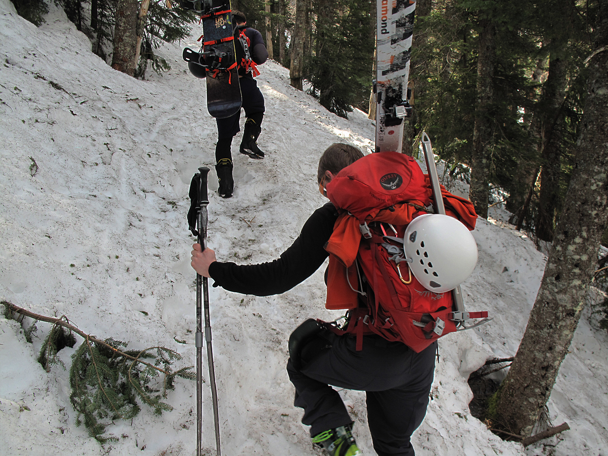
After the first 1 1/2 mile, or so, the headwall of the ravine is reached and certainly felt as for a half mile it is astonishingly steep and with frozen snow under foot, a bit sketchy.

The top of the headwall where the trail traverses to the right and back to the river...

......and first crossing....

........and stop and admire this view to the northwest. You can see what I mean by the purples and russet colors.  In the middle distance is the Dartmouth Range with Mt. Deception, Mt. Dartmouth and Mt. Mitten L to R. Just behind that ridge is the top of Cherry Mountain, aka Mt. Martha (an older name of Cherry Mountain.) There's a "nub" at the northeast end of the Cherry Mt./Mt, Martha ridge called Owl's Head, which is one of two Owl's Heads in close proximity to each other and which cause no end of confusion. The Owl's Head that's part of Mt. Martha is also referred to as the Jefferson Owl's Head. I did a blog article on a summer hike up the Jefferson Owl's Head back around 8-24-12 with photos and descriptions. It's a great hike.

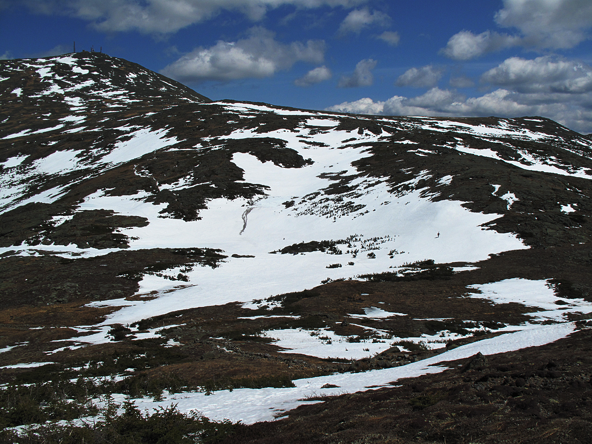
It's only a hop, skip and a jump to tree line from where trail crosses the Ammonoosuc and where the views become even more spectacular. This is approximately the 2 mile mark in the climb to the hut. That's the summit of Mt. Washington in the back ground. As the day began to warm above freezing everywhere you stood on the snow pack you could hear water running, melt water, underneath the snow and heading down hill.

The view to the northwest improved with elevation gain. This is just below 5,000 feet in altitude.

A beautiful day! If you look carefully you will see tiny specks of skiers on the snow fields.

This is packing your "boards".

Lakes of the Clouds Hut with the summit of Monroe to the right in background.

Approaching Lakes from below I was mesmerized by this ice formation next to the hut. It was an ice dam, but I'd never seen one quite like it. It was huge for one thing, and for another, it looked kind of ominous. What if the temperature hit a critical degree and the whole thing let go and some poor soul was just below it?

This is what I found behind the ice dam, a third lake of a temporary nature, or, I guess, a seasonal lake. It was huge--about half the size of a football field and you can see how deep it is by where it reaches halfway up the windows. It's holding a huge amount of water.

It looks like Lakes is sinking!

Decision time. The camaraderie between back country skiers is reminiscent of the early days in Tuckerman Ravine. They're independent but quick to form a spontaneous and loosely knit  group, as the group here. Most of them were heading for Oakes Gulf anyway, but a group increases safety for all as well as companionship. Back country skiers are responsible for their own rescue, or Self Rescue, if they're hurt, so the group adds some insurance. One caveat has been the terrible toll this season of  back country avalanches at Stevens Pass in Washington state and, more recently, in Colorado where entire groups of 6-7 skiers have died in huge avalanches. Skiers have died in avalanches in the White Mountains, too, but infrequently.

An experienced, well-equipped, back country skier.

My main interest was the larger of the two lakes where I wanted to spend the better part of the afternoon, but it meant cutting a 4 inch diameter hole through the ice which, after one glance, I realized was going to be impossible. The lake was covered with tons of snow particularly in the areas where it is deepest and where I had hoped to measure ice thickness and water temperatures at incremental depths. I did manage to get some good water temperature readings.

The "shark's tooth" rock had some open water around it so I was able to get good readings of water temperature that weren't compromised by surface water temperatures. The interesting ephemeral lake at the back of the hut was probably caused by the weight of the snow pressing down on the lake ice. The ice, with some plasticity, was bending downwards in the center of the lake perhaps as much as 2 feet so it's likely that the pressure on the ice was forcing water out of the lake. The run-off from the lake would then flow to the ice dam at the hut and be temporarily stored there. The currrent forecast is for warmer temperatures this week so the fate of the ice dam may be sealed and the impounded water may soon have the freedom to race down the mountain. 

Its somewhat difficult to see the mass of snow, a huge drift apparently, that has come to a standstill in the middle of the lake. This photo, taking advantage of a cloud passing in front of the sun, shows the amount and location of the snow and the problems that would need to be resolved to make a hole anywhere near the center of the lake.

Melt water was moving energetically in sluices and surface cracks in the ice and moving briskly across the lake, down to the hut, and below the hut.

Melt water was also moving down slope from the upper part of the ridge and towards the lake. This is is a small example of "slush flow", a form of mass wasting, caused by the downhill motion of snow in the spring. The dark color is from tiny rock particles and sand that the water is moving.

The southwest corner of the lake with enormous drifts holding tons of snow still.

Mt. Monroe.

In the ongoing discussion about trails and trail history Mt. Monroe, being a 4000 Footer close to the hut, is climbed often with the result that trail erosion has been a major problem. Several decades ago the problem was solved to some extent by this "stairway" built by the AMC trail crew. It manages to funnel most hikers up a specific route which helps protect adjacent plants and halts erosion. The exception is this time of year when snow partially covers the ground and hikers and skiers are all over the mountain and, generally, not heeding signs, blazes, and terrace walls meant to coax them into staying on the trail.

This loose glacial till is a reminder of the original trail here before the stairs were built and its still unstable, still eroding, and, apparently for some, looks more like the trail then the stairway.

A clump of balsam firs (Abies Balsamea) at 5,220 feet on Mt. Monroe, which is close to the upper-most range for this species. There are clumps or individual trees at slightly higher altitudes including 5,700 feet on Mt. Adams and 5,800 feet on Mt. Washington.

Close up of plants growing to the left of the Mt. Monroe Trail near the balsam firs in the photo above. The elongate brownish leaves belong to Labrador Tea (Ledum groenlandicum) one of the most common of the alpines on the Presidential Range. The intricate, grayish plant is actually a lichen,  Black-footed reindeer lichen (Cladonia stygia).

A climber near the summit of Monroe. The snow was perfect for "boot skiing"--skiing with no skis, just using your boots like skis. It needs a fairly steep slope to work successfully.
 
 Looking due north from just below the summit of Mt. Monroe.

 Diapensia near the summit of Mt. Monroe.

 Mt. Washington from Mt. Monroe. When I used to stand here evenings watching the sunset from Monroe this view reminded me of Scotland where I will be a week from now--driving up the west coast towards Skye and the Coolins. I'm certainly excited about that, and finally having a bit of vacation,  but  torn about missing May in the Whites. It's a lovely month in both places.
Looking down at the Lakes of the Clouds and the area immediately around them reminds me of the palm of hand stretched out and facing upwards, cupped slightly to catch every drop of moisture throughout the year. . I'm not sure if either of the lakes is also fed by springs. It's possible, but looking at this photo you can see how the topography creates this catchment area that sustains them both

 Looking at the headwall of Oakes Gulf from Mt. Monroe. The presence of the snow helps clarifies the drainage patterns of this part of the range created by the ridges in this photo. Three rivers: The Saco, the Androscoggin and the Ammonoosuc all have their beginnings here.

 Oakes Gulf Headwall and Dry River drainage with Mt Kearsarge (Pequawket) in background.
  
A closer look at the Oakes Gulf headwall and why skiers were congregating here. There's still a lot of skiing available. I didn't pay that much attention to the weather patterns this past winter but at least a few of the larger storm systems must have approached from the southeast with this much snow on the south facing walls.


A station for the Dwarf Cinquefoil (Potentilla Robbinsiana) near Lakes of the Clouds Hut. If you read a past section of the blog on early history and visiting botanist you know that William Oakes, of Oakes Gulf fame, named the Potentilla Robbinsiana after his friend Dr. James Robbins who was first to "discover" the small and unique plant in the 1820s. In 4-5 weeks from taking this photo (in the first few days in June) a dwarf cinquefoil will be blossoming near the center of the photo as well as across Monroe Flats and in other locations. A once extremely rare alpine the Robbinsiana has made a come-back with help from a number of botanists.

Skiers high up on Mt. Monroe.

Skiers on the southeast flank of Mt. Monroe.

This was great. I first met Jonathan and Mike on the floor of Ammonoosuc Ravine, down on the avalanche track, where they had been the first to ski the ravine after the avalanche. I was hiking around and taking photos of all the damage. That was 3 years ago. It was great to run into them again, here in front of Lakes, as I got ready to leave. You could say they know the mountain as well as anyone ever has and that they're superb skiers.

Lower snow fields near the top of the Ammonoosuc Ravine headwall.

A last look.


A trip on the Ammy takes you past Gem Pool which has always been one of its drawing points.

Afternoon shadows and sun on snow.

One of my themes is how important it is for kids, children, to experience the mountains, a wilderness, and preferably in their early years, with their parents; to hike, carry packs, sweat, scale peaks, feel like rejoicing in the views, the rivers, the wind, rain, and the silence: to move gracefully through the patterns of sunlight and shadows, to be awed and delighted by the simplicity of truly beautiful things.

This small patch of leaves and sticks, I'll predict, will be covered with bright red trilliums on my birthday, June 11th.


Sunday, April 21, 2013

4-21-13 More On Path Building by the Appalachian Mountain Club between 1860 and 1920

The following is included because it's reliable trail history from Frank H. Burt that, in most cases or comparisons, corroborates the trail history I've compiled and recently published in several recent articles under the heading The Pemi Traverse.  I'm including these odds and ends because they're accurate, they provide a really valuable chronology, and they're brief. Some of the information will be redundant but I'm including it for the sake of reliability. Writing history can be challenging because it requires reading many sources and ferreting out discrepancies.  I want to provide readers with what is most reliable, most accurate. If reading history bores you I will not complain if you skip these sections.


Frank H. Burt was a prolific writer. He spent many years in the White Mountains and witnessed a lot of history being made. He wrote: "It was my good fortune in the early days of the Club to meet many active Appalachians, both on Mt. Washington and at field meetings in different parts of the mountains and it was an interesting part of my duties to report in Among the Clouds their path work and exploration." (Appalachia XIV, p. 47)


In 1901 Frank H. Burt became the editor of Among The Clouds, the newspaper printed on the summit of Mt. Washington since the summer of 1877 when and where it was founded by his father, Henry Burt. Frank continued printing the paper until the summer of 1908 when a massive fire destroyed most of the buildings on the summit including the Among the Clouds newspaper office.

Frank, by 1908, had become a fixture in the mountains and as a newspaper owner and editor he was a storehouse of stories and information. Many times during his life, he died in 1946, he was on hand at important Appalachian Mountain Club events to entertain guests with little known stories about the White Mountains. He had a good memory. The following narrative begins with a prepared speech he gave at an AMC meeting that he titled, "The White Mountains 40 Years Ago" meaning the period from 1870 when he made his first visit to the mountains with his father and up into the 20th century.

His 1870 visit was brief, he told the guests. He was only 10 years old and his memory contained only snapshots of things that appealed to a 10 year old boy, certainly a few of the huge, new hotels. For instance, he and his father stayed their first night at the Profile House in Franconia Notch which sprawled across several acres and was several stories high. They then traveled by a six-horse-team Concord Coach to the Crawford House, a trip, he reported, that took 5 hours, or half a day. In transit they went past the brand new Twin Mountain House, completed in 1869, and the newest version of the White Mountain House still under construction. The original White Mountain House, once owned owned by Horace Fabyan, had burned to the ground in1853. By 1870 the Cog Railway up Mt. Washington was complete and quickly gaining deserved fame. The Cog Railway was the primary reason Henry and Frank were visiting. In 1870, at the time of their first visit, a connecting rail line from Fabyans to the Cog base station didn't yet exist. By 1870 the tracks of the Boston, Concord and Montreal Rail Road (B.C.M.R.R.) reached Fabyans from Boston via Littleton, NH. The lack of a connecting line from the Cog to the main road had been a major problem in constructing the Cog Railway because all of the lumber, machinery and rolling stock for the Cog Railway had to be transported to the site of the base station on huge sleds pulled by long trains of oxen! It was also a problem for Henry Burt because he wanted to move an entire newspaper business to the summit that included the heavy presses.

In 1875 the Portland and Ogdensburg Rail Road finally completed a main line up through Crawford Notch that joined with the B.C.M. at Fabyans, and, the following year, the B.C.M. extended its tracks to just below the Cog Railway Base Station at Marshfield, and the tracks for the Cog were extended down to meet the B.C.M. tracks. It became possible to get on a train in New York, Boston, Montreal, Portland, Springfield or Worcester and, with an easy car change at Marshfield to hop on the Cog Railway and be puffing your way to the summit of Mt. Washington

Frank Burt's second visit to the White Mountains came in 1877, the year after the AMC was founded.  This time he and his father traveled royally on the White Mountain Express from their home in Springfield, MA, where they began their trip at 12 noon and arrived at Fabyans in 5 hours arriving there in time for supper! (I wish the White Mountain Express was still running.) It was quite a change from 1870! With them was all the printing equipment to set up tAmong the Clouds on the summit where it would be printed every day for 31 years, but only during the summer.

 Staff of Among the Clouds at Marshfield. Frank H. Burt is third from the left.

That first night at Fabyans the AMC was holding its fourth "Field Meeting" which were basically planning sessions for the nascent mountain club. Frank sat a table with J. Rayner Edmands and E. C. Pickering, the Club's new President. A few days later Among the Clouds was up and running on the summit and the front page story was about the AMC's field meeting at Fabyans. From that date the AMC, the entire region, had its own historian.

The caption for this photo read "Slideboarding Among the Clouds to Beat The City Dailies".The slideboards were popular but dangerous "sleds" built to descend the tracks at blinding speeds.

In his "The AMC Forty Years Ago" talk Frank reeled off everything he'd noticed in from 1870 that was of historical importance regarding trails and exploration. After briefly noting the 1870 trip he continued, "by 1877 the Glen Path, Crawford Path and Davis Path were wholly forgotten, there were no trails on the northern peaks. I never saw even traces of the Gordon Path of 1860. Lowe's Path opened in 1876-1877, and, although there were trampers using it (Lowe's Path), we went a whole week in the summer of 1880 without seeing a single tramper that came up to the summit by way of the Northern Peaks. Vestiges of the Fabyan Path could be seen low on the mountain near the Cog base station at Marshfield. Traces of it could be found in 1907and 1915, maybe 3/4 of a mile in length. (This writer, in 2010 and 2011, found traces of the Fabyan Path in the form of switchbacks located at timberline and close to the Cog tracks.)

"Fishing parties, chiefly, were exploring the Great Gulf, occasionally brought up the Gulf by Ben Osgood from the Glen House, or he would bring them over the northern peaks.

"Major Raymond blazed the Raymond Path in 1860 but it was overgrown by 1870 and impassable. Not until 1879 was it opened to the foot of the Tuckerman Headwall.

"Pathless peaks in 1877 included the following: The Carters. Moat, Wildcat, Baldface-Eastman Range, Twin Mountain Range, Kinsmans, Garfield, Jackson, Webster,  Willey, Carrigain, Lowell, Anderson, and Osceola. Permanent Camps were unknown. Hermit Lake Camp built by Dr. W. B Parker of the AMC was one of first. Hermit Lake was then called Glen Lake.

"Dr. W. G. Nowell was the first Councillor [sic] of improvements (trails) and in 1877 reported progress on a path up Mt. Lowell and the beginning of the Carter Notch Path. The same year Dr. W. B. Parker made the Moat Path assisted by William L. and Charles P. Worcester. 1878 a path up Mt. Willey by Charles Lowe who also worked on a path up "Middle Mountain" (Middle Moat?) in North Conway. The 1878 Field Meetings were held at Fabyans and in North Conway. At the meeting Charles Fay began raising money for a path (The American Institute of Instruction Path) from Livermore to Waterville and up Carrigain. Parties from both the field meetings ascended Moat, Willey, and Carrigain.

"Dr. W. B. Parker was Councillor [sic] of Improvements. He reported the completion of the Carter Dome Path by Jonathan G. Davies, the Livermore-Waterville-Carrigain Paths, and a path to Crystal Cascades and Tuckerman Ravine from Pinkham Notch. Guests staying at Greeley's Inn in Waterville Valley cut a trail up Mt. Osceola. Field meetings in 1879 were held at Crawford, Waterville and Intervale.

"A. E. Scott was Councillor of Improvements in 1880-1882 and the field meetings were held in Plymouth, Fabyans and Jackson. At the Jackson meeting in 1881 it was announced that Ben Osgood had opened a trail in the Great Gulf from the Glen House to the Summit. J. Rayner Edmands was attending the Jackson meeting and he organized a party that tramped from Jackson through Carter Notch to the Glen House and up the new Great Gulf trail to the Summit.

"At the 1882 Field Meeting in Jefferson it was announced that the Watson Path had been completed by Laban Watson to the summit of Mt. Madison. In 1882 Dr. W. B. Parker was again Councillor of Improvements and announced the opening of a path over the Twin Mountain Range in conjunction with the new Twin Mountain House (1869). The new path was dedicated at June field meeting at the Twin Mountain House after which a large party of 30-40 club members went up North Twin and camped at a "New Camp" made by Charles Lowe on the 'slope of North Twin' and they tramped the next day over the entire range, camping that night at Bear Brook at the base of Mt. Bond. The next morning a dozen members of this party including several women plunged boldly into the Wilderness,  and came out at Willey House after nearly a week in the forest." (White Mountains 40 Years Ago, by Frank H. Burt, Vol. XIV, Appalachia, p 37).

This next section covers the AMC trails in the Great Gulf that were cut during Warren Harts' tenure as Councillor of Improvements in 1908-1910. There are, in Appalachia, hundreds of accounts that are worth bringing forward to the present and it's difficult to chose which have the most value. The following are some of my favorites.

Report of the Councillors for the Autumn of 1908
Improvements
by Warren W. Hart

"New Paths: May 29-30 a trail was cut about the larger Carter Lake by George N.. Whipple and the Councillor.

"June 24-27 a path was constructed from Star Lake to the summit of Mt. Adams. [Ed: The Star Lake Trail on your maps]. This trail will enable visitors at the Madison Hut who ascend Mt. Adams via head-wall of King's Ravine to return on the easterly side of J. Q. Adams via Star Lake. The advantages of the Gulfside Trail for commencing the ascent are obvious, while the return by the new trail will be more sheltered from northerly and westerly winds. The view of Madiosn Ravine are wild and the midsummer cloud shadows on Osgood Ridge are very interesting during the descent by this route. The path was the result of a Club party (consisting of Dr. and Mrs. Ralph Larrabee, Miss Gertrude Newhall, Elbridge K. Newhall, and Horation Newhall, Jr.) with who the Councillors spent several very pleasant days at the Madison Hut. We were aided also, by Willis O. Evans, and Chester and Herbert Heath.

"September 13-18 a trail was constructed through the Great Gulf, the most important work of the year. The party consisted of George N. Whipple, Ralph C. Larrabee, Lawrence Strong, and the Councillor, spent the night of September 12 at the edge of the Gulf, on the north bank of the West Branch. On the morning of the 13th, disregarding superstition, we commenced work at the Osgood Path, nearly two miles from the Glen, and by nightfall had blazed a way to the crest of a bluff, ear the junction of the Madison Brook and the West Branch [Ed: West Branch refers to the West Branch of the Peabody River on your maps] which affords a remarkable view of Mt. Washington and the Northern Peaks. We named it the 'Proscenium', because the semicircular wall of mountains from this point at evening , seem but a few hundred yards distant. This view is destined to become famous. That evening we were joined by Chester and Leon Heath, two of the most efficient men employed by this department.

"On the following day we blazed our way across Madison Brook and entered a wide logging road on the north bank of the West Branch. We utilized this through all its diminishing stages until we reached its very beginning, a point where logging in the Great Gulf ceased many years since. At nightfall we left our path and tramped on to an excellent camping-place, a short distance below the junction of the Jeffferson Brook with the West Branch. Here we spent our third night in the open.

"On the 15th Dr. Strong was summoned by telegram to leave for Boston, thus reducing our party to five. We returned to the point where we had left our work of the day before, and blazed a trail through a delightful forest of virgin spruce and for the first time since leaving the Osgood Path cross the West Branch. At the point of crossing we discovered the old blazes marking the trail cut by B. F. Osgood in 1881, and now completely overgrown. We succeded in following these blazes, and druing the day completed our path as far as Jefferson Brook.

"On the following day Dr. Larrabee and Mr. Whipple ascended the precipitous side of Mt. Jefferson on an exploring trip, while we continue our path work through a extensive blow-down and past a high waterfall. A short distance farther on we reached the most beautiful waterfall in the Gulf, which we name 'Weetamoo Falls'.

"We were joined at nightfall by Messrs. Whipple and Larrabee, who reported that from the heights the Gulf appeared interminable, and that it seemed doubtful if we could complete our trail. They did not know, however, that in their absence we had advanced the path nearly one and on half miles. On the following morning we were fortunate in finding many good leads through the underbrush. It was our fifth day of toil, and we could devote only another half day to the work. Under the circumstances we were somewhat surprised and altogether pleased when, at 4 p.m., we reached a slight eminence and saw but a few hudred yards distant the beautiful, isolated Spaulding Lake. Here we passed our sixth night in the open.

"On the morning of the 18th we cut a trail about the lake, completed the main path to the head-wall of the Gulf, and there constructed a line of temporary cairns , completing the trail shortly after noon.

"In 1909 we hope to indicate, in an unmistakable manner, the point where the path joins the Gulfside Trail, a short distance below the summit of Mt. Washington; to build a line of permanent carirns on the head-wall; to construct a bark camp in the Gulf; and to cut a trail from the West Branch up the difficult wall of Mt. Jefferson, past the spot where the great drift of snow clings far into the summer, and into the Gulfside Trail [Ed: what would become the delightful Six Husbands Trail].

Report of the Councillors for the Year 1909
Improvements
By Warren W. Hart

"During the season of 1909, the Department received, in it field work, the vigorous and efficient aid of twenty Appalachians, coming from six different states. New trails were constructed, extending our path posessions several miles, while independent path-builders did excellent work. Our expenditures were  $487.26, although the report of the Treasurer will show a slightly higher sum, as certain bills for the preceding year were not presented in time to be included in the acounts for the year 1909.

"Great Gulf Camp. Late in June Alexander Wilson, Harry  W. Pinkerton, and F. L, Steele, Jr., joined me on a working-trip in the Great Fulf. At Gorham we hired Delmont L. Heath, Willis O. Evans, and John B. Sanborn. We arrived on teh 27th and found that Dr. Ralph C. Larrabee and George L. Howard, who had preceded us by a day, has selected an admirable site for a permanent camp.

"On the 28th we commenced work on the new camp and completed it July 1. It is 10 X 16 feet; it is situated on the south bank of the West Branch, within a few feet of the trail; is about five miles from the Glen House and three from the summit of Mt. Washington; and will accommodate eight or ten persons. A small brook which flows near by furnishes excellent drinking water, while the West Branch is within a stone's throw. The location being protected by forests, we ventured to make the frame of the camp high enough for any one to stand erect at the front. It was constructed eight feet from the boulder, which serves as a fire shield, in order to avoid the smoke nuisance; and as well-equipped campers in the Gulf seldom have occasion to build a fire except for cooking purposes, it may discourage the keeping of a fire burning through the night. When the party is asleep, a fire is sometimes dangerous and, as a rule, is a waste of fuel. Many campers fail to see the objection to burning slash and deadfalls, but when this fuel is gone wood must be brought from a distance or the standing trees will be cut and the beauty of the camp site ruined, as in the case of hermit Lake Camp and Carter Notch Camp.

"Six Husbands Trail: On the 28th of June, 1908, Elbridge K. Newhall, Horatio Newhall, Jr, and myself, left the Gulfside Trail, went down the easterly slopes of Mt. Jefferson, over the great drift of snow, to the tip of the Knee and then down the sky-line of the ridge, into the Jefferson Ravine. We were so impressed with the scenery of this region that we began, immediately, to plan new trails for the benefit of the public. On the following day we chanced to meet Dr. P. M. Dawson, a summer resident of Randolph, and he suggested, without knowing of our journey of the previous day, that the Club construct a path from the Gulfside Trail to the tip of the Knee.

"On the 28th of June 1909, precisely one year after the earlier journey, I went over the same course in company with Dr. Ralph C. Larrabee, Alexander Wilson, and F. L. Steele, Jr. The sun was blazing down upon the peaks, but we ound the great drift eight hundered feet wide and three hundred feet long. It may be of interest to state that this drift had not entirely disappeared on July 27. We found that Dr. Dawson had done some path work between the Gulfside Trail and the tip of the Knee. Dr. Larrabee and myself spent considerable time in looking for a suitable course for the trail, and on June 29, with the aid of Mr. Wilson, the course was lined out for a half mile from the Great Gulf Trail, cross the West Branch and continuing through a charming forest to a stream flowing down Jefferson Ravine. On the following day, Wilson having returned home, Larrabee, Steele, Sanborn, Evans and myself  [Ed: Six Husbands] cut the trail as far as its course was indicated, but were obliged to leave it unfinished and take up another important work.

"On August 1 our second working party, including Harry W. Tyler, Frank H. Burt, F. Allen Burt [Ed: Frank H. Burt's son], Mr. Wilson, Mr. Steele, and Mr. Sanborn [Ed: again, six husbands] set to work on this trail. Later in the day we were joined by Dr. Dawson, who, in response to my invitation, spent two days in the work. Our course passed some great boulders, led through several caverns, and brought us to an interesting ledge. Here we constructed a rude ladder which answered our purpose very well. We called this Wilson Reach, because Mr. Wilson, with his great height and length of arm, could reach to the top of the first shelf. On the following day the same party, with the exception of Mr. Wilson, who returned home, completed the path to a point a few hundred yards below the tip of the Knee. On August 3 Mr. Sanborn and myself cut through the scrub, as far as the great drift, following , to some extent, the course indicated by Dr. Dawson. On August 4 Sanborn and I continue our work, and, with the aid of Steele and F. Allen Burt, constructed a line of cairns from the site of the great drift to the Gulfside Trail. This completed the new path, which is slightly less than two miles in extent."

Warren Hart lending a hand to Frank Allen Burt as they ascend one of the difficult sections of the Six Husbands Trail in 1910, shortly after the trail was completed. All photos used in this article were taken from Frank Allen Burt's The Story of Mt. Washington published by Dartmouth Publications, Hanover, NH., 1960

"We found ice in several caverns, but the (snow) drift had vanished, and in the depression it had occupied the buds of the flowers were just opening, for to them it was spring. From this spot during the latter part of July it was possible to stand beside thousands of tons of snow and see on one side the violets, and on the other side the grasses scorched brown as autumn.

"The party first to pass over the new trail included Eldredge H. Blood, Alice F. Blood, Jane F. Blood, and Robert E. Blood of Lyn, Caroline Taylor of Baltimore, and Frank A. Turnbull of Lynn. This was on August 4, and the last few hundred yards of trail had not been completed at this time.

[Ed: there's a final note, a question about the naming of The Six Husbands Trail. Various reporters have attributed the name to the so-called six husbands of Weetamoo, who was a powerful sachem of the Pocasset band of Algonkians in what is now Massachusetts. She actually only had five husbands. The most famous was named Wamsuttta. He was the oldest son of Massasoit the sachem, or chief, of the Wampanoag band. Warren Hart and crew named the falls in the Great Gulf, "Weetamoo Falls" and later, a new trail cut from the Auto Road down into the Great Gulf was named the Wamsutta Trail. One by one, they might all have been named as part of a theme that was popular at the time, or perhaps not. At that time people perhaps believed Weetamoo did have six husbands. On the other hand the Six Husbands Trail was made by six husbands working on it together, even though at times they were only five husbands and for a shorter time, they were seven husbands. For most of the time there were six husband working on the Six Husband Trail. Frustratingly,  Frank H. Burt in his "Nomenclature of The White Mountains" evades the issue completely and, for some mysterious reason, skips over Wamsutta, and Weetamoo, and why it was named the Six Husbands Trail.]

Adam Slide Trail: On the 29th of June, while Mr. Wilson and I were exploring Jefferson Ravine, we discovered a brook flowing out of the mountain-side. We decided that the mew path up Mount Adams should pass this spot and planned the course of the trailas afar as the foot of the great slide. On the following day Dr. Larrabee, with the aid of Steele, Sanborn,and Evans, marked the path up the series of slides neraly one half mile in extent and through the scrub to the bare creas of the long easterly ridge of Mount Adams.

"On July 31 this trail was completed by another party, including Rev. C. L. Lyons, C. L. Noyes, H. W. Tyler, George M. Weed, F. H. Burt, J. W. Sanborn, and myself. During the day Nature showered her attentions upon us in sow, hail, rain, warm sunshine and a cold penetrating wind.

"The trail is about one and three eights miles in length, is quite rough and difficult, but the ridge is desolate and magnificient.

"Season of 1910: During the coming season we hope to extend the Six Husbands Trail westerly, from the Gulfside Trail to the summit of Mount Jefferson, also to extend it easterly, from the Great Gulf to the Mount Washington Carrigage Road, and, probably, on through the Alpine Gardens [Ed: this work was never actualized].

"Independent Path Builders: On August 25 (1909)  Eldredge H. Blood commenced the construction of a path which descends from Star lake over the southerly side of the Parapet, continues along the lower slopes of Mount Adams, and joins the Adam Slide Trail at a point about one mile from the Great Gulf Camp. The path is nearly two miles in extent, and, for trampers carrying packs, will be the easiest route between the Gulf and the Madison Hut. Mr. Blood was aided in the work by other member of his family, and employed John H, Boothman and John Hayes. The trail was completed September 18, and reflects great credit upon Mr. Blood. It is interesting, is well supplied with water, and should become popular."

That is the extent of my canonizing of the early Club trail makers. At least for now. I think these vignettes of the more difficult and exciting trails help me, at least, fully appreciate the work involved in locating and constructing trails, and the trails themselves. Knowing who built them and when makes it less likely to take the trails for granted. It also tells us that these trail builders had something important to offer us which, for want of a better work, is the beauty of these mountains.

The End

Thursday, April 18, 2013

4-17-13: Historical Notes Regarding Two Early Shelters, Cascade Camp and The Perch, on the Northern Peaks, and A Story of Being Snow Bound at Lakes of the Clouds Hut in September 1915.

Revised historical notes regarding the construction of Cascade Camp and The Perch on the Israel Ridge Trail.  (From Appalachia, Vol. XV, p. 113. Story by Louis Fayerweather Cutter. Photos are  from the December 1956 Appalachia.)

Cascade Camp (above) was built by J. Rayner Edmands, Charles Lowe,
his son, Charley Lowe, S. H. Thorndike, who was a friend of Edmands',
and a man named Ashley who worked for the Lowes. They built Cascade
Camp and The Perch between June 11th and 13th, 1892. The fire place
was originally located by Edmands at the base of the large rock ledge
where it would reflect heat into the shelter, but due to the close quarters
of rock and shelter the first smoked badly. Edmands remedied that by
building the chimney in the foreground.

J. Rayner Edmands was born in 1850 in Boston and at the age of 18, while a student at Harvard College, visited the White Mountains for the first time. He spent a short vacation at Jefferson Highlands where he had a fine view of Mt. Adams and Mt. Jefferson and Cascade Ravine. He went for a few short hikes to familiarize himself with the terrain. In most of the narratives of the creation of the Appalachian Mountain Club in 1876 Edmands is credited as one of the founders along with E.C. Pickering, the Club's first President. Edmands would serve in many administrative posts of the AMC including serving a term as President.

After college Edmands traveled and spent a few years climbing in the Rockies where he became familiar with the "graded paths" of the Western mountains.  These are gently sloping trails that switchback up and down mountains and are designed more for horse back riding than hiking. In July 1891 Edmands, according to Cutter, is "back in the White Mountains agitating for [the creation] of national forests. On July 7, 1891 he began the work that continued for his entire life time." This, of course, was his passion for path making. Edmands created a dozen of the primary paths, mostly on the Northern Presidentials, as well as the Edmands Path on Mt. Pleasant (Eisenhower). The Gulfside Trail from Madison Hut to the summit of Mt. Washington is probably his best known work.

Edmands' paths are distinctive for several reasons and their primary attribute is they are "graded" in a similar way to the trails Edmands was introduced to in the West. They have a graded, smooth tread, more like a sidewalk than a trail and rather than heading directly up a steep mountain flank, they climb gently with the use of "switchbacks". He also introduced the idea of "stairs" in which he used selectively placed rocks to create stairs on steep sections to ease the strain on hikers but also to slow  erosion of the tread from water runoff and hikers.

Cutter wrote, " In 1891 J. Rayner Edmands, with Charles Lowe and his eldest son, Charley Lowe, and S.H. Thorndike, ventured into Cascade Ravine  and built a crude camp they called Cliff Shelter From there they began to blaze a trail on what was then called the Emerald Tongue and that later was called Israel Ridge." (Israel Ridge was named after the Israel River which, in turn, was named by a local hunter, Israel Glines, in the early 1700s, after himself in a successful attempt to enter the pages of history. From Lawson, p. 50).

The next season (1892) Edmands in company with S.H. Thorndike, found the site for a more permanent camp where the Israel Ridge Trail first crosses the stream of the Cascades and starts the actual climb up Israel Ridge.
Cascade Camp in a photo by Guy L. Shorey and reproduced from
Among the White Hills, the Life and Times of Guy L. Shorey,
edited by Guy Gosselin and Susan Boothman Hawkins and
published by the Mount Washington Observatory, 1998

"On Saturday, June 11, 1892, Edmands, Eugene Hunt, Charley Lowe and another man by the name of Ashley who worked for the Lowes in Randolph,  got the camp well started by building two lean-tos at right angles to each other both facing a big rock with the fire pit set against the rock between the two lean-tos. The paper was to be of waterproof paper fabric."

"On Monday, June 13th, Eugene Hunt, Charley Lowe, Ashley, Thorndike, and Edmands returned to Cascade Camp. Part of them worked to finish that camp while Edmands, Hunt and Lowe went further up the ridge to another site and started work there on the Perch. The whole party slept at Cascade Camp that night and had to put the fire out because it smoked so badly. (p. 135) A stone chimney was fashioned (see photo above) and afterwards the fire "drew" perfectly.

 The Perch in 1929

Louis describes finding Edmands at tree line on the Israel Ridge in the Fall of 1892--not at the trail's present location but on the old "straight path" that passed a feature referred to as The Eye. "Already," Cutter observed, "he had developed his system of cairning above tree line by which, without an excessive number of cairns, a trail could be followed in the fog." (p. 135)

Historically the two shelters, Cascade Camp and The Perch were important in the construction of trails and the delight of many hikers who used them to spend the night. The Perch is still in use. Cascade Camp was destroyed in a storm in October 1927, but it was a very popular destination for a generation of Randolph hikers.

Snyder Brook. At some point in my long narrative on path building I mentioned that Snyder Brook that emanates from Madison Spring and Star Lake near Madison Hut was named after Ben Osgood's dog. That's incorrect. It was Charles Lowe's dog that was named Snyder. Apparently Lowe gave that name to his dog after Rip Van Winkle's dog in the famous tale by Washington Irving.

 Snowbound at Lakes of the Clouds Hut, September 1915
From Appalachia Vol. XIV June 1916 p. 119.


Photo of Lakes of the Clouds Hut taken in August 1915 when it officially opened. 

The Lakes of the Clouds, the Appalachian Mountain Club's hut located on the open southwest ridge of Mt. Washington at the base of Mt. Monroe and close to the two lovely Lakes of the Clouds, was officially opened on August 7, 1915 and, in the opening day ceremony, was dedicated to "Those who enjoy the higher altitudes." It had accommodations to sleep and feed 36 overnight guests.

Whitehall, the author of the story that follows, begins his account by pitying people who have "found their lives to be boring and tame." He goes on to say that the "Great Storm of September 1915 furnished unexpected the stage properties for the scenario about to be unfolded and [that] furnished the amateru actors with more than they had bargained for." (p. 119)

The storm lasted for several days and made "its fury felt from Canada to the Gulf of Mexico. It was especially severe in the White Mountain region where the terrible gale devastated forest as no storm has done for many years. In the Franconia and Crawford Notches roads were rendered impassable by the fallen trees, while in some places heavy growths of timber were cut off as if by the stroke of a giant scythe. The old Peak House on Mt. Chocorua, which had sheltered many happy trampers during more than a quarter of a century, strained at the moorings for the last time, and the place of its anchorage knew it no more."

Whitehall's party ascended Mt. Washington on a Saturday morning in mid-September. It was windy but sunny with no warnings as to what was to come. They spent a few hours on the summit and then descended to the hut arriving just before dinner time and they spent the night there. They woke Sunday morning to the sound of the wind screaming around the corners of the hut. The force of the wind, according to Whitehall, bowed in the new steel window frames, buckling them to the point where the guests were sure they were going to break and implode in on them.

They had no way to measure the velocity of the wind but they found it impossible to leave the shelter of the hut. The government weather bureau located on the summit measured the wind at 175 mph but the day following the storm the U.S Weather Bureau corrected it to 186 miles per hour. The wind blew continuously throughout Sunday and into Monday. On Monday the group began to ration their food which was already nearly gone. Whitehall reported that they decided on a "brunch" which was a new concept and he defined it as, "brunch; a modern title, ascribed to Gilette Burgess to designate a meal in which breakfast and lunch are combined."

The wind continued to howl all day Tuesday and they were still not able to leave the hut. The hutmaster, George, who came away from the great adventure with the highest praise of his guests for his resolve, resourcefulness, and nerves of steel (he had been on the AMC Trail Crew for a number of years prior to working at Lakes), fashioned some "bread" from bits of leftover flour he found on shelves and elsewhere. He dipped the bread in bacon drippings to add calories and taste.

 Rime a foot thick on the exterior, northwest wall of the hut on the day following the storm.

The guests spent almost whole days wrapped in blankets lying on their bunks or pacing back and forth in the narrow confines of the hut. The storm raged through Wednesday and at 11 pm the wind had not decreased. It had blown continuously for four days at speeds of 180 mph. At 5:15 on Thursday morning they woke to perfect calm. The wind had ceased. Whitehall wrote, "The sky was clear and there was much rejoicing. 'Ohs' and 'Ahs' could be heard from all as it was such a beautiful day and everything was covered with snow and ice so that it all sparkled as the sun came up. We were rewarded with clear views. Heaven was a feckless dome, the valleys a glorious green, and rising high and lofty above the Lakes of the Clouds the great cone of Mt. Washington appeared in spotless white frost feathers to a foot in depth and covering everything including the walls of the hut."

 Frost and snow covered cone of Mt. Washington above the Lakes of the Clouds

George, the hutmaster, guided the party up to the summit (no mean feat with all the ice) from where they were able to see the "golden ocean".  They used mirrors to signal loved ones in the valley sending them the "all clear" message that they were all safe. "The response was amazing," Whitehall wrote, "not only from Jackson but beyond and on either side [of the mountain] messages were being flashed up to us. It was as if everyone in New Hampshire was watching."

Whitehall concluded, "This is just a little tale of what happened to a small group of people that have humdrum lives."

Tuesday, April 16, 2013

4-16-13 L.C. Bliss' Alpine Zone of the Presidential Range; a 50th anniversary reproduction.

I've finished this project with brilliant results achieved by my printing wallah, Paradise Copies of Northampton. Its a 50th anniversary reproduction of Bliss' original study published in 1963 as his Master's degree at the University of Illinois. I changed the cover photo but the rest of the 68 page booklet is the same. It's a study of the geology, weather and plants of the Presidential Ridge with excellent black and white photos. The plant list is also excellent and comprehensive representing the entire 110 alpine and sub-alpine plants identified on the ridge. And it fits right into your pack. A number of folks wrote to say they would like copies. They're $7.50 each including postage and handling. Send me an email if you'd like to purchase a copy: macphail.alexander@gmail.com.