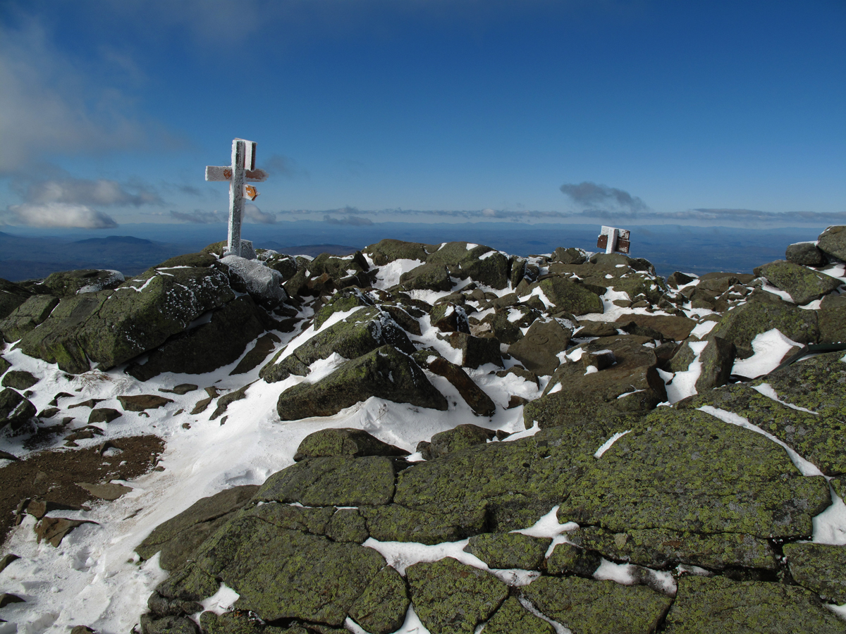
This article has lots of photos that are a special gift to an extraordinary person and a mountain friend of many years, Charley Richardson, who is currently unable to hike and misses the mountains. Today the light was astonishing and the views from the summit were also astonishing. You could just see the top of the Eiffel Tower in Paris. Honest! See you soon, Charley.


Throughout the day the colors were rich and vibrant.

I stopped here on my way down in mid-afternoon to admire the
late afternoon light caught in these same trees. The sun was low and in the
west and the light slanted in from behind those trees in the background. The light shimmered as the wind rippled the beech leaves that are still clinging to the trees. Ryan Adams has a song with the line, "I wish I was the wind,
I'd touch your face." Standing in the soft wind and warm sun felt like being kissed.

It's lovely is all I can say.


Certified organic, locally crafted soil. One of the artisans is inspecting the new soil.
 |
| I used to tell the camp groups I was guiding up Lafayette to the hut that this was a giant's grave. Then, at night at the hut, I'd tell them ghost stories featuring the giant and they'd stay away all night. Then they'd be grumpy and difficult to keep moving on the trail the next day. It really wasn't such a good idea. Anyway, there are lots of ghost stories about the White Mountains. Some are true. |
 |
| We used to call this section of the trail "Subway" because it was a trench that had been eroded by foot traffic and so deep that when you were hiking in it you couldn't see over the top on either side. The trail crew rerouted the trail in a few places and in others back filled the trench, like you see here, but it continues to erode. |
 |
| In the December 1929 Appalachia, pg. 359, Paul Jenks contributed a piece, "Recovery of the Old Bridle Path on Mt. Lafayette", which is wonderful in many respects and a good read. The trail was first opened as a bridle path in June, 1852, but had been used as a foot path as early as 1850. It was abandoned in the 1860s. Jenks and three other hardy souls set out in late summer 1929 to try and locate the old trail. Jenks wrote, "it was a great opportunity as may come to an amateur only once in a lifetime; (this is the man that helped open Garfield Ridge in 1914, 1915, and 1916) it was the last remaining problem of its kind in the White Mountains." p. 362 At any rate after a lot of bushwhacking and retracing of steps they were able to locate the entire length of the old trail and, with a lot of work, standardized it for use by the time Lonesome Lake hut was secured and construction of Greenleaf Hut was completed the following year. |
 |
| First views of the ridge, Mt. Lincoln and Little Haystack (right) from the switch back at the low end of Agony Ridge. I should point out that the Old Bridle Path was cut and maintained by a local businessman, similar to the Crawford Path on Mt. Washington, to take sightseers to the summit of Mt. Lafayette beginning in the mid-1800s. They traveled on horseback up the same trail used by hikers today. A "hotel" on the summit, really just a rough, low cut building with windows, provided shelter and some warmth from the weather. The building burned leaving the stone foundation which can still be seen. Remember the stone foundation on Moosilauke? They're both relics of early attempts to turn a great view from a summit into cash. Mt. Washington, being the highest, was the most popular and the most civilized with a hotel that was a real hotel with comfortable beds. Franconia Notch with its alpine scenery and beautiful lakes was a popular vacation spot up to the 20th century. There were several large (huge), lovely hotels in the notch that were served by trains from New York, Boston, Portland and Montreal. |
 |
| At the switch-back the trail hops up on this sidewalk-like ledge of Conway granite (or diorite) for the steep climb up on to the ridge. |
 | |||
| The Conway granite has been intruded by this softer red granite that is more common over near Fryburg, ME. It's much softer than the Conway granite and as you hike up the ridge and pass several outlooks you will notice how crumbly the red rock is compared to the whiter Conway granite. In the photo the red granite is eroding from water runoff. |
 |
| This is the intrusive red granite that has been weathered and sculpted by wind, rain, and freeze-thaw dynamics. This rock is weathering faster than the Conway granite.... |
 | ||
that you see here..
|


 |
| Quarrying with an artistic touch. |
 |
| Looking up the agonies towards Lafayette's summit and part of the Walker Ravine headwall. |
 |
| More of the enticing morning light where the trail climbs the 3 "agonies". There are actually 5 or possibly 6 agonies if you count all the bumps along the ridge to just below the summit, but only 3 are counted; the ones below Greenleaf Hut. The fourth agony is where the hut is located. |
 |
| This character was a delight as were his two dogs. He explained how much he loves hiking and being in the Whites and said he had gone out west to try the hiking out there but had to leave his dogs at home. "I couldn't do it," he said. "I missed my dogs too much." So he came home. |
 |
| The Agony ridge takes it's name primarily from people like the lucky mean and women who work work at Greenleaf Hut each summer and have to carry all kinds of interesting things up it and down it. The photo shows the bottom of what we call the "first aggy" or first agony. It's also referred to as "Red Rock" because of the color of the surficial rock which has a high iron content. It's very slippery when its wet and not much fun to pack up with excessive loads. The last time the Old Bridle Path,was used by four legged animals was back in the early 1960s when the AMC used to own a string of pack mules that were used to bring in what we called the "initial" which was the heavy canned food goods. The mules were around for 20-25 years. A lot of those initial supplies that are used to get the hut up and running at the beginning of each summer, including the propane gas, is now brought in by helicopters. Hut croos pack the "fresh" (foods) and additional supplies throughout the summer. If and when you hike up this 30 yard stretch of trail think how they got a horse to climb up it. They did it by a little trick which was to hand line the horses around red rock on the Walker Ravine side of the ridge on a solid ledge of Conway granite that had steps for the horses made of wood and held by iron bolts cemented into the granite. You can still see the bolts. |
 |
| This is the slippery part of Red Rock. In pouring rain it's a good scramble. |
 |
| This is the top of White Rock. The horses had to climb steeply along the edge of the ravine to reach this spot and rejoin the trail. I would imagine the riders got off the horses and walked this. |
 |
| The woods on the west side of the trail. The ridge drops steeply and a 100 feet down becomes a cliff that drops down into Franconia Notch. |
 |
| He left the highway early and is doing the Franconia Ridge Loop. He said the ridge was cold and windy. |
 |
| This meadow-like place on the trail and just below the hut is a measuring stick for balsam fir growth. I've kept track of it for more than 5 decades and remember what it looked like, say, in 1961 when it was twice the size it is now. I used to refer to it as an "alp" and wanted to bring a cow up for the summer so we could have fresh milk. |
 |
| Greenleaf Hut shuttered for the winter. It closed for the season two weeks ago in late September. It's nickname is The Flea. All the huts have nicknames. Galehead Hut is Ghoul, Zealand Falls Hut is Zool, Madison Hut is Chez Madison or Madhaus, Lakes is simply Lakes, or used to be, Mizpah is The Pah, Carter is Cata, and Lonesome is Lonesome. |
 |
I was reclining and basking in the ample sun on the porch when a couple of hikers appeared who had obviously been camping by the looks of their packs and had come down off the summit. Two young men came along first, introduced themselves and asked about water. It turned out that they were from the outdoor club of Haverford College in Pennsylvania and had been on their fall camping trip. There were a total of 30 students on the trip but they had divided into two groups of 15 students. Fifteen went east from Franconia and 15 came west from Crawford Notch and they passed each other somewhere in the middle.
They kept arriving.....
 
and arriving....
|
 |
That morning they had hiked over from the Mt. Garfield tent site, about 5 miles, and were low on water. There's no water available at Greenleaf Hut when the hut is closed. There is a spring but it is on the north end of Eagle Lake and nearly inaccessible. The students decided to filter water from the lake to fill water bottles. Inertia caught up with this student and she instantly fell asleep on the comfortable rocks. |

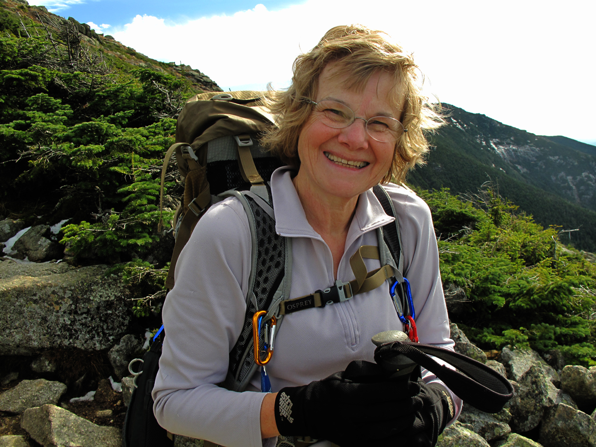 |
No one's belted me yet when I've asked to take their photo. She was a little reluctant but took a nice picture anyway. |
 |
| There were all kinds of characters out and about. |
 |
| Texting into the wind. |
 |
| The summit! The reward for all the labor: this exquisite view across New Hamphsire into Maine, Vermont, New York and Quebec, Canada. Mt.Washington and the Presidential Range are in the background, North and South Twin the dark, middle ridge with Guyot and Bond further to the right, and Mt. Garfield in the foreground on the left. |
 |
| Looking due north over Lafayette's north peak. You can see the Pilot Range and for some reason the Percy Peaks are hidden. Mt. Sutton in Quebec is clearly visible. |
 |
| Looking northeast with Adams and Jefferson of the Presidentials on the right in the medium distance. You can also clearly see the Mahoosucs in the far distance with Old Speck and Goose Eye visible. In the center of the photograph is Mt. Cabot surrounded by the Kilkenny Wilderness and to the left is the Pilot Range again. Cherry Mt. aka Mt. Martha is in the center of the photo in the middle distance. North Twin is behind and to the right of Garfield which is in front with the cliffs. |
 |
| The light was intense and the colors amazing. Looking east at Mt. Washington over the Twins with Garfield to the left and, in back, Guyot and Bond. In the back row, right is Mt. Kearsarge. In the back row, left is the Mahoosucs. |
 |
| Mt. Washington to the left, Mt. Carrigain on the right. |
 |
| Looking southeast at Mt. Carrigain on the left, Mt. Flume on the right in middle distance (at the end of the ridge). In the middle, to the right of Carrigain are the Hancocks, and Osceola. In the distance, left to right, are the Ossipees, Passaconway, Whiteface, Sandwich Dome and Tecumseh. Nice photo! |
 |
| Looking South towards Lincoln and Flume with the Sandwich Range to the left. Thursday morning, to research the feasibility of the Pemi Traverse I've been hinting that I might try, I bushwhacked up Big Coolidge mountain north of the town of Lincoln to see if there was a possible line from there to Flume but it was dense conifers, so dense it would take the fillings out of my teeth if I tried crawling through it. However, there's an abandoned trail running from the Kancamagus Highway up to Flume that skirts the east side of Mt. Osseo (or Whaleback) and that might be a bushwhack legitimately since it's been abandoned 40 years. I want to check it out and see, first, if I can find it, and, two, if it's passable. |
 |
| Looking west to Moosilauke and the Kinsmans with Sugarloaf in Vermont in the background. |
 |
| One last look across the "Pemi" to the Twins and the "Wash". |
 |
| Heading down in afternoon sunlight. |
 |
| The afternoon view of Lafayette and Lincoln from Thermopylae. |
 |
| The "sidewalk" on the lower section of the ridge. |
 |
Getting towards the bottom of the ridge and the end of a lovely day.
On the way down from the ridge I passed a young woman who was coming up the trail and who asked if I had seen two "older men" heading up and I said that I had and had checked with them how far they were planning to hike explaining that it was getting late to try for the summit. The men were congenial and thanked me for my concern. The young woman explained that they were friends of her father's and they'd all been hiking together but her father's health was not good. As she described her father's declining health she was overcome with grief and expressed the fear that his illness was serious and, if it was true, he would never climb Lafayette again, or hike again. Her grief was palpable and standing there on the trail I felt terrible for her and her father, of the loss that is inevitable and the pain that will come with it. Her dad and I are the same age and I thought about my daughters. It brought up my denial about what could happen to me and it's impact on my family. I identified with the young woman and her father both. So, I want to say to her how much your candor and openness affected me and how sorry I am for your loss and the painful changes lying ahead, and, most of all, I want to say thank you. |
 |
Afternoon light on the trail down.
|