
For some time I've wanted to hike the length of the Mt. Deception-Mt. Dartmouth ridge. It runs east and west from Jefferson Notch near the base of Caps Ridge on Mt. Jefferson out to Route 302, near Bretton Woods ski area. The highest points on the ridge are Mt. Dartmouth at 3,727' and Mt. Deception at 3610' above sea level (asl). It's a bushwhack as there are no trails which is part of the intrigue, but a primary motivation is to find out if the ridge and/or summits afford great views of Mt. Washington and the other Presidential peaks? My daughter, Liz, who is visiting from California (Lake Tahoe and the Sierras), and I, needed to hike so last Saturday (4-30-11) we made an initial exploration of Mt. Deception (above photo). Mt. Dartmouth is a mile or so away to the right (east) and out of the photo.

We entered the woods off the Cog Railway Base Station Road following well defined snowmobile trails for half a mile. It was chilly with light rain but it felt good to be moving. The forest in this vicinity was made up of dense balsam fir with some poplars and, along a stream and a beaver dam, there was a lot of speckled alder. Beaver had been cutting the alder and the occasional white birch (photo).

The beaver pond was a sprawling, shallow body of water that filled in an old logging scar. There were ample signs that beaver have moved back into the pond and are raising the water level to accommodate their lodges.

The fresh cuttings here are speckled alder which is a heavy wood to tote around in your teeth but these samples were brought from several hundred feet away.

Starting uphill we traversed an extensive grove of sugar maples (Acer saccharum) that had been selectively cut 75 or 80 years ago. The clouds were breaking up and the sunlight gradually intensified making the morning a lot warmer then when we started out.

We found this old wood road (lined with large boulders aka glacial erratics left here 12,000 years ago, or so0 that was in good shape and probably popularly used for snowmobiling in the winter. The Willey Range is in the right background. The deep V in the center background is the top of Crawford Notch.

Bushwhacking without foliage is best as you can easily trace your route based on visible landmarks. In our case we had Mt. Tom due south seen in the background and the Bretton Woods ski slopes due west of us not but not in the photo. Bushwhacking, traveling off trail, means going where you feel like going and not being constrained or anesthetized by a trail, but it includes various hardships as well. It can be time consuming as we found out on this outing.

The soil was very soft, wet and slippery. In the hardwood areas there must have been a million trout lilies (
Erythronium americanum) like the one above. That isn't an exaggeration, either. They were everywhere we looked. Most had not formed blossoms but a few, like this one, had a blossom on the verge of opening. This plant is also referred to as "dog toothed violet" but is not in the violet family. One of its identification features is the mottled pattern on the leaves which are said to resemble the colors of a brook trout (Salvelinus fontinalis).

Yellow violet (
Viola rotundifolia), one of the earliest spring flowers, were also everywhere and, being closer to the ground, were further along in achieving maturity.
 Trillium erectum
, or Red Trillium, is also an early flower and right on schedule.
 Polystichum acrostichoides
, Christmas fern. Try saying the latin name fast. This is an evergreen fern and easy to identify by the unusual shape of the pinnules (small leaves).

The higher areas of this sugar maple grove had some old trees that seemed huge in comparison to the individual trees at lower elevation. This one, also in the photo below, was nearly 7 feet in circumference.

A measurement of the sugar maple circumference at breast height= 83.25 inches, or about 26.5 inches in diameter.

There was a quick transition between the hardwoods and these softwood tracts as the slope steepened and we got higher on the ridge. The traveling on the ridge itself was very difficult as we clawed our way over and around innumerable blowdowns. Liz is visible up ahead in this photo with her rusty-red shirt.

These are instances when you sigh heavily and remember the myriad advantages trails provide.

But even without trails traveling is often pleasant as in areas like this where you can construct a trail with your imagination.

A hundred feet below the ridge the going got slower but this is fairly typical of most bushwhacks in the White Mountains in the 3000-3500 foot altitude zone and not all that difficult to navigate.

At the ridge, however, we got into an upheaval of fallen timber, lots of it, and in every direction. Looking through it, trying to find a passage, reminded me that this is a perpetual feature of the forest and the phenomenon represented by the blowdowns is not a purely destructive cycle but a way the forest has of rejuvenating itself. These trees will become soil and as they break down into humus new seedlings will emerge in countless numbers.

A lot of the blow downs were fresh, from this winter or perhaps a year ago. They're still photosynthesizing so it's difficult to tell exactly when they came down. The boles (or trunks of the trees) are pointing due south in this case so they came down in a "northeasterly" storm. The area of fallen trees was extensive and represents the top of the ridge where there is little soil and the bed rock is just a few inches down. The largest of these trees were growing in only 4-5 inches of soil.

After the 1938 Hurricane a lot of the ridge tops in the White Mountains looked like this. During the summer of 1939 trail crews worked feverishly to open up the main trails but it was back breaking work. A deep concern was the risk of fire. "Fireless Hell" was a phrase coined at that time to describe the enormous amount of dead wood resulting from the storm throughout the area.

Liz climbed a tree to get this photo looking into Ammonoosuc Ravine on Mt. Washington, 2 miles awaywith fresh snow on the upper slopes and still in the clouds. The white line left of center is the Cog Railway track.

I'm going to say this is a
Ganoderma tsugae, or Hemlock Varnish Shelf fungi, but I may be off a bit. At any rate it's a bracket, or shelf fungi, growing on a red spruce (
Picea rubens) that was among the blow downs. Ganoderma as a family is associated with both deciduous (hardwood) and coniferous (soft wood) trees. One of the Ganoderma family,
Ganoderma applanatum, is also referred to as "artists' conch". It's commonly found on deciduous trees in the northeastern U.S.. They grow quite large and have been used like a "canvas" for drawing pictures and sigining names using a sharp stick as a pencil.

We had to retreat off the ridge to by-pass the blow downs. We descended a couple of hundred feet skirting a large cliff face and trudging through a snow crusted bog on the south side and then found an easy passage for a good distance.

As we ascended back up on to the ridge there were still pockets of rotting snow. We brought snowshoes in case there was deep snow but never had to put them on. It's very difficult to crawl over and under blow downs with snow shoes on but they're essential when going off the well packed trails as snow in the woods, even in April, can be quite deep.

On the ridge again the going is a bit easier. The sun was now high and the day had become clear and warm.

This is the ridge just below the summit of Mt. Deception. It made for fairly easy traveling, but interspersed with difficult areas ...

where special care was needed to navigate through like this area of large, myriad blow downs.

This and the photo below are solidly on the ridge and a 1/4 mile from the summit of Mt. Deception. My guess would be, other than the summit itself where blowdowns probably prevail, the ridge to Mt. Dartmouth would look like this, fairly easy to navigate.


We reached out turn-around time before we reached the summit. Liz and I contemplated the option of going on to the summit but decided to stay on schedule (and on the safe side) and compromised by taking a different route down to extend our explorations.

The clouds were still draped over the Presidentials. There were occasional glimpses of Mt. Washington through the trees as we came back down.

Dropping quickly back into hardwoods we found ourselves in an extensive moose yard that covered several acres. All the moose signs were fresh, not over a day or two old, so we knew there were moose about but that we would be exceptionally lucky to see one. One issue with bushwhacking, unless you're very careful where you step and avoid breaking twigs, is that you alert wildlife to your presence and they're long gone by the time you see their tracks.

The moose yard was in a perfect location for winter sheltering with a broad southern exposure, high on the ridge away from snow mobiles with a sharp rise in the ridge to the north to cut the wind and lots of food and water.

A seasonal stream bisected the moose yard with water flowing from melting snow on the ridge.

The stream bed contained aquatic plants that moose prefer to almost anything and that are the mainstay of their summer diet.

Liz took this photo of air bubbles seen from under the water. The bubbles emanated from one of the small cataracts in the stream and show how water is aerated as it falls continuously. Water quality in the White Mountains in high because of the bedrock and low levels of silt and organic matter but steepness of slope and its relationship to aeration is another factor.

The clouds eventually lifted off of Mt. Washington and we were able to see across to Mt. Pleasant (Mt. Eisenhower) anf the southern Presidential range.

It's difficult to see the details but this boulder slid several hundred feet down the ridge plowing a deep furrow and pushing up a pile of soil in front. The moss growing on the downhill side of the boulder and other signs indicate that the sliding occurred some time ago and that the boulder has come to rest perhaps permanently.

This, a much large boulder, slid down this steep southern slope of the mountain and was stopped by a birch tree that has continued to grow up and around the boulder.

All of these boulders on the south flank of the mountain that we saw from the moose yard down are most likely glacial erratics deposited here 12,000-14,000 ya. This group of three larger boulders were the largest we encountered with the one on the left measuring 12 feet by 12 feet by 40 feet.

This one was shaped like a couch, semicircular and 15 feet long.

The day had transformed into a warm, bright spring afternoon with a few clouds filtering the sunlight as we reached the base of the mountain.

A bleached beech leaf.

Liz preferred the loftier passage over the stream.

Back at the beaver dam we were shocked by these masses of frogs' eggs we had somehow missed in the morning. They'd been deposited in shallow water and covered an area of 30 square feet.

Looking up at the frogs' eggs from below the surface of the pond.

Mt. Washington in the late afternoon sunlight from Bretton Woods. The snow cover has shrunk considerably.

The ridge line of Mt. Deception. Our hike traversed the main ridge from the left hand summit to just below the main summit on the right. Mt. Dartmouth is about a mile further to the right.
 For some time I've wanted to hike the length of the Mt. Deception-Mt. Dartmouth ridge. It runs east and west from Jefferson Notch near the base of Caps Ridge on Mt. Jefferson out to Route 302, near Bretton Woods ski area. The highest points on the ridge are Mt. Dartmouth at 3,727' and Mt. Deception at 3610' above sea level (asl). It's a bushwhack as there are no trails which is part of the intrigue, but a primary motivation is to find out if the ridge and/or summits afford great views of Mt. Washington and the other Presidential peaks? My daughter, Liz, who is visiting from California (Lake Tahoe and the Sierras), and I, needed to hike so last Saturday (4-30-11) we made an initial exploration of Mt. Deception (above photo). Mt. Dartmouth is a mile or so away to the right (east) and out of the photo.
 We entered the woods off the Cog Railway Base Station Road following well defined snowmobile trails for half a mile. It was chilly with light rain but it felt good to be moving. The forest in this vicinity was made up of dense balsam fir with some poplars and, along a stream and a beaver dam, there was a lot of speckled alder. Beaver had been cutting the alder and the occasional white birch (photo).
 The beaver pond was a sprawling, shallow body of water that filled in an old logging scar. There were ample signs that beaver have moved back into the pond and are raising the water level to accommodate their lodges.
 The fresh cuttings here are speckled alder which is a heavy wood to tote around in your teeth but these samples were brought from several hundred feet away.
 Starting uphill we traversed an extensive grove of sugar maples (Acer saccharum) that had been selectively cut 75 or 80 years ago. The clouds were breaking up and the sunlight gradually intensified making the morning a lot warmer then when we started out.
 We found this old wood road (lined with large boulders aka glacial erratics left here 12,000 years ago, or so0 that was in good shape and probably popularly used for snowmobiling in the winter. The Willey Range is in the right background. The deep V in the center background is the top of Crawford Notch.
 The soil was very soft, wet and slippery. In the hardwood areas there must have been a million trout lilies (Erythronium americanum) like the one above. That isn't an exaggeration, either. They were everywhere we looked. Most had not formed blossoms but a few, like this one, had a blossom on the verge of opening. This plant is also referred to as "dog toothed violet" but is not in the violet family. One of its identification features is the mottled pattern on the leaves which are said to resemble the colors of a brook trout (Salvelinus fontinalis).
 Yellow violet (Viola rotundifolia), one of the earliest spring flowers, were also everywhere and, being closer to the ground, were further along in achieving maturity.
 Trillium erectum, or Red Trillium, is also an early flower and right on schedule.
 Polystichum acrostichoides, Christmas fern. Try saying the latin name fast. This is an evergreen fern and easy to identify by the unusual shape of the pinnules (small leaves).
 The higher areas of this sugar maple grove had some old trees that seemed huge in comparison to the individual trees at lower elevation. This one, also in the photo below, was nearly 7 feet in circumference.
 There was a quick transition between the hardwoods and these softwood tracts as the slope steepened and we got higher on the ridge. The traveling on the ridge itself was very difficult as we clawed our way over and around innumerable blowdowns. Liz is visible up ahead in this photo with her rusty-red shirt.
 These are instances when you sigh heavily and remember the myriad advantages trails provide.
 But even without trails traveling is often pleasant as in areas like this where you can construct a trail with your imagination.
 A hundred feet below the ridge the going got slower but this is fairly typical of most bushwhacks in the White Mountains in the 3000-3500 foot altitude zone and not all that difficult to navigate.
 At the ridge, however, we got into an upheaval of fallen timber, lots of it, and in every direction. Looking through it, trying to find a passage, reminded me that this is a perpetual feature of the forest and the phenomenon represented by the blowdowns is not a purely destructive cycle but a way the forest has of rejuvenating itself. These trees will become soil and as they break down into humus new seedlings will emerge in countless numbers.
 A lot of the blow downs were fresh, from this winter or perhaps a year ago. They're still photosynthesizing so it's difficult to tell exactly when they came down. The boles (or trunks of the trees) are pointing due south in this case so they came down in a "northeasterly" storm. The area of fallen trees was extensive and represents the top of the ridge where there is little soil and the bed rock is just a few inches down. The largest of these trees were growing in only 4-5 inches of soil.
 After the 1938 Hurricane a lot of the ridge tops in the White Mountains looked like this. During the summer of 1939 trail crews worked feverishly to open up the main trails but it was back breaking work. A deep concern was the risk of fire. "Fireless Hell" was a phrase coined at that time to describe the enormous amount of dead wood resulting from the storm throughout the area.
 Liz climbed a tree to get this photo looking into Ammonoosuc Ravine on Mt. Washington, 2 miles awaywith fresh snow on the upper slopes and still in the clouds. The white line left of center is the Cog Railway track.
 I'm going to say this is a Ganoderma tsugae, or Hemlock Varnish Shelf fungi, but I may be off a bit. At any rate it's a bracket, or shelf fungi, growing on a red spruce (Picea rubens) that was among the blow downs. Ganoderma as a family is associated with both deciduous (hardwood) and coniferous (soft wood) trees. One of the Ganoderma family, Ganoderma applanatum, is also referred to as "artists' conch". It's commonly found on deciduous trees in the northeastern U.S.. They grow quite large and have been used like a "canvas" for drawing pictures and sigining names using a sharp stick as a pencil.
 We had to retreat off the ridge to by-pass the blow downs. We descended a couple of hundred feet skirting a large cliff face and trudging through a snow crusted bog on the south side and then found an easy passage for a good distance.
 As we ascended back up on to the ridge there were still pockets of rotting snow. We brought snowshoes in case there was deep snow but never had to put them on. It's very difficult to crawl over and under blow downs with snow shoes on but they're essential when going off the well packed trails as snow in the woods, even in April, can be quite deep.
 On the ridge again the going is a bit easier. The sun was now high and the day had become clear and warm.
 This is the ridge just below the summit of Mt. Deception. It made for fairly easy traveling, but interspersed with difficult areas ...
 where special care was needed to navigate through like this area of large, myriad blow downs.
 This and the photo below are solidly on the ridge and a 1/4 mile from the summit of Mt. Deception. My guess would be, other than the summit itself where blowdowns probably prevail, the ridge to Mt. Dartmouth would look like this, fairly easy to navigate.
 We reached out turn-around time before we reached the summit. Liz and I contemplated the option of going on to the summit but decided to stay on schedule (and on the safe side) and compromised by taking a different route down to extend our explorations.
 The clouds were still draped over the Presidentials. There were occasional glimpses of Mt. Washington through the trees as we came back down.
 Dropping quickly back into hardwoods we found ourselves in an extensive moose yard that covered several acres. All the moose signs were fresh, not over a day or two old, so we knew there were moose about but that we would be exceptionally lucky to see one. One issue with bushwhacking, unless you're very careful where you step and avoid breaking twigs, is that you alert wildlife to your presence and they're long gone by the time you see their tracks.
 The moose yard was in a perfect location for winter sheltering with a broad southern exposure, high on the ridge away from snow mobiles with a sharp rise in the ridge to the north to cut the wind and lots of food and water.
 A seasonal stream bisected the moose yard with water flowing from melting snow on the ridge.
 The stream bed contained aquatic plants that moose prefer to almost anything and that are the mainstay of their summer diet.
 Liz took this photo of air bubbles seen from under the water. The bubbles emanated from one of the small cataracts in the stream and show how water is aerated as it falls continuously. Water quality in the White Mountains in high because of the bedrock and low levels of silt and organic matter but steepness of slope and its relationship to aeration is another factor.
 The clouds eventually lifted off of Mt. Washington and we were able to see across to Mt. Pleasant (Mt. Eisenhower) anf the southern Presidential range.
 It's difficult to see the details but this boulder slid several hundred feet down the ridge plowing a deep furrow and pushing up a pile of soil in front. The moss growing on the downhill side of the boulder and other signs indicate that the sliding occurred some time ago and that the boulder has come to rest perhaps permanently.
 This, a much large boulder, slid down this steep southern slope of the mountain and was stopped by a birch tree that has continued to grow up and around the boulder.
 All of these boulders on the south flank of the mountain that we saw from the moose yard down are most likely glacial erratics deposited here 12,000-14,000 ya. This group of three larger boulders were the largest we encountered with the one on the left measuring 12 feet by 12 feet by 40 feet.
 This one was shaped like a couch, semicircular and 15 feet long.
 The day had transformed into a warm, bright spring afternoon with a few clouds filtering the sunlight as we reached the base of the mountain.
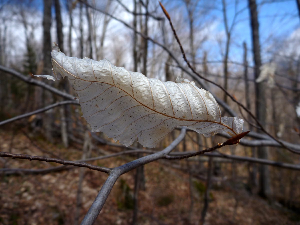 A bleached beech leaf.
 Liz preferred the loftier passage over the stream.
 Back at the beaver dam we were shocked by these masses of frogs' eggs we had somehow missed in the morning. They'd been deposited in shallow water and covered an area of 30 square feet.
 Looking up at the frogs' eggs from below the surface of the pond.
 The ridge line of Mt. Deception. Our hike traversed the main ridge from the left hand summit to just below the main summit on the right. Mt. Dartmouth is about a mile further to the right.
No comments:
Post a Comment