Sunday, November 18, 2012

11-17-12 Osseo aka Whaleback Mountain, A Bushwhack (complete)

Lovely morning light on Rt. 118, one of the great back roads of New Hampshire, as I headed north over a shoulder of Mt. Moosilauke Saturday (11-17-12) on the way to Lincoln. NH. It was another gorgeous fall day, perfect for hiking, with temps in the low 20 (F) to start but promising a warm day.

My goal was Mt. Osseo, the middle peak in the background. It’s now officially Whaleback Mt. due to the similarity between the pointed summit and the dorsal fin of a whale, or dolphin. Big Coolidge Mt. is to the left of Whaleback and Potash Knob is to the left and lower.  And, while it's true I was going to bushwhack (hike off-trail), I also wanted to see if I could locate the old Mt. Osseo Trail that was abandoned in the mid-1960s (it's last mentioned in the 1960 AMC White Mountain Guide) and that, for 60 years, served as the southern leg of the Franconia Ridge Trail. The Osseo Trail came down the ridge from Mt. Flume, threaded its way over Osseo/ Whaleback Mt. and descended to the Kancamagus Highway just east of Lincoln.  For the purpose of this article I am going to stick with Whaleback Mt. as it's the name found on most maps. However, I'm going to refer to the trail as the Old Osseo Trail because there is a new Osseo Trail that plunges down from Mt. Flume to the Lincoln Woods Trail a mile north of the Lincoln Woods Visitors Center. 


I parked here at end of the road and walked out behind one of the condos and started hiking.

The old Osseo Trail follows Clear Brook for a short distance. This is a branch of Clear Brook.

The morning sunlight was delicious and highlighted the rolling, uneven forest floor.
I'd anticipated finding evidence of both older and more recent logging operations right behind the condominiums as this region was heavily logged in the 1880-1890s right up to the summits of all the neighboring mountains by the famous J. E. Henry whose mills stood less than three miles from this stump. The tree that grew here was obviously cut down with a saw because of the level top but it's difficult to say when. We would have to know what kind of tree it was, softwood or hardwood, and look for other stumps in the immediate area to know if it was cut during a formal logging operations. There were no other stumps and my opinion was that the tree was a softwood, possibly a hemlock, and was cut aroud 40 years ago. There was evidence of more recent logging upslope from this stump that probably occurred when the condos were being built in the early 1970s.
Examples of wind-felled trees. Throughout my hike on Saturday I was confronted with vast areas and numbers of fallen trees, like giant "pick-up-sticks". The impression, on viewing the numbers of dead falls, is that the only enterprise nature is conducting here is soil building and little else. Everwhere you look the impetus seems to be on soil building in all its diverse stages.
The other notable objects that I saw on my hike was a mind boggling array of glacial erratics the size of this one, which was small by comparison, and larger, as big as houses. Some were so large they had forests growing on top of them.
In the "pit and mound" topgraphy of the forest floor I found this pile of broken-up red granite that had been interred in the root ball of a large tree that fell here and has since rotted away. The granite is continuing its metamorphosis into sand and as time goes by it will become sand as it becomes amalgamated into the surrounding soil while adding nutrients and tilth.
A healthy beech tree. I saw many, many beech trees with advanced beech bark disease (BBD) throughout the hike from the lowest elevation to the uppermost areas of the ridge. This tree was 68 inches in circumference, or 21.6 inches in diameter. The largest beech tree I measured during the day Saturday was 28 inches in diameter. 

Bear claw marks on a beech tree. I remember seeing these more often when I was a kid.
When biodiversity was a subject we all talked about a lot there was an adage to remind people that a lot of the biodiveristy in forest ecosystems, perhaps as much as 85 percent of it, goes unseen as it' comprised of  microscopic organisms that are responsible for the decomposition of the dead organic matter like this beech tree. These tiny and numerous animals represent high levels of energy available to the entire system in a number of ways. One way is to provide food source for larger animals like woodpeckers that feed on the grubs, termites, etc. Bears occasionally will tear up a felled tree, or knock a standing dead tree like the one in the photo, looking for food in the form of grubs, insect larvae, beetles, etc. Beetles represent a high percentage of the diversity in a northern forest ecosystem.
A lovely, large, living, yellow birch (Betula alleghiensis) 95.5 inches in circumference or 30 inches in diameter. The size of this tree, and several others close to this size that I measured on Saturday, raises questions about the logging that occurred here 120-130 years ago in the late 1800s. There are photos from that time showing these mountains, Big Coolidge, Whaleback, and Potash Knob, denuded of trees when the loggers finished their work here and moved up the river. The logging roads extended right to the summits. Seemingly nothing was left uncut. However, the size of this birch would indicate a tree older than 120 years. Was it left behind as a seedling too small to cut by the loggers? Or did it grow rapidly in this location due to the absence of any competitive trees?
Whaleback in view. I had hiked up and over two low ridges and now had a high ridge to ascend to get up to the top of the ravine to the east of the summit. Having the leaves off the trees is a major advantage to bushwhacking during the six cold months of the year because of the visiblity. In this case I didn't need a compass. I could see Whaleback's summit (due North) and make out the ski slopes on Mt. Loon, to the south, pretty much the entire time. So I had my two reference points for navigating.
It's difficult to see due to the bright sun striking the camera lens but to the right, a bit, you can see Loon Mt. and I could see white lines of the ski trails being groomed for Thanksgiving weekend. You'll be able to see them in a photo taken from the summit to get an idea. Hiking off the trail requires knowledge about navigation, and knowledge about "place" as in knowing landforms from different angles, brooks and rivers, cliffs, topography, etc, and it requires self-confidence in that knowledge (experience). It also requires some endurance  as, a lot of the time, its hard work, physically more demanding then trail hiking (but not all the time) and can certainly be more frustrating because, in bushwhacking you don't always achieve your goal and have to change plans.

There wasn't a breath of wind. Everything was still. I heard juncos and ravens as I sat here in the sun for awhile enjoying the solitude. The air temperature was 30 degrees (F) and the sun was hot on my face and arms. I was wearing my usual hiking outfit of Patagonia shorts and a long-sleeved, light weight merino wool top with sleeves pushed up, but I was sweating profusely as I hiked. That's a statement about fall hiking. The caveat is that it can get cold in an instant. Crossing over the ridges and descending the shadowed northerly flanks I immediately got chilled. In the photo the slope is getting steeper and often calling for use of hands as well as feet for traction. 
The balsam and spruce on the north facing slope of the ravine I chose to climb directly to the summit of Whaleback. This is at about 2700 feet.
Just a short way up the ravine I encountered this maze. This cross stacking of felled trees represents a real obstacle when bushwhacking and it's best to find a way around it because it's easy to get hurt threading your way threw it unless you're agile. It can take extra time, as well. If you do decided to go through it be careful.
Then there's this stuff. At about 3,000 feet in elevation you usually begin to run into these dense areas of balsam and spruce on north slopes, on ridges and near the summit. It can be incredibly tight and interwoven like a fence, and you have to be patient. Protecting your face and arms is necessary. You also have to try and keep your bearings which is easy most of the time as you are either going uphill or downhill. Just remember, it will end. It's like waiting for on-coming traffic to end when trying to make a left-had turn driving.
When it does begin to thin again you'll see light in front and you'll be able to re-check your "line", or direction and location, and get back on track. On Saturday, in this dense growth I was moving at about 1 mph, or less, while bushwhacking and this isn't even close to how bad it can get on the higher peaks. The rate of progress varies, of course, and in the open woods you can crank, but it is while swimming through this dense vegetation that you'll truly recognize the benefits of a trail.
This is "good passage" on the ridge or summit slopes. I took the photo where it was fairly clear. I reached this point by crawling and pulling myself through with both arms which is typical. There could be a book about the yoga of bushwhacking. There's a ribbon-like zone throughout the White Mountains of short, densely crowded balsam and spruce trees with alder and mountain ash thrown in here and there, that runs through and around the mountains sometimes as low as 3300 feet but always found at 4000 feet up to the tree line itself. Moving through this is difficult and it will often be so dense that it will take all your energy to move a couple of feet. You'll find breaks, clearings, rock outcrops, etc, where you can rest and check your direction. In an article titled "Bushwhacking--Pain or Pleasure" in the June 1963 Appalachia (by Marie Carden and Ronald Glower) the authors state it's "certainly true of some bushwackers who go out of their way to get in a situation where they have to fight through that awful stuff that grows on the top of mountains that the guide book calls 'stunted spruce' rather than follow a trail. But for most people, bushwhacking is a mean to an end rather than an end in itself. It can be either a torture or, with practice quite enjoyable. This is true whether it be for a half-day, or a whole day, or a real production of two or more days."(p. 530)
I was able to stand up and hike in normal fashion for a good deal of the climb up Whaleback on Saturday. I only had to actually crawl a dozen yards, or so. At one point I went past this patch of moss that was somehow in partnership with the sunlight coming through the balsams. It looked like the moss had been able to maximize its use of the sun.
This is the sort of thing you are likely to find when you're hiking off trail. It's cool. Makes you want to move right in. I didn't realize it when I first popped out of the dense firs right next to this leaning boulder that I was standing on the old Osseo Trail.  I was delighted because it would make getting to the summit much faster and easier.

The following is an experience I had that illustrates the points made in the bushwhacking article in AppalachiaOn a south east ridge of South Twin there is a prominent rock outcrop visible from Galehead Hut that beckons to you. From the huts front porch it appears that a fine view of the hut, the Franconia's, and the western half of the Pemi can be seen from there. Having felt the "itch" you attempt getting onto the ridge to gain the outcrop by trying various entry points: from above  descending to it from the Twin Way using a compass bearing. In ten yards your clothes are in shreds. You turn back. You try another entry points. In 20 yards you have no clothes. You turn back. If you keep trying you'll get wiser and eventually you'll find a way through and you'll sit there in awe because the view really is superb. I've tempted myself with staying there overnight to take photos of the hut after dark with the inside lights glowing from the windows, or at dawn when the Franconias and Garfield are in sunlight and the hut it still in shadow, etc. 

I remember when getting to West Bond was a bushwhack just like what I described above and I think a lot of summits including Zealand Mt., Mt. Field, Lowell, Nancy, the Hancocks, Owls Head, were all bushwhacks up to the early 1960s. Certainly, prior to the early 1900s where there was flurrry of trail building activity from Randolph to the Pemi, everyone had to bushwhack who wanted to hike.
This is looking down a stretch of the old Osseo Trail just below the summit.
And from the same spot this is looking up the trail. As you can see it looks neglected to a degree but still in good shape. I was to find numerous places where someone fairly recently, in the past 3-5 years had been "standardizing" it with an axe and saw as several blowdowns that had reached across the trail were trimmed back.
The notation in the 1960 guide book mentions this ledge just below the summit and the view south. That's Loon Mt. across the valley with the ski area. They were taking advantage of below freezing temperatures to try and get some snow on the slopes in hopes of attracting skiers for the long Thanksgiving weekend.
This is looking slightly southeast from the Osseo-Whaleback summit towards the entire Sandwich Range. Left to right is Mt. Hitchcock, The Moats in the background, Mt. Kancamagus, Mt. Tripyramid, Osceola East Peak and Mt. Osceola, Mt. Tecumseh in the back, Scar Ridge and a ridge on Loon Mt. in the right foreground.
Left to right: Signal Ridge, Mt. Carrigain, Mt. Hitchcock in foreground, North and South Hancock, Mt. Huntington, and the Moats in the background.
Mt. Washington on the left and the Pemigewasset Valley in the center with a shoulder of North Hancock to the right (or it's possibly Mt. Carrigain).
I followed the old Osseo Trail for a mile, or so, on the way back down and found it well kept.
It appears unused for the most part...
with the exception of a few small human touches....
.......but for the most part it was hard to discern as an actual trail. Someone has freshly painted yellow blazes, and, as noted above, blow downs have been cut back off the trail. It's possible that it is used during the summer months by residence of the Loon condominium complexes.
In the blog article describing my hike up Mt. Lafayette a month ago I showed photos of frost "quarrying" of rocks, or how freeze-thaw mechanics break ledge and large pieces of rock into smaller and smaller pieces, but this glacial erratic found on the lower slope of Whaleback set a new standard for quarrying in the the square edges and flush planes. It looks as though it was sculpted by an artist using good rock chisels and a practiced hand.

I left the trail at the bottom of the first steep ridge coming down from the summit and found my way back to my car following the approximate route I'd taken on the ascent. It was early afternoon and the light in the woods was amazingly bright and warm and created these dark, crisp shadows these maples and birch.

Sunday, October 28, 2012

10-28-12: More Notes: A moose on the summit of Mt. Washinton, a photo from 1983 by Al Oxton.

This is a famous photo that was taken by Al Oxton in the fall of 1983 of a moose hiking up the Crawford Path. The photo was first published on the cover of the November 1983 AMC Bulletin. At the time Oxton was on the crew of the Obs (Mt. Washington Weather Observatory) and spotted the moose from the kitchen window. He used a telephoto lens. The moose was eventually corralled by Fish and Game Department personnel and eventually was "put down" because it was suspected that it was quite sick and suffering from parasites lodged in its brain. That turned out to be the case, but still a sad story.

There is another story contained in this photo about the types of parasites that infect moose and white tailed deer in New England and that, in the past, may have had a dramatic impact on the population numbers of these ungulates. The parasite is a worm, Parelaphostrongylus tenuis, which has long been found in white tailed deer and generally does not harm the deer. The life cycle of these worms is complicated. They first appear in the space between the deer's/moose's skull and the brain where females lay eggs that become larvae that pass through the moose's bloodstream to its lungs. The larvae are coughed up by the deer or moose and land on the ground where they are eaten by snails and slugs. Then, moose and deer, inadvertently eat the small snails when they are browsing foliage. The larvae then make it back to the deer's and moose's brain to complete another cycle. The caveat is that the moose's brain, unlike the deer's, isn't a suitable environment for the adult worms to produce eggs. Instead the moose becomes gravely ill, develops symptoms just like the moose in the photo did of stumbling, acting erratically, walking in circles, and appearing tame. In the wild, the moose eventually dies.

When Al took this photo, in 1983, the moose were just making a come back in the White Mountains  after being completely absent, at least south of Route 2, for many years.


I received the following email this morning from an old friend which I want to pass along because there may be some naturalists and, particularly "birders", who might have an interest:

Hi Alex,

I remember hiking up Tuckerman's ravine trail with you in 1984? as well as conversing in a few social occasions allied with the MCZ Entomology crew when you were going out with our dept. assistant who's name is escaping me momentarily.

Anyway I came across your blog by chance and became heady with the delicious memories it evoked of the Whites where I honed my naturalist skills. I have been immersed in the Andes for 23 years now and distracted by the great bird continent but longingly observe the whites as we sometimes drive from Boston to Ottawa through the notch to visit Sherry's family.

Keep up the great blogging and if you know of any birders headed to Ecuador or the Galapagos I can help :) !

Cheers,

Charlie Vogt

General Manager, Andean Birding
Salazar Gómez E-1482 y Eloy Alfaro
Quito, ECUADOR
 

Thursday, October 18, 2012

10-18-12 Mt. Lafayette: The Perfect Day.

This article has lots of photos that are a special gift to an extraordinary person and a mountain friend of many years, Charley Richardson, who is currently unable to hike and misses the mountains. Today the light was astonishing and the views from the summit were also astonishing. You could just see the top of the Eiffel Tower in Paris. Honest! See you soon, Charley.
When they say "follow your bliss", this is as close as I can get. Thursday the morning air was cold. I'd already hiked a few miles on a wild goose chase bushwhacking on Mt. Coolidge trying to get up Mt. Flume but, in defeat, turned my thoughts to summiting Mt. Lafayette. This was how the trail looked as I set forth. It was mid morning and the sun was just up over the ridge, and having escaped from the clouds, it had caught in the trees  turning the beech leaves into gold, and flickering, picked its way across the carpet of leaves setting them on fire one by one.
The Falling Waters Trail can be taken literally. I happen to dislike it for reasons I don't even remember, but it could never replace the Old Bridle Path so I hardly give it a thought. Falling Waters is usually quite busy as it's the first leg in the well used loop that goes up Little Haystack to Franconia Ridge at treeline and surfs along the high ridge to Mt. Lafayette, descends the Greenleaf Trail to Greenleaf Hut and continues down the Old Bridle Path to the car park. Of course, you can go clockwise and descend by the Falling Waters Trail if you like going against the herd.
Clouds that formed spontaneously over the summits and ridge from the warm air rising into the cold, upper air, filtered the sunlight, softening it, and created these warm brown tones in the leaf carpet.
Throughout the day the colors were rich and vibrant.
I stopped here on my way down in mid-afternoon to admire the late afternoon light caught in these same trees. The sun was low and in the west and the light slanted in from behind those trees in the background. The light shimmered as the wind rippled the beech leaves that are still clinging to the trees.  Ryan Adams has a song with the line, "I wish I was the wind, I'd touch your face." Standing in the soft wind and warm sun felt like being kissed.
It's lovely is all I can say.

A log that long ago fell here, and I remember it from 20 years ago, is still intact but slowly being hollowed out by termite larvae (worms) and waste material from all their chewing stands in a pile at the downhill end of the log. It will mix into with the older forest soil as a rich fertilizer.
Certified organic, locally crafted soil. One of the artisans is inspecting the new soil.
I used to tell the camp groups I was guiding up Lafayette to the hut that this was a giant's grave. Then, at night at the hut, I'd tell them ghost stories featuring the giant and they'd stay away all night. Then they'd be grumpy and difficult to keep moving on the trail the next day. It really wasn't such a good idea. Anyway, there are lots of ghost stories about the White Mountains. Some are true.
We used to call this section of the trail "Subway" because it was a trench that had been eroded by foot traffic and so deep that when you were hiking in it you couldn't see over the top on either side. The trail crew rerouted the trail in a few places and in others back filled the trench, like you see here, but it continues to erode.
In the December 1929 Appalachia, pg. 359, Paul Jenks contributed a piece, "Recovery of the Old Bridle Path on Mt. Lafayette", which is wonderful in many respects and a good read. The trail was first opened as a bridle path in June, 1852,  but had been used as a foot path as early as 1850. It was abandoned in the 1860s. Jenks and three other hardy souls set out in late summer 1929 to try and locate the old trail. Jenks wrote, "it was a great opportunity as may come to an amateur only once in a lifetime; (this is the man that helped open Garfield Ridge in 1914, 1915, and 1916) it was the last remaining problem of its kind in the White Mountains." p. 362 At any rate after a lot of bushwhacking and retracing of steps they were able to locate the entire length of the old trail and, with a lot of work, standardized it for use by the time Lonesome Lake hut was secured and construction of Greenleaf Hut was completed the following year.
First views of the ridge, Mt. Lincoln and Little Haystack (right) from the switch back at the low end of Agony Ridge. I should point out that the Old Bridle Path was cut and maintained by a local businessman, similar to the Crawford Path on Mt. Washington, to take sightseers to the summit of Mt. Lafayette beginning in the mid-1800s. They traveled on horseback up the same trail used by hikers today. A "hotel" on the summit, really just a rough, low cut building with windows, provided shelter and some warmth from the weather. The building burned leaving the stone foundation which can still be seen. Remember the stone foundation on Moosilauke? They're both relics of early attempts to turn a great view from a summit into cash. Mt. Washington, being the highest, was the most popular and the most civilized with a hotel that was a real hotel with comfortable beds. Franconia Notch with its alpine scenery and beautiful lakes was a popular vacation spot up to the 20th century. There were several large (huge), lovely hotels in the notch that were served by trains from New York, Boston, Portland and Montreal.
At the switch-back the trail hops up on this sidewalk-like ledge of Conway granite (or diorite) for the steep climb up on to the ridge.
The Conway granite has been intruded by this softer red granite that is more common over near Fryburg, ME. It's much softer than the Conway granite and as you hike up the ridge and pass several outlooks you will notice how crumbly the red rock is compared to the whiter Conway granite. In the photo the red granite is eroding from water runoff.

This is the intrusive red granite that has been weathered and sculpted by wind, rain, and freeze-thaw dynamics. This rock is weathering faster than the Conway granite....
that you see here..
that has also been weathered and sculpted by the same dynamics. These equally spaced "cleft notes" pose a mystery in how, exactly, they formed but wind, water, ice, etc. were the primary contributors. The photo below illustrates "quarrying"  where smaller blocks of the Conway granite break off larger ones. Some of them tumble down into Walker Ravine from time to time.

Quarrying with an artistic touch.
Looking up the agonies towards Lafayette's summit and part of the Walker Ravine headwall.
More of the enticing morning light where the trail climbs the 3 "agonies". There are actually 5 or possibly 6 agonies if you count all the bumps along the ridge to just below the summit, but only 3 are counted; the ones below Greenleaf Hut. The fourth agony is where the hut is located.
This character was a delight as were his two dogs. He explained how much he loves hiking and being in the Whites and said he had gone out west to try the hiking out there but had to leave his dogs at home. "I couldn't do it," he said. "I missed my dogs too much." So he came home.
The Agony ridge takes it's name primarily from people like the lucky mean and women who work work at Greenleaf Hut each summer and have to carry all kinds of interesting things up it and down it. The photo shows the bottom of what we call the "first aggy" or first agony. It's also referred to as "Red Rock" because of the color of the surficial rock which has a high iron content. It's very slippery when its wet and not much fun to pack up with excessive loads. The last time the Old Bridle Path,was used by four legged animals was back in the early 1960s when the AMC used to own a string of pack mules that were used to bring in what we called the "initial" which was the heavy canned food goods. The mules were around for 20-25 years. A lot of those initial supplies that are used to get the hut up and running at the beginning of each summer, including the propane gas, is now brought in by helicopters. Hut croos pack the "fresh" (foods) and additional supplies throughout the summer.  If and when you hike up this 30 yard stretch of trail think how they got a horse to climb up it. They did it by a little trick which was to hand line the horses around red rock on the Walker Ravine side of the ridge on a solid ledge of Conway granite that had steps for the horses made of wood and held by iron bolts cemented into the granite. You can still see the bolts.
This is the slippery part of Red Rock. In pouring rain it's a good scramble.
This is the top of White Rock. The horses had to climb steeply along the edge of the ravine to reach this spot and rejoin the trail. I would imagine the riders got off the horses and walked this.
The woods on the west side of the trail. The ridge drops steeply and a 100 feet down becomes a cliff that drops down into Franconia Notch.
He left the highway early and is doing the Franconia Ridge Loop. He said the ridge was cold and windy.
This meadow-like place on the trail and just below the hut is a measuring stick for balsam fir growth. I've kept track of it for more than 5 decades and remember what it looked like, say, in 1961 when it was twice the size it is now. I used to refer to it as an "alp" and wanted to bring a cow up for the summer so we could have fresh milk.
Greenleaf Hut shuttered for the winter. It closed for the season two weeks ago in late September. It's nickname is The Flea. All the huts have nicknames. Galehead Hut is Ghoul, Zealand Falls Hut is Zool, Madison Hut is Chez Madison or Madhaus, Lakes is simply Lakes, or used to be, Mizpah is The Pah, Carter is Cata, and Lonesome is Lonesome.
I was reclining and basking in the ample sun on the porch when a couple of hikers appeared who had obviously been camping by the looks of their packs and had come down off the summit. Two young men came along first, introduced themselves and asked about water. It turned out that they were from the outdoor club of Haverford College in Pennsylvania and had been on their fall camping trip. There were a total of 30 students on the trip but they had divided into two groups of 15 students.  Fifteen went east from Franconia and 15 came west from Crawford Notch and they passed each other somewhere in the middle.

 They kept arriving.....

and flopping down...(the great pleasure of unburdening yourself of a heavy pack one's been carrying hour after hour and being able to collapse on the ground or a warm, flat rock).


                                                                       and arriving....
That morning they had hiked over from the Mt. Garfield tent site, about 5 miles, and were low on water. There's no water available at Greenleaf Hut when the hut is closed. There is a spring but it is on the north end of Eagle Lake and nearly inaccessible. The students decided to filter water from the lake to fill water bottles. Inertia caught up with this student and she instantly fell asleep on the comfortable rocks.

I like to see groups of students, teens, or young kids in the mountains, with their families, school groups, summer camps, etc, because I see them (and treat them) as the "next generation", the ones who hopefully will come back time and time again and eventually bring their families here and, in time, take an interest in preserving the knowledge, the memories, the love and the respect for these mountains that earlier generations have preserved for them.
This gleeful young man is from Sherbrooke, Province of Quebec (PQ) or, as they say in Quebec, the "Eastern Townships". He had arrived in the morning and we met by chance in the parking lot. He opted to take the Falling Waters trail to Little Haystack and then head north over Franconia Ridge to Lafayette and descend from there. We were supposed to meet in the middle of the ridge but I was dawdling and stopping to take photos so we passed each other on Lafayette.

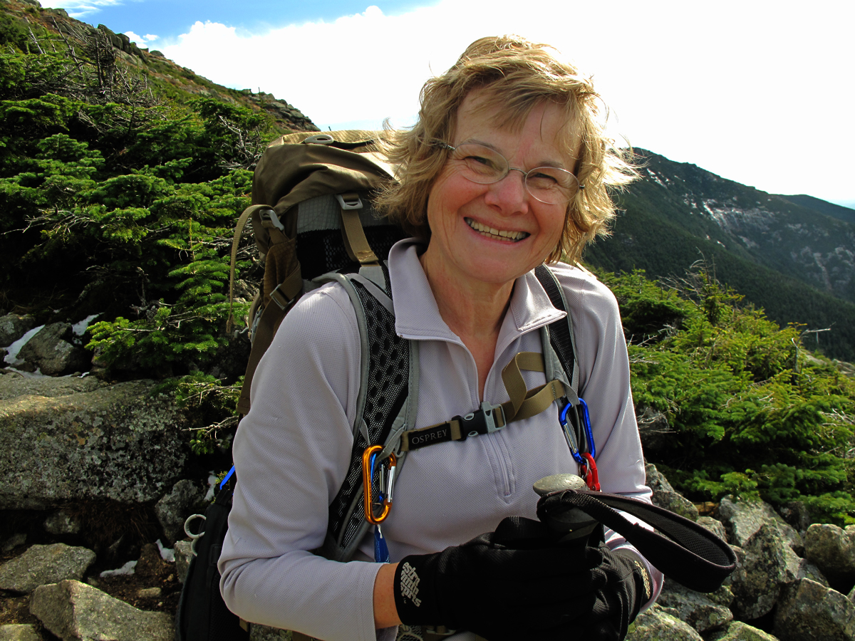
No one's belted me yet when I've asked to take their photo. She was a little reluctant but took a nice picture anyway.

 and her husband was obliging as well.
There were all kinds of characters out and about.
Texting into the wind.
The summit! The reward for all the labor: this exquisite view across New Hamphsire into Maine, Vermont, New York and Quebec, Canada. Mt.Washington and the Presidential Range are in the background, North and South Twin the dark, middle ridge with Guyot and Bond further to the right, and  Mt. Garfield in the foreground on the left.
Looking due north over Lafayette's north peak. You can see the Pilot Range and for some reason the Percy Peaks are hidden. Mt. Sutton in Quebec is clearly visible.
Looking northeast with Adams and Jefferson of the Presidentials on the right in the medium distance. You can also clearly see the Mahoosucs in the far distance with Old Speck and Goose Eye visible. In the center of the photograph is Mt. Cabot surrounded by the Kilkenny Wilderness and to the left is the Pilot Range again. Cherry Mt. aka Mt. Martha is in the center of the photo in the middle distance. North Twin is behind and to the right of Garfield which is in front with the cliffs.
The light was intense and the colors amazing. Looking east at Mt. Washington over the Twins with Garfield to the left and, in back, Guyot and Bond. In the back row, right is Mt. Kearsarge. In the back row, left is the Mahoosucs.
Mt. Washington to the left, Mt. Carrigain on the right.
Looking southeast at Mt. Carrigain on the left, Mt. Flume on the right in middle distance (at the end of the ridge). In the middle, to the right of Carrigain are the Hancocks, and Osceola. In the distance, left to right, are the Ossipees, Passaconway, Whiteface, Sandwich Dome and Tecumseh. Nice photo!
Looking South towards Lincoln and Flume with the Sandwich Range to the left. Thursday morning, to research the feasibility of the Pemi Traverse I've been hinting that I might try, I bushwhacked up Big Coolidge mountain north of the town of Lincoln to see if there was a possible line from there to Flume but it was dense conifers, so dense it would take the fillings out of my teeth if I tried crawling through it. However, there's an abandoned trail running from the Kancamagus Highway up to Flume that skirts the east side of Mt. Osseo (or Whaleback) and that might be a bushwhack legitimately since it's been abandoned 40 years. I want to check it out and see, first, if I can find it, and, two, if it's passable.
Looking west to Moosilauke and the Kinsmans with Sugarloaf in Vermont in the background.
One last look across the "Pemi" to the Twins and the "Wash".
Heading down in afternoon sunlight.
The afternoon view of Lafayette and Lincoln from Thermopylae.
The "sidewalk" on the lower section of the ridge.
 Getting towards the bottom of the ridge and the end of a lovely day.

On the way down from the ridge I passed a young woman who was coming up the trail and who asked if I had seen two "older men" heading up and I said that I had and had checked with them how far they were planning to hike explaining that it was getting late to try for the summit. The men were congenial and thanked me for my concern. The young woman explained that they were friends of her father's and they'd all been hiking together but her father's health was not good. As she described her father's declining health she was overcome with grief and expressed the fear that his illness was serious and, if it was true, he would never climb Lafayette again, or hike again. Her grief was palpable and standing there on the trail I felt terrible for her and her father, of the loss that is inevitable and the pain that will come with it. Her dad and I are the same age and I thought about my daughters. It brought up my denial about what could happen to me and it's impact on my family. I identified with the young woman and her father both. So, I want to say to her how much your candor and openness affected me and how sorry I am for your loss and the painful changes lying ahead, and, most of all, I want to say thank you.
Afternoon light on the trail down.