On Thursday afternoon (10-14-10) my daughter, Liz, and I played hooky for a few hours and headed for Zealand Falls Hut just in front of a well publicized "Nor'easter" that was bearing down on the Hills with heavy rains, wind, and cooler temperatures. We got on the trail a little after 4 pm just as dark clouds moved in from the southeast.

The fall foliage colors driving north through Vermont were beautiful, highlighted by the brilliant as well as orangey yellows and carmen reds of the maples, aspens, birches and beech but on the northern tier of the White Mountain National Forest (WMNF) recent storms shredded most of the leaves leaving only scattered streaks of bright colors (like these maple leaves) which are all the more intense in contrast to the dark greens of the conifers.

Without leaves the visibility increases dramatically in the woods and gives a perspective that is startling in comparison to its lack in the warm months when the leaves are out. One thing that jumps out visibly is the vast number of young balsam firs many of them of equal height that represent nursery stock for this plant population.

The density of the balsams in key areas where direct sunlight is available, such as areas of recent blow downs and along the corridor created by the trail, is an indicator of how well the firs compete but also suggests how adaptive they've been over time. I enjoy thinking about the success ratios of these trees because I'm so curious about the make up of the forest here and how, exactly, it evolved, including its diversity, since the Wisconsinan glacial ice sheet was here approximately 12,000-14,000 years ago.

The concept of succession comes to mind looking at this old tree stump that is decaying into an assortment of organic matter created by the woody material from the trunk, the leaves around it, and the decaying macro and micro organisms that aid and abet the decay process, like the Haircap moss that has flourished along the trunk of the downed fir tree. There on top of all that contagion of decay, the old tree dying, is a proud, young balsam chomping at the bit to establish itself in that newly created niche.
 Trametes versicolor
 (I think), colloquially called "Turkey Tails" is another agent of decay that assists in breaking down wood fibers to create soil. I say "I think" because I haven't stopped to key the fungus out and there are a couple that resemble the true
Trametes versicolor.

Reaching the area of old and new beaver activity the clouds were becoming denser and it definitely smelled like rain was imminent.

The refurbished beaver dam, next to the Zealand Trail, that's been here for several generations of beaver families (going back decades). For a little over a year there's been evidence of new beaver activity in the valley after a hiatus of several years. Beavers are matriarchal so they need a female to begin a colony.

The clouds got thicker and more ominous by the minute...

until it looked like we were going to get drenched...

and then the clouds thinned a bit and it got lighter.

Rasberry leaves. The Rose family again.
Rubus idaeus
This place, just before the A-Z Trail turnoff, is so familiar to me. I love the corridor of birches and the simplicity. Humans have been passing by here, some in noisy, smoke belching locomotives, long before I ever came along but I've skied through here in dazzling moonlight on still January nights, or in blizzards when the tree swayed wildly making loud creaking and snapping noises, and I've run by here on hot July afternoons aiming for the cold, bath tub-sized pot holes in the ledges along Whitewall Brook. This stretch of trail never fails to remind me of old friends and, as I pass through, I often get that urge to connect with them, to start a letter in my head with long descriptions of what I'm seeing; one of those letters you write but never send.

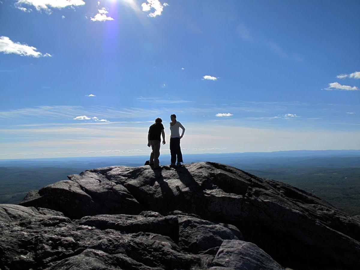
The north end of Zealand Pond with Zealand Mountain in the background.

Fall colors.

We came to the hut purposefully to hang out with these guys, Peter and Charley Richardson. They're father and son, but I guess you could figure that out. You may recall that Peter was at Madison Springs Hut back in late August for a mini-reunion. He worked at Madison for a while in 1942 before moving over to Lakes of the Clouds to finish the summer there. In 1948 he and his wife, Keenie, ran Zealand for the summer. Charley worked in the huts from 1969 to 1972, including a summer at Zealand. His brother Chris also worked in the huts. Then Charley's son, Nick, worked in the huts, so three generations of Richardsons have worked in the huts. Charley became a grandfather last week so there may be an Anabel Richardson who'll make blueberry pancakes at Zealand some day. This multi-generational phenomenon, and it's not unusual, speaks to several attributes of working in the huts. One is that it's a great job in and of itself, but attendant to that is the love, the deep attachment, many of those who've worked in the huts feel for the mountains and that brings them back year after year.

This is the Zealand Fall Croo with "Mac" on the left, Hannah, Catherine and Johannes. They have a difficult time leaving the mountains as well. They, too, come back year after year, but it was a great pleasure to see them and enjoy their company once more before they scatter to the four points of the compass for the winter. The hut will "close" as a full service facility for the season this week and revert to "caretaker basis" meaning it stays open all winter with a croo of two but guests must bring their own food, sleeping bags, etc. They can use the stoves, cookware, plates, etc.

This was the trail below the hut on Friday morning.

The rain was a good "soaker" including soaking us but welcome, certainly, in this era of a global water crisis. This is the west shore of the pond with the woods opened up by the loss of leaves.

Looking back across the Pond at the Falls and the ridge.

Looking across the pond that the trail has become.


An abundance of water.


The bridge over troubled water. A new beaver dam has exacerbated the situation so that the rain water is slowed down as it moves through this part of the valley. There's just a lot of water at the moment. It was impossible not to get wet, bridge or no bridge.

Liz far ahead.

The Zealand River at 9 am Oct. 15th.

The Zealand River at the same spot at 5 pm Oct. 14th. The water comes up quickly during these fall storms because there is nothing around absorbing the water, no leafy trees, and once the soil is saturated the water runs downhill quickly until it finds a well marked "trail". I've mentioned how the mountains lakes, having been glacially formed as "kettle holes", are never "flushed" the way this stream bed gets flushed every time there's a heavy rain so that it gets "recharged", in a sense. Not that the river is made young again, but a lot of the detritus is removed, and it doesn't become "eutrophied" the way the mountain lakes do with multiple successions of soil and plants until they return to forest.

It's usually a quick hop, step and jump to get across the Zealand River here and it became a bit of an adventure as the water was up a foot, or more. We reconnoitered upstream a ways and found a good crossing where the water was only up to our knees but the rocks below the surface made it a bit treacherous.

Elizabeth at 21 and soaked to the bone.

But being out in the woods on a rainy day is wonderful, particuarly when you can come back to a cozy, warm place with a fire, but even without a refuge there's a wonderful sensuality in the woods when everything is rain wet and sweet smelling. The rain closes you in, enfolds you, so there's a deeper sense both of isolation and of being part of the forest.

There are definitely treats on a rainy day like the blazing yellows against the wet black trees.

The rain Friday was heavy enough to turn the forest into a river.
 On Thursday afternoon (10-14-10) my daughter, Liz, and I played hooky for a few hours and headed for Zealand Falls Hut just in front of a well publicized "Nor'easter" that was bearing down on the Hills with heavy rains, wind, and cooler temperatures. We got on the trail a little after 4 pm just as dark clouds moved in from the southeast.
 The fall foliage colors driving north through Vermont were beautiful, highlighted by the brilliant as well as orangey yellows and carmen reds of the maples, aspens, birches and beech but on the northern tier of the White Mountain National Forest (WMNF) recent storms shredded most of the leaves leaving only scattered streaks of bright colors (like these maple leaves) which are all the more intense in contrast to the dark greens of the conifers.
 Without leaves the visibility increases dramatically in the woods and gives a perspective that is startling in comparison to its lack in the warm months when the leaves are out. One thing that jumps out visibly is the vast number of young balsam firs many of them of equal height that represent nursery stock for this plant population.
 The density of the balsams in key areas where direct sunlight is available, such as areas of recent blow downs and along the corridor created by the trail, is an indicator of how well the firs compete but also suggests how adaptive they've been over time. I enjoy thinking about the success ratios of these trees because I'm so curious about the make up of the forest here and how, exactly, it evolved, including its diversity, since the Wisconsinan glacial ice sheet was here approximately 12,000-14,000 years ago.
 The concept of succession comes to mind looking at this old tree stump that is decaying into an assortment of organic matter created by the woody material from the trunk, the leaves around it, and the decaying macro and micro organisms that aid and abet the decay process, like the Haircap moss that has flourished along the trunk of the downed fir tree. There on top of all that contagion of decay, the old tree dying, is a proud, young balsam chomping at the bit to establish itself in that newly created niche.
 Trametes versicolor (I think), colloquially called "Turkey Tails" is another agent of decay that assists in breaking down wood fibers to create soil. I say "I think" because I haven't stopped to key the fungus out and there are a couple that resemble the true Trametes versicolor.
 Reaching the area of old and new beaver activity the clouds were becoming denser and it definitely smelled like rain was imminent.
 The refurbished beaver dam, next to the Zealand Trail, that's been here for several generations of beaver families (going back decades). For a little over a year there's been evidence of new beaver activity in the valley after a hiatus of several years. Beavers are matriarchal so they need a female to begin a colony.
 The clouds got thicker and more ominous by the minute...
 until it looked like we were going to get drenched...
 and then the clouds thinned a bit and it got lighter.
 Rasberry leaves. The Rose family again. Rubus idaeus
 This place, just before the A-Z Trail turnoff, is so familiar to me. I love the corridor of birches and the simplicity. Humans have been passing by here, some in noisy, smoke belching locomotives, long before I ever came along but I've skied through here in dazzling moonlight on still January nights, or in blizzards when the tree swayed wildly making loud creaking and snapping noises, and I've run by here on hot July afternoons aiming for the cold, bath tub-sized pot holes in the ledges along Whitewall Brook. This stretch of trail never fails to remind me of old friends and, as I pass through, I often get that urge to connect with them, to start a letter in my head with long descriptions of what I'm seeing; one of those letters you write but never send.
 The north end of Zealand Pond with Zealand Mountain in the background.
 Fall colors.
 We came to the hut purposefully to hang out with these guys, Peter and Charley Richardson. They're father and son, but I guess you could figure that out. You may recall that Peter was at Madison Springs Hut back in late August for a mini-reunion. He worked at Madison for a while in 1942 before moving over to Lakes of the Clouds to finish the summer there. In 1948 he and his wife, Keenie, ran Zealand for the summer. Charley worked in the huts from 1969 to 1972, including a summer at Zealand. His brother Chris also worked in the huts. Then Charley's son, Nick, worked in the huts, so three generations of Richardsons have worked in the huts. Charley became a grandfather last week so there may be an Anabel Richardson who'll make blueberry pancakes at Zealand some day. This multi-generational phenomenon, and it's not unusual, speaks to several attributes of working in the huts. One is that it's a great job in and of itself, but attendant to that is the love, the deep attachment, many of those who've worked in the huts feel for the mountains and that brings them back year after year.
 This is the Zealand Fall Croo with "Mac" on the left, Hannah, Catherine and Johannes. They have a difficult time leaving the mountains as well. They, too, come back year after year, but it was a great pleasure to see them and enjoy their company once more before they scatter to the four points of the compass for the winter. The hut will "close" as a full service facility for the season this week and revert to "caretaker basis" meaning it stays open all winter with a croo of two but guests must bring their own food, sleeping bags, etc. They can use the stoves, cookware, plates, etc.
 This was the trail below the hut on Friday morning.
 The rain was a good "soaker" including soaking us but welcome, certainly, in this era of a global water crisis. This is the west shore of the pond with the woods opened up by the loss of leaves.
 Looking back across the Pond at the Falls and the ridge.
 Looking across the pond that the trail has become.
 An abundance of water.
 The bridge over troubled water. A new beaver dam has exacerbated the situation so that the rain water is slowed down as it moves through this part of the valley. There's just a lot of water at the moment. It was impossible not to get wet, bridge or no bridge.
 Liz far ahead.
 The Zealand River at 9 am Oct. 15th.
 The Zealand River at the same spot at 5 pm Oct. 14th. The water comes up quickly during these fall storms because there is nothing around absorbing the water, no leafy trees, and once the soil is saturated the water runs downhill quickly until it finds a well marked "trail". I've mentioned how the mountains lakes, having been glacially formed as "kettle holes", are never "flushed" the way this stream bed gets flushed every time there's a heavy rain so that it gets "recharged", in a sense. Not that the river is made young again, but a lot of the detritus is removed, and it doesn't become "eutrophied" the way the mountain lakes do with multiple successions of soil and plants until they return to forest.
 It's usually a quick hop, step and jump to get across the Zealand River here and it became a bit of an adventure as the water was up a foot, or more. We reconnoitered upstream a ways and found a good crossing where the water was only up to our knees but the rocks below the surface made it a bit treacherous.
 Elizabeth at 21 and soaked to the bone.
 But being out in the woods on a rainy day is wonderful, particuarly when you can come back to a cozy, warm place with a fire, but even without a refuge there's a wonderful sensuality in the woods when everything is rain wet and sweet smelling. The rain closes you in, enfolds you, so there's a deeper sense both of isolation and of being part of the forest.
 There are definitely treats on a rainy day like the blazing yellows against the wet black trees.
 The rain Friday was heavy enough to turn the forest into a river.